Formation and Types of Offshore Oil Reserves and Drilling Technologies
The formation of oil is a complex geological process that takes millions of years. Organic matter from ancient marine plants and animals undergoes transformation due to extreme pressure and temperature over time. This results in the formation of oil, which accumulates in sedimentary basins, particularly in Canada. Various types of oil traps, including fold traps, fault traps, and salt dome traps, create reserves. Different drilling technologies, such as submersible rigs and jack-up rigs, are employed to extract oil from these offshore deposits, each designed to withstand unique environmental challenges.


Formation and Types of Offshore Oil Reserves and Drilling Technologies
E N D
Presentation Transcript
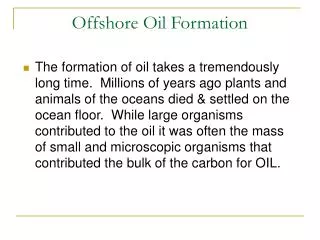
Offshore Oil Formation • The formation of oil takes a tremendously long time. Millions of years ago plants and animals of the oceans died & settled on the ocean floor. While large organisms contributed to the oil it was often the mass of small and microscopic organisms that contributed the bulk of the carbon for OIL.
Over many thousands of years bacterial action and extreme pressure from layers of sediment converted the organic matter to oil & gas. The extreme pressure came form the continuous build up of sediment. The pressure created tremendous amounts of heat which helped the process along.
The oil moved within the soil and oil reserves formed when non-porous rock lay above porous rock. Oil seeps up through the porous rock & is trapped by the non-porous rock.
Western Canada Sedimentary Basin • (our primary source of oil) • 2. Hudson Bay Basin • 3. Mackenzie and Banks Basins • 4. Canadian Arctic Basin • 5. Baffin Bay • 6. Labrador Sea Shelves • 7. Scotian Shelf • 8. Grand Banks • 9. Anticosti • 10. Maritimes Basins.
Atlantic Sedimentary Basins
Hibernia Cross Section Oil (light-green lines and blobs) and gas (red lines) in the Hibernia Formation (yellow) in the Carson Basin, mainly in stratigraphic traps. The brick colour underlying the oil and gas stream lines represents the Egret type source rock.
Oil and Gas Traps • All oil and gas traps have • a nonporous rock cap and • a porous rock source. The porous rock allows the oil to seep into the cavity and the nonporous rock prevents the oil from leaving.
Oil Reserves • Fold Trap: the up fold or anticline in the layers of the earth's crust form the reservoir.
Oil Reserves • Fault Trap: the vertical movement of the earth's crust forms a v-shaped reservoir.
Oil Reserves • Salt Dome Trap: The salt dome forms an up-fold in the earth's crust not unlike the anticline caused by tectonic forces.
Oil Reserves • Stratigraphic trap: has a former limestone reef as its porous rock feeding the reservoir.
Submersible Oil Rig • Supported primarily on large pontoon-like structures submerged below the surface. The operating decks are elevated 100 or more feet [30 m] above the pontoons on large steel columns. • Once on the desired location, this type of structure is slowly flooded until it rests on the seafloor. After the well is completed, the water is pumped out of the buoyancy tanks, the vessel refloated and towed to the next location. • Submersible rigs are normally limited to ocean depths of 20 m.
Semi Submersible • Float on the ocean • This floating drilling unit has pontoons and columns that, when flooded with seawater, cause the pontoons to submerge to a predetermined depth. Although it is moved by wave action, it sits low with a large part of its structure under water. This, combined with eight huge mooring anchors, make it a very stable installation • 200 m for anchored and 2000 m for dynamically positioned
Ocean Ranger (semi submersible) • Valentine's Day, 1982: a terrible storm rages off the coast of Newfoundland. On the Grand Banks, the Ocean Ranger, the world's mightiest drilling rig, is pounded by waves more than 20 metres high. At the height of the storm, the "indestructible" rig begins to tip over, then capsizes. All 84 men on board — 56 of them from Newfoundland — perish. • http://archives.cbc.ca/environment/extreme_weather/topics/349/ • http://archives.cbc.ca/environment/extreme_weather/topics/349-1874/ • http://www.thecanadianencyclopedia.com/index.cfm?PgNm=TCE&Params=A1ARTA0005876
Jack-up Oil Rig • Instead of floating over its drilling location the Jackup has long leg structures, which it lowers to and into the sea bed raising the rig out of the water. (100 m)
Gravity Based Oil Rigs • The Hibernia GBS sits on the ocean floor approximately 200 metres in depth with its topsides extending approximately 50 metres out of the water. The platform acts as a small concrete island with serrated outer edges designed to counter ice bergs. • http://www.hibernia.ca • http://www.thecanadianencyclopedia.com/index.cfm?PgNm=TCE&Params=M1ARTM0011173
FPSO • A Floating Production, Storage and Offloading Vessel
Once the field is depleted, the FPSO can be moved to a new location. In areas of the world subject to cyclones (NW Australia) or icebergs (Canada), some FPSOs are able to release their mooring/riser turret and steam away to safety in an emergency.