Download
1 / 6
四川省汶川县发生 8.0 级大地震 ( 北纬 31 度,东经 103.4 度 )
60 likes | 246 Vues
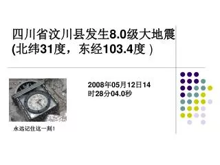
四川省汶川县发生 8.0 级大地震 ( 北纬 31 度,东经 103.4 度 ). 2008 年 05 月 12 日 14 时 28 分 04.0 秒. 永远记住这一刻!. 汶川地理位置.
Télécharger la présentation 
四川省汶川县发生 8.0 级大地震 ( 北纬 31 度,东经 103.4 度 )
An Image/Link below is provided (as is) to download presentation
Download Policy: Content on the Website is provided to you AS IS for your information and personal use and may not be sold / licensed / shared on other websites without getting consent from its author.
Content is provided to you AS IS for your information and personal use only.
Download presentation by click this link.
While downloading, if for some reason you are not able to download a presentation, the publisher may have deleted the file from their server.
During download, if you can't get a presentation, the file might be deleted by the publisher.
E N D
Presentation Transcript
四川省汶川县发生8.0级大地震(北纬31度,东经103.4度)四川省汶川县发生8.0级大地震(北纬31度,东经103.4度) 2008年05月12日14时28分04.0秒 永远记住这一刻!
汶川地理位置 • 汶川县位于四川盆地西北部边缘,居阿坝藏族羌族自治州东南部,东邻彭州市、都江堰市,南靠崇州市、大邑县,西接宝兴、小金县,西北和东北分别与理县、茂县相连,县域东西宽84公里,南北长105公里,总面积8820平方千米,森林覆盖率达48%。县城威州镇位于县境北部岷江与杂谷脑河交会处,海拔1325米,周围有茶坪山脉、邛崃山脉等众多山体围绕,距省城成都146公里、州府马尔康246公里,国道213,317线穿城而过。
More Related