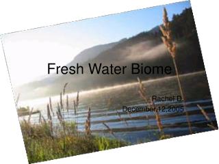
Waterways in Southwest Victoria: Values, Conditions & Impacts<br>
260 likes | 371 Vues
Explore the comprehensive overview of waterways discussing their values, impacts, and condition in the West Regionally Significant Area (RFA) of Victoria, Australia.<br>

Waterways in Southwest Victoria: Values, Conditions & Impacts<br>
E N D
Presentation Transcript
South West Waterways Values, Condition & Impacts A context for water issues in the West RFA Dr. Tim Fletcher
Introduction • General presentation - sets the context for more specific presentations which follow • The information presented is not “new” • it is a broad summary of the state of knowledge of regional waterways • Presents the big picture of waterways in the region - both the condition & impacts • puts RFA water issues in regional context
Outline • Waterways in the West RFA region • Values & uses (demands) of waterways • Impacts on waterways • Condition of regional waterways • Methods to protect waterway values
Waterways within the West RFA Covers part of 16 river basins Goulburn Campaspe Loddon Avoca Yarra Maribyrnong Werribee Wimmera-Avon Moorabool Barwon Otway Coast Lake Corangamite Hopkins Portland Coast Glenelg Millicent
Waterways in the Corangamite region(Barwon, Moorabool, Lake Corangamite & Otway Coast Basins)
Waterway Values & Uses • Environmental • Economic • Social Many competing demands...
Economic & Social Values • Water supply • drinking & domestic (e.g. garden watering), industrial, agriculture (stock & irrigation) • Extraction • fish, gravel, sand, soil (floodplain) • Tourism & recreation • walking, sightseeing, fishing, boating, swimming • Aesthetics • rural landscape, parkland, urban design • Waste discharge • sewerage, industry, stormwater
Environmental Values • Instream • habitat for fish, macroinvertebrates (“bugs”), macrophytes (“plants”) • Riparian (streamside) zone • habitat corridor, unique landscape element (ecotone) • Floodplain • intermittent habitat (billabongs), nutrient transfer, sediment deposition • Dynamic, variability, diversity
Impacts on Waterways • Urbanisation • Agriculture • Forestry • Others (e.g. mining)
Impacts of Urbanisation (e.g Geelong, Ballarat) • Hydrology • increased impervious area, decreased vegetation cover • “flashy catchments” - rapid flows over short time • leads to downstream erosion & scouring • river isolated from its floodplain • extraction of flows for water supply • Water quality • increased sediment transport • increased nutrients (N, P) - sewerage, fertilisers, etc • reduced dissolved oxygen (DO) • pathogens, heavy metals, hydrocarbons, litter • Channel & riparian zone • gross modification • channelisation, clearing of vegetation - loss of diversity • barriers to fish passage (weirs, culverts, etc)
Impacts of Agriculture • Hydrology • Vegetation removal (runoff, erosion, groundwater, salinity) • Diversion & storage of stream water • impacts on aquatic communities (flora & fauna) • Flood control (levees, etc) • river isolated from floodplain, flow concentration, erosion • Water Quality • sediment & nutrients (fertiliser use, stock access & cropping, soil erosion) • pathogens (stock access) • potential chemical contamination (herbicide/pesticide) • changed organic inputs, dissolved oxygen levels
Impacts of Agriculture (cont.) • Channel & Riparian Zone • vegetation removal (changed shade, temperature, etc) • de-snagging, channel “cleaning” & “straightening” • loss of habitat • channel deepening & erosion (from increased runoff) • fish barriers (storages, weirs, poorly designed crossings) • reduced physical and biological diversity • smaller range of habitats (suits less species)
Impacts of Forestry • Hydrology • short and long-term changes to water yield • presentation by Dr. Rob Vertessy • Water quality • sediment mobilisation & transport • presentation by Dr. Jacky Croke • Channel & riparian zone • short or long-term changes to vegetation structure • depending on proximity of harvesting • generally less than urbanisation or agriculture
Condition of Waterways in SW Vic • Two comprehensive assessments of environmental condition: • Mitchell (1990) • 96 sites • Index of Stream Condition (ISC) (1999) • 217 sites
Condition Assessment - ISC • Hydrology • deviation from natural flows • Physical form • bed & bank stability • barriers to fish passage • instream habitat (snags, etc) • Streamside zone • vegetation cover & condition, weeds, regeneration • Water quality • total phosphorus, turbidity, EC, pH • Aquatic life • macroinvertebrate population diversity Five sub-indices Index of Stream Condition
Very Poor Excellent 7% 13% Poor Good 29% 25% Moderate 26% Results • Excellent • Generally in forested areas: • Otways (e.g. Gellibrand, Barham, Ford Rivers) • Moorabool River (e.g. below Lal Lal Reservoir) • Very Poor • Generally in/near urban areas, or where intensive agriculture is present: • Naringhil & Kuruc-a-Ruc Cks • Yarrowee River & Winter Ck (near Ballarat) Mitchell, 1990
Yarrowee River
GellibrandRiver Ford River
Aire River Moorabool River
How can we best protect our waterways? • Considering that • there are many different values/uses of land and water ….
Protecting waterway values... • Initial assessment of capability/impacts of the particular use • Best practice land use • urbanisation • agriculture • forestry BUT all of the above depend on • Long-term environmental monitoring • both broad scale/background & specific
Some references Mitchell (1990). The environmental condition of Victorian streams Ladson & White (1999). An index of stream condition: reference manual Commissioner for the Environment (1988). State of the environment report 1988 - Victoria’s inland waters Corangamite CaLP (1997). Corangamite Regional Catchment Strategy Fletcher & Bren (1999). Cumulative effects analysis; grasping the big picture of environmental change in rivers. In Proceedings of 2nd Australian Stream Management Conference