Download
1 / 9
90 likes | 252 Vues
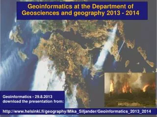
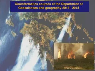
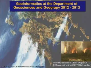
Geoinformatics at the Department of Geosciences and Geograpy 2012 - 2013. forest fires in southern Greece (August 26 2007) detected with MODIS TERRA satellite. 31.8.2012 Department of Geosciences and Geography. Geoinformatics personnel. Tuuli Toivonen : Senior lecturer in GI

E N D
Geoinformatics at the Department of Geosciences and Geograpy2012 - 2013 forestfires in southernGreece (August 26 2007) detected with MODIS TERRA satellite 31.8.2012 Department of Geosciences and Geography
Geoinformaticspersonnel TuuliToivonen: Senior lecturer in GI (research leave until July 2014) Mika Siljander: Senior lecturer in GI (until July 2014) Petri Pellikka: Professor • Matti Mõttus : • Postdocresearcher, • docent • Pekka Hurskainen: • -PhDStudent • CHIESA projectcoordinator • - GI-teaching • Janne Heiskanen: • Postdocresearcher, Johanna Hohental: PhD. Student Tuure Takala: PhD. Student XiaochenZou : PhD. Student • Maeda, EduardoEiji: • -CHIESA project • Postdocresearcher, Jari-Pekka Mäkiaho: PhD. Student Maria Salonen: PhD. Student – moving to Copenhagen
Geoinformaticscourses in English 2012-2013 – suitable for exchangestudents 2012 – period 1 562820 Raster GIS in Environmental Studies (5 cr.) (course is full – but it is possible to make thiscourseindependentlyifyouareexperienced GIS user– course material can be downloaded from the Internet – University ofHelsinkiMoodleplatform - https://moodle.helsinki.fi/). Email tomika.siljander@helsinki.fi for more information 560411, Basics of GIS for English-speaking students, 3 cr. (ArcGIS 10 software) This is a new Web GIS basic course that will be implemented in Moodleplatformhttps://moodle.helsinki.fi/. Students willuseEsriVirtual Campus Web training material and reportto University ofHelsinkiMoodle page. Email tomika.siljander@helsinki.fi for moreinformation. Starting date 11.9.2012 – sign in usingWebOodi – available on the nextweek ! 562830, Applied Spatial Statistics, (3 cr.) More info: AthanasiosVotsisathanasios.votsis@helsinki.fi 04.09.-16.10.12 Tuesdays 12.15-15.00 at A113, Physicum building (course is full but email toAthanasiosVotsis if it is possible to make it independently)
Geoinformaticscourses in English 2012-2013 – suitable for exchangestudents 2012 – period1 562830, Applied Spatial Statistics, (3 cr.) More info: AthanasiosVotsisathanasios.votsis@helsinki.fi 04.09.-16.10.12 Tuesdays 12.15-15.00 at A113, Physicum building Objectives: This is a hands-on course, aimed at introducing to the student basic concepts and methods in applied spatial statistics and spatial analysis. We will be focusing on environmental and economic research problems, and use ArcGIS, R, and GeoDa. The course is relevant to students of geography, environmental science, and economics. Some familiarity with basic concepts of multivariate statistics and GIS is desired. By the end of the course students will be familiar and able to work with spatial dependence and heterogeneity, global and local spatial autocorrelation, spatial regressions, and the corresponding statistical tests for arriving at the optimal regression specification. Evaluation Attend the 6 practicals and prepare a final report combining the individual work of each practical. Credits: 3
Geoinformaticscourses in English 2012-2013 – suitable for exchangestudents 2012 – period 2 56301 Remote Sensing Methods (5 cr.) - Kaukokartoitusmenetelmät (56301) 31.10.-22.11.12 Wednesdays 16.15-20.00 and Fridays 15.15-19.00 at A113, Physicum building. (responsibleteacher: prof. Petri Pellikka. Email: petri.pellikka@helsinki.fi) Lectures – in Finnish(English PowerPointslidesexists) Practicals: normallywehaveoneenglishgroup Practicalsthemes: (from the last year – might be somechangesthisyear) Practical 1: Introduction to ERDAS IMAGINE and optical remote sensing data sets Practical 2: Importing, geometric corrections and error assessment Practical 3: Radiometric corrections and profiles Practical 4: Spectral and spatial image enhancements Practical 5: Ground reference test data collection for image classification Practical 6: Unsupervised classification of a Landsat 7 image, and image subsetting Practical 7: Supervised classification of a Landsat 7 image and accuracy assessment Practical 8: Draping images over DEMs and using Virtual GIS Practical 9: Creating graphical models in ERDAS IMAGINE Model Maker Practical 10: Free Practical time for questions & report writing.
Geoinformaticscourses in English 2012-2013 – suitable for exchangestudents 2013 – period 3 No planned GI course given in English 2013 – period 4 56455 Advanced remote sensing (5 cr.) (JanneHeiskanen )janne.heiskanen@helsinki.fi08.04.13-23.04.13 (10.15-12.00) and 15.04.13-30.04.13 (12.15-16.00) Lectures Mon - Tue 10-12 o'clock, practicals Mon - Tue 12-16 'o'clock 562827 Imaging spectroscopy (4 cr.) (responsibleteacher and dates – notknownyet – checkfromWebOodi)
562820 Raster GIS in environmental studies (5 cr.) – advanced GIS course 2012 – Period 1 Teacher: Dr. Mika Siljander05.09.-17.10.12 Practicals: Wednesday’s 12.15-16.00 GIS lab A113-A114 , Physicum building Course is alreadyfull but it is possibleto make it independently– detailedinstructions and GIS data is available from Moodlee-learningplatform at the University of Helsinki. GIS labcanbeusedwhenthere is no othercourse – at the period 1 thereshouldbesomeavailabletime in GIS lab. See the schedulefound at the GIS labdoor. If you have a fairlygood GIS skills and you are interested to make the courseindependently - email: mika.siljander@helsinki.fi
562820 Raster GIS in environmental studies (5 cr.) PRELIMINARY KNOWLEDGE: fairly good GIS skills. Basic knowledge in Excel, Access and SPSS are appreciated. REGISTRATION for EXCHANGE students: emailto mika.siljander@helsinki.fi COURSE DESCRIPTION: The aim of Raster GIS course is to learn how GIS and Remote sensing techniques are used in environmental studies. Software used in this course: ArcGIS 10, MS Excel and Access; SPSS (PASW Statistics) 18; Maxent COURSE AIMS AND MAIN THEMES: Students should achieve knowledge how to process and use Raster GIS and Remote sensing data in environmental studies and how to create and handle GIS-databases. Basics of spatial statistics and spatial modeling are also learned. TO PASS THE COURSE: No exam; write a final report Grading: 1 to 5
562820 Raster GIS in environmental studies (5 cr.) Practical 1: ArcGIS ModelBuilder and creating GTOPO30 1 km pixel size digital elevation model for Africa. Practical 2: Creating and analyzing environmental raster GIS data using GTOPO30 DEM and land cover data for Africa Practical 3: GIS analysis of wildfires in Russia Practical 4: Raster GIS operators, map algebra and conditional processing Practical 5 and 6: Image georeferencing and creating digitital elevation model (DEM) by on-screen digitizing; grassland fire analysis using ModerateResolutionImagingSpectroradiometer (MODIS) derived remote sensed fire data; introduction to Shuttle Radar Topography Mission (SRTM) 90 m pixel size elevation data. Practical 7: Basics in species distribution modeling (SDM) using Maxent software and ArcGIS