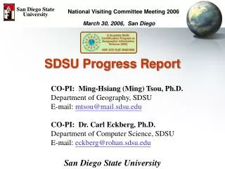
SDSU Progress Report
San Diego State University. National Visiting Committee Meeting 2006. March 30, 2006, San Diego. SDSU Progress Report. CO-PI: Ming-Hsiang (Ming) Tsou, Ph.D. Department of Geography, SDSU E-mail: mtsou@mail.sdsu.edu CO-PI: Dr. Carl Eckberg, Ph.D. Department of Computer Science, SDSU

SDSU Progress Report
E N D
Presentation Transcript
San Diego State University National Visiting Committee Meeting 2006 March 30, 2006, San Diego SDSU Progress Report CO-PI: Ming-Hsiang (Ming) Tsou, Ph.D. Department of Geography, SDSU E-mail: mtsou@mail.sdsu.edu CO-PI: Dr. Carl Eckberg, Ph.D. Department of Computer Science, SDSU E-mail: eckberg@rohan.sdsu.edu San Diego State University
SDSU Team members(bi-weekly meeting) Dr. Ming-Hsiang (Ming) Tsou, CO-PI Department of Geography, San Diego State University Dr. Carl Eckberg, CO-PI Department of Computer Science, San Diego State University Graduate Students: Antony(Tony) Howser (2004-now), Geography Department Kim Dodson (Oct. 2005 – now). Geography Department Gagan Arora (Oct. 2005 – now). Computer Science Department Jing-Yi Chen (2004-2005) Geography Department Yinghui Li (2004-2005) Computer Science Department Wendy Zou (2004-2005), Computer Science Department
Research Activities: Object 2 and 3: • Develop a standards-based curriculum, aligned across the three education levels. • SDSU: a new GE-level 104 has been approved by the University Senates at SDSU, March 7, 2006. This new course will be developed by matching the DACUM process at Mesa College and link to the Helix High School new GIS course (GIS 1c/2c). • Dr. Tsou will start to teach this GE course in Fall 2006. • Possible articulation agreements alighted across the three education levels (Object 2 and 3).
An Integrated GIS Education Program • High Schools (GIS 1c/2c) • Community Colleges • (Mesa College GIS 110, 111, 112) • Universities (four years undergraduate and graduate study – M.A., M.S. and Ph.D. programs) General Education– GEOG 104 • Advanced: GEOG 381, 484, 584, CS 537, CS 657. • (Seamless GIS Education Integration) Students can continue the learning of GIS technology and get some transfer credits between the three levels.
Research Activities: Object 4: • Prepare high school teachers and post-secondary faculty to provide the GIS skills training. • SDSU: collaborate with three high schools (High Tech High, Helix High, and Hoover High to introduce the GIS technology, and resources (books, websites, Web tools). • 120 Helix high students visit SDSU for a two-hour tours of Web-GIS, Google Earth, and GPS technologies in Nov. 2005 and March 2005). • Dr. Tsou and Tony Howser visit Hoover High to introduce the GIS technology (twice per year). • Dr. Tsou visits High Tech High during the 2005 GIS day event to deliver four talks in four different high school courses. • (2006 Summer Workshop for High school teachers? At SDSU? underdevelopment)
2005 GIS Day Activities (Nov. 16 2005)http://geoinfo.sdsu.edu/hightech/photoAndMultimediaArchive.htm
San Diego State University Google Earth Learning Modules March 3rd, 2006, 120 Helix High students visit our GIS labs to learn GIS and GPS technology.
Research Activities: Object 5 • Develop a Web-based GIS Career awareness program. • SDSU: revise the project web-based based on the 2005 evaluation report and create a new, career-oriented website for our project and education programs. • Install new Web-based mapping tools and modules: • Population modules in Human Geography (Helix High) • Fast food chains and Diabetes module (Hoover High) • GPS-TO-GIS coordinate conversion tool. • US Street Address to GIS coordinate conversion tool. • Google Earth Tools for awareness program (under-development) • High School GIS skill certificates(Under-development)
Project Website:http://geoinfo.sdsu.edu/hightech GIS Technology and Career Awareness Web Portal (for high school students)
Helix High – Human Geography:Population Learning Modules Customized ArcIMS User Interface Old-version Vs. New User Interface
Hoover High – Obesity and Fast Food (Overweight Students) + Web-based Address Matching Tools
High School GIS skill certificates (Under-development) High School GIS Career Awareness Program: • Complete the learning module ONE: Google Earth and Digital Data format (introduce RS data, Vector data by using Google Earth). • Compete the learning module TWO: Understanding various GIS applications in different fields (homeland security, environmental protection, etc.) • Complete the learning module THREE. Introduce the future of GIS, Web-GIS, wireless mobile GIS and their impacts to our society in the 21st century. • Submit an GIS Career essay (three pages around 1000 words) about their learning results from three modules and their future GIS career plan. After completed all four items (1-4), we can issue a High School GIS Career Skill certificates to the students (on-line applications?).
San Diego State University Multimedia Web GIS(Google Earth Movies) Movie created by video editing software – adding titles, effects, sounds, and music.
Research Activities: Object 6 • Share the Model GIS program with other educational institutions and communities across the U.S. • Conference Presentation and Proceeding: • 2005 ESRI International User conference: Ming-Hsiang Tsou and Antony Howser, Web-based and Mobile GIS for High School GIS career awareness. • 2006 AAG conference: Ming-Hsiang Tsou,Web-based GIS for Bridging the Gap of GIS Education between Universities and High Schools. • Book chapter: • Ming-Hsiang Tsou, (Accepted). The Integration of Internet GIS and Wireless Mobile GIS. In Manual of GIS, edited by Marguerite Madden, published by the American Society for Photogrammetry and Remote Sensing (ASPRS) • Peer Review Journal Article: • Tsou, M.H., Guo, L., and Howser, T. (2006). A Web-based Java Framework for Cross-Platform Mobile GIS and Remote Sensing Applications. GIScience & Remote Sensing. 42(4). Pp. 333-357.
Delcan Butler, The Web-Wide World, Nature, vol. 439, Feb. 16, 2006
Object 6 (continue) • Share the Model GIS program with other educational institutions and communities across the U.S. • Continue --- • Invited to participate the future planning of a National Geospatial Technology Resource Center. Ms. Deidre Sullivan, MATE Center, Monterey Peninsula College. • Collaborate with other NSF-ATE projects around the San Diego Regions: a new NSF-ATE grant (2006) to develop a GIS program at Southwestern College (SWC) with their faculty: Ken Yanow and Erin Browder,Southwestern College. (Sharing the project experiences and the GEOG 104 information). • Website Usage Analysis (downloads and visitors numbers).
Website Usage Analysis (Web logs) http://geoinfo.sdsu.edu/hightech/LogAnalysis/Log031505_031506 March 15, 2005 – March 15, 2006 17,067 visitors total (3559 unique IP).
San Diego State University Major Findings: • Let the students have Fun! (Google Earth tutorial / learning modules) (Helix High Visit) • Web-GIS can be adopted easily for High School Computer Lab – No GIS software installation needed! (Hoover high example). • Work with high school teachers together and fulfill their needs. Working with three high schools in San Diego now –High Tech High, Helix High, and Hoover High
San Diego State University Work with High School Teachers Together Helix High (Charter School in California) will start the first high school-level GIS course in Fall 2006 Semester -- GIS 1C/2C • Term 1 (Fall) • Unit 1 – Introduction to GIS • Unit 2 – Web Based GIS • Unit 3 – Basics GIS using ArcExplorer Java Edition • Mapping Our World lessons • Term 2 (Spring) • Unit 4 – Teacher Directed GIS unit • Unit 5 – Data collection and analysis • Unit 6 – Student Created/Driven GIS Capstone Course Project
San Diego State University Conclusion • Phase I – teach with GIS: Using GIS to help existing courses (biology, human geography, information technology, etc.) and teachers’ needs. • Phase II -- teach about GIS: Officially introduce the theories and technologies of GIScience. By combining [teach about GIS] and [teach with GIS], high school teachers will help their students to develop GIS Career awareness. Integrate new technologies (Web GIS, multimedia, 3D visualization) for the new generation of students.
San Diego State University NEXT STEP? • Evaluation of the effectiveness of Web-based GIS learning modules. • Create on-line community for K-12 GIS education -- Weblog for every high school teachers who are interested in GIS education. • Articulation -- develop an AP class for high school GIS course? (equal to the University-level Intro GIS course – General Education?)
San Diego State University NEXT STEP? • Connect to Upper Level GIS courses at SDSU • CS 537: GIS Component Architecture (Map Object for Visual Basic and Java Edition). • CS 657: Spatial Databases (Oracle Spatial Databases – OODBMS and OR-DBMS). • GEOG 484: Introduction to GIS. • GEOG 584: GIS applications. • GEOG 583: Internet Mapping and Distributed GIS. • GEOG 683: Advanced GIS. (seminar).
Weblog for every high school teachers and GIS educators On-line Community GIS forum
Related Links and References • Http://map.sdsu.edu • Http://map.sdsu.edu/mobilegis • Http://www.sdbay.sdsu.edu • Http://geoinfo.sdsu.edu/reason Q & A Books & Papers (PDF available upon request) Internet GIS (book) – (Chapter 9. mobile GIS) http://map.sdsu.edu/gisbook Tsou, M.H. (2004). Integrated Mobile GIS and Wireless Internet Map Servers for Environmental Monitoring and Management, Cartography and Geographic Information Science. 31(3), pp. 153-165. Tsou, M.H. (2004). Integrating Web-based GIS and On-line Remote Sensing Facilities for Environmental Monitoring and Management. The Journal of Geographical Systems, No. 6: 1-20.
GEOG 104(http://map.sdsu.edu/geog104) Intro Geospatial Technology Movie (5 minutes) • On-line lecture notes • Web-based GIS exercises • On-line Quiz • Introduction to Cartography, Remote sensing, GPS, GIS and spatial analysis.
Web-based GIS (Internet GIS) San Diego State University Client (Web browser) + Java applets Internet Map Server (ArcIMS) Web Server (map.sdsu.edu Internet Client (Web browser) + IMS Viewer Client (Web browser) Regional Database (GIS) Server Client The Network is the Computer The Internet is Your GIS.
Web-based GIS Advantagesfor high school teachers and students • Avoid the complicated (and often expensive) software installation in traditional GIS. • Students can utilize a Web browser to access maps and GIS from anywhere (schools, homes, or libraries). • Combine with Multimedia(sounds, animation, and 3D) in an integrated Web environment.
Mobile GIS • Mobile GIS refers to an integrated software/hardware framework for the access of geospatial data and services through mobile devices via wireline or wireless networks (Tsou, 2004). (Notebooks, PDA, Tablet PC, Pocket PC, etc.) WHY mobile GIS • Field works: data collection and validation process, coupled with GPS and wireless communications. • Real-time update / change • Global Positioning System (GPS) integration.