Download
1 / 1
20 likes | 189 Vues
FIRMS/ NASA LANCE - FIRMS. The Fire Information for Resource Management System: Easily Accessible Fire Data in NASA LANCE Diane Davies 1 , Shriram Ilavajhala 1 , Minnie Wong 2 , Chris Justice 2 , Kevin Murphy 3 , Jeff Schmaltz 3 and Mike Teague 3

E N D
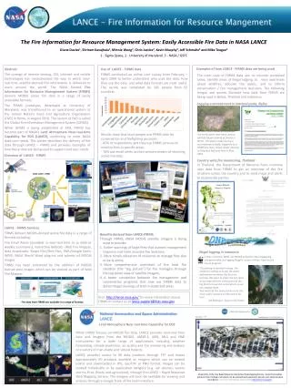
FIRMS/ NASA LANCE - FIRMS The Fire Information for Resource Management System: Easily Accessible Fire Data in NASA LANCE • Diane Davies1, Shriram Ilavajhala1, Minnie Wong2, Chris Justice2, Kevin Murphy3, Jeff Schmaltz3 and Mike Teague3 • 1 - Sigma Space, 2 - University of Maryland, 3 - NASA / GSFC • Abstract • The synergy of remote sensing, GIS, internet and mobile technologies has revolutionized the way in which near-real-time satellite-derived fire information is delivered to users around the world. The NASA funded Fire Information for Resource Management System (FIRMS) delivers MODIS active fire data in a range of easily accessible formats. • The FIRMS prototype, developed at University of Maryland, was transitioned to an operational system at the United Nations Food and Agriculture Organization (FAO) in Rome, in August 2010. The system at FAO is called the Global Fire Information Management System (GFIMS). • While GFIMS is being established at FAO, FIRMS has become part of NASA’s Land Atmosphere Near-real-time Capability for EOS (LANCE), continuing to meet NASA data-user needs. This poster describes the delivery of fire data through LANCE – FIRMS and provides examples of how these data are being used to support end user needs. • Use of LANCE - FIRMS data • FIRMS conducted an online user survey from February – April 2009 to better understand who uses the data, how they use the data, and what data formats are most useful. The survey was completed by 345 people from 65 countries. Examples of how LANCE - FIRMS data are being used The main uses of FIRMS data are: to monitor protected areas, identify areas of illegal logging, to raise awareness about wildfires, educate the public, and to inform conservation / fire management decisions. The following images and quotes illustrate how data from FIRMS are being used in Belize, Thailand and Indonesia. Logging encroachment in national parks, Belize Data use Photo courtesy of Friends for Conservation and Development, Belize) Results show that most people use FIRMS data for conservation and firefighting purposes. - 82% of respondents said they use FIRMS services to monitor fires in specific areas. - 76% use email alerts as their primary means of receiving active fire data. Fire email alerts have been used to identify illegal clearing of forests in Belize. This photo, taken during a reconnaissance flight, triggered by a FIRMS fire alert, shows illegal clearing in Chiquibul National Park in May 2007. Overview of LANCE - FIRMS Country wide fire monitoring, Thailand In Thailand, the Department of National Parks routinely uses data from FIRMS to get an overview of the fire situation across the country and to send maps and alerts to responsible parties. NASA LANCE Respondents FIRMS data have been used in a wide range of publications. LANCE - FIRMS Services FIRMS delivers MODIS-derived active fire data in a range of formats including : Fire Email Alerts (available in near-real time or as daily or weekly summaries), Interactive WebGIS - Web Fire Mapper, data downloads: Shape files/Text Files, KML/Google Earth, WMS, NASA World Wind plug-ins and subsets of MODIS images. FIRMS has been enhanced by the addition of MODIS burned-area images which can be viewed as part of Web Fire Mapper. • Benefits derived from LANCE-FIRMS • Through FIRMS, NASA MODIS satellite imagery is being used to provide: • Earlier warnings of large fires that warrant management response and more accurate fire locations, • More timely allocation of resources to manage fires due to early alerts, • More comprehensive overviews of the total fire situation (the “big picture”) for fire managers through the top-down view of satellite imagery, • A better connection between fire management and conservation programs that now use FIRMS data to detect illegal clearings of land in protected areas. Illegal logging in Indonesia In Riau, Sumatra: WWF use MODIS active fire data engage big companies who are logging illegallyas part of their ‘Eyes on the Forest program’ “Everything is covered in smog. The media are calling us to get the latest information on where the fires are burning. We want to relate the hot spots to our map with the concessions of the big forest conversion corporations so we can engage them. Your web site has been proven to be the most useful resource on the web to do this.” GIS Manager, Eyes on the Forest • Visit: http://lance.nasa.gov/ for more information about FIRMS or contact us at lance-support@lists.nasa.gov Fire data from FIRMS are available in a range of formats • Land Atmosphere Near real-time Capability for EOS • While FIRMS focuses on MODIS fire data, LANCE provides near-real time data and imagery from the MODIS, AMSR-E, AIRS, MLS and OMI instruments for a wide range of applications including weather forecasting, climate prediction, air quality and the monitoring and analysis of a variety of man-made and natural hazards. • LANCE provides access to 96 data products through FTP and makes approximately 40 products available as imagery which can be viewed online and downloaded in JPG, GeoTIFF or PNG format. Images can be viewed individually or by application category (e.g. ash plumes, severe storms, fires, floods and agriculture), through the LANCE – Rapid Response Web Mapping Service. The imagery will soon be available for viewing and analysis through a Google State of the Earth interface. Screenshot of the new Rapid Response interactive Web Mapping Service client that enables products from multiple instruments to be overlaid with population density and administrative boundaries. For more information, please visit: http://lance.nasa.gov/