Download
1 / 28
280 likes | 397 Vues
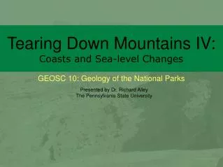
Tearing Down Mountains IV: Coasts and Sea-level Changes. Presented by Dr. Richard Alley The Pennsylvania State University.

E N D
Tearing Down Mountains IV:Coasts and Sea-level Changes • Presented by Dr. Richard Alley • The Pennsylvania State University
Sept. 18, 1999 Landsat image of Cape Cod. The Outer Beach (magenta arrow) along the right-hand side of the Cape is eroding back at a few feet per year. Some of the sand is building out to the south and north (yellow arrows), but some of the sand is being lost to deeper water, so the Cape is shrinking. All pictures in this slide show, except this one, by R. Alley, C. Alley, J. Alley or K. Alley. http://www.nasa.gov/centers/goddard/news/topstory/2003/0901natlpark.html
One good tern… deserves another.
The great Nauset Marsh, viewed from the back porch of the Salt Pond Visitor Center, Cape Cod National Seashore.
A fish that doesn’t watch out may realize too late that he blue it. Great blue herons, Nauset Marsh.
Salt marshes are highly productive, and support a diversity of life… including sandpipers (top) and yellowlegs (right). Nauset Marsh, Cape Cod.
Waves and tidal currents move immense amounts of sand, leaving beautiful ripples, as shown in these closeups from First Encounter Beach.
Nauset Light. The light was moved in 1996, just before the rapid erosion of the bluffs along this part of the coastline dropped this historical building into the waves. Everyone with a long memory of the Cape has stories of things that have been lost to the encroaching sea.
Great Rock, the Cape’s largest glacial erratic (big rock carried by the glacier) attests to the ability of ice to move pieces of many different sizes. The rock extends below the picture, and then about as far into the ground as above.
Acadia and surroundings. The yellow arrow points toward the fjord of Somes Sound in Mount Desert Island. The dotted line marks an area of interest for NASA and the National Park Service, and regions beyond have been blacked out. All pictures except this by C. or R. Alley http://www.nasa.gov/centers/goddard/earthandsun/nps_data.html Credit: NASA GSFC & Y.Q. Wang at the Laboratory for Terrestrial Remote Sensing, University of Rhode Island
The Rockefeller-constructed carriage roads and their graceful bridges are well-loved at Acadia, which offers wonderful opportunities for bicycling. Dr. Alley and daughters Janet (left) and Karen for scale.
Bass Harbor Head Lighthouse (left) and Portland Head Lighthouse (top), Acadia National Park and vicinity.
Loons in rain, Seal Cove Pond, Acadia. The deep, glacially carved lakes of the island are outstanding for kayaking and canoeing.
Jordan Pond and the Bibble Mountains. The rounded granite summits and U-shaped valleys are clear evidence of past ice.
Even a rainy day can be enjoyable on the shore, as here at Ship Harbor. Notice the “beach” is composed of cobble-sized rocks.
The no-beach granite coast of Acadia National Park in the fog.
Ice flow as indicated by the red arrow smoothed this island, and plucked rocks off the lee or downglacier side to the right.
Coasting Down the Coast. Including a bit on sea-level change, some disasters, and some coastal processes, in some beautiful places. All pictures by R. Alley or taken from government Web sites as indicated. The image of Cape Cod National Seashore and surroundings is from Landsat 7. http://www.nasa.gov/centers/goddard/news/topstory/2003/0901natlpark.html
Raised delta, Milne Land, east Greenland. About 12,000 years ago, a stream flowing to the left from beneath a glacier built the sandy fingers of this delta out into the sea. Then, the ice melted, allowing the land to rise, so the delta is now about 300 feet above sea level (sea is barely visible to the far left).
Two views of the Westport Jetty, Washington. Longshore drift from the right has built up sand to the right but caused erosion to the left of the barrier. Also notice in the left picture that waves are slowed by the shallower waters near the jetty. http://apps.ecy.wa.gov/shorephotos/scripts/bigphoto.asp?id=GRA0397 and GRA0398. Washington State Department of Ecology Shore photos--the state photographed their coasts, and makes those pictures available to the public--what a great idea!
http://coastal.er.usgs.gov/hurricanes/katrina/photo-comparisons/mainmississippi.htmlhttp://coastal.er.usgs.gov/hurricanes/katrina/photo-comparisons/mainmississippi.html Before-and-after photos of the aftermath of Hurricane Katrina, near Biloxi, Mississippi. The antebellum house (upper right) and pier house indicated by the red arrows were destroyed.
http://coastal.er.usgs.gov/hurricanes/katrina/photo-comparisons/chandeleur.htmlhttp://coastal.er.usgs.gov/hurricanes/katrina/photo-comparisons/chandeleur.html Before-and-after photos of the impacts of Hurricane Katrina on the Chandeleur Islands, about 100 miles east of New Orleans. The sites marked by the yellow arrows can be identified in both photos.
Before-and-after photos of the impacts of Hurricane Fran (1996) on Topsail Island, North Carolina. http://coastal.er.usgs.gov/hurricanes/mappingchange/images/photos/onslow-fran.jpg The house indicated by the left yellow arrow largely collapsed, that shown by the right yellow arrow lost its deck, and most of the other houses and much of the road were destroyed.
Evidence of longshore drift of sediment, Scoresby Sund, Greenland. The small stream valley flowing from the top (blue arrow) has been dammed by sediment transported along the coast (between the red arrows).
Mudder Bugt, Milne Land, east Greenland. The upper picture is a slightly turned close-up of the top part of the lower picture. Sand from the braided stream (lower right) is reworked by waves into the barrier beaches and spits seen, but the beaches are pierced by inlets.
Satellite image of the Outer Banks of North Carolina, from USGS and NASA. Streams flowing from the left (two are indicated by blue arrows) have been flooded by sea-level rise in their lower reaches. Sand from the streams has been built into barrier islands (two shown by yellow arrows). Although the area covered by this picture is much bigger, the features are clearly almost identical to those shown in the previous pictures.