Download

1 / 36
360 likes | 514 Vues
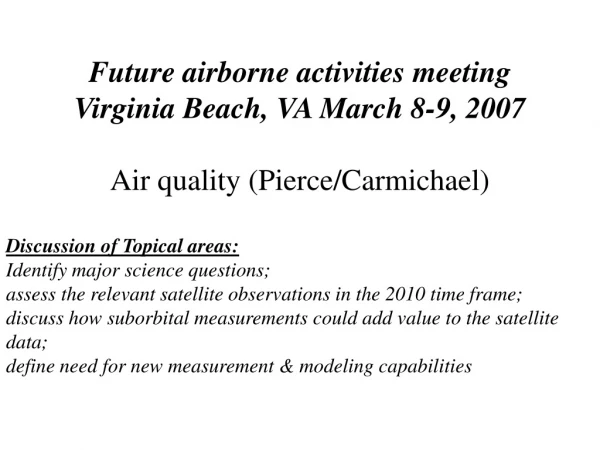
Future airborne activities meeting Virginia Beach, VA March 8-9, 2007 Air quality (Pierce/Carmichael) Discussion of Topical areas: Identify major science questions; assess the relevant satellite observations in the 2010 time frame;

E N D
Future airborne activities meeting Virginia Beach, VA March 8-9, 2007 Air quality (Pierce/Carmichael) Discussion of Topical areas: Identify major science questions; assess the relevant satellite observations in the 2010 time frame; discuss how suborbital measurements could add value to the satellite data; define need for new measurement & modeling capabilities
Mandate: US GEO Near Term Opportunity • The Global Earth Observation System of Systems (GEOSS): advancing air quality assessment and forecasting capabilities. • Improve the ability to forecast air quality across large parts of the country (and in other parts of the world) for which forecasts are not currently available; • Provide better information about emissions and transport mechanisms on regional to international scales; and • Provide important information to help the public avoid harmful exposures and to help air quality management better reduce and respond to air pollution episodes over the short and long terms. Near-term opportunities identify observing systems or integration of components that meet high-priority societal needs, and making improvements to update existing systems that can be completed within 5 years and have tangible, measurable results. http://usgeo.gov/docs/nto/Air_Quality_NTO_2006-0925.pdf
Mandate: Decadal Survey Recommendations Recommendations from the National Research Council Committee on Earth Science and Applications from Space Decadal Survey: Earth Science and Applications from Space: National Imperatives for the Next Decade and Beyond Highlights added
EPA Rulings impacting 2010-2015 US Air Quality • On March 10, 2005, EPA issued the Clean Air Interstate Rule (CAIR). • CAIR will reduce air pollution that moves across state boundaries by capping emissions of sulfur dioxide (SO2) and nitrogen oxides (NOx) in the eastern United States. • When fully implemented, CAIR will reduce SO2 emissions in these states by over 70 percent and NOx emissions by over 60 percent from 2003 levels. • On March 15, 2005, EPA issued the Clean Air Mercury Rule to reduce mercury emissions from coal-fired power plants. • The Clean Air Mercury Rule builds on EPA’s Clean Air Interstate Rule (CAIR) to significantly reduce emissions from coal-fired power plants - the largest remaining sources of mercury emissions in the country. • When fully implemented, these rules will reduce utility emissions of mercury from 48 tons a year to 15 tons, a reduction of nearly 70 percent.
Current Continental US (CONUS) Air Quality Ozone & PM2.5: Eastern US/California Urban Ozone: Houston, Dallas, Denver, etc… Mercury: Eastern US significant US Power Plant contribution Western US significant Non-US contributions
Eastern urban/rural fine particles 30 Bottom: Regional Contribution 25 Top: Urban Increment 20 15 ug/m3 10 5 0 Indy/LIVO SLC/GRBA Tulsa/WIMO Bronx/BRIG Fresno/PINN Atlanta/2 Sites Charlotte/LIGO Missoula/MONT Richmond/JARI St.Louis/3 Sites Baltimore/DOSO Birmingham/SIP Cleveland/MKGO Urban Increment Regional Contribution Regional Transport Is a Major Fraction of PM2.5 and Ozone Top: Urban Bottom: Rural 12-month average PM2.5 mass from speciation samplers Reference: 2002 EPA Trends Report http://www.epa.gov/air/airtrends/chem_spec_of_pm2.5_b.pdf
Historic and Projected NOx and SO2 Power Plant Emissions SO2 NOx 70% Projected, w/ CAIR 60% Source: EPA
2015 Projected CAIR impacts on Ozone and Particle Pollution Nonattainment areas for 8-hour ozone pollution only Nonattainment areas for fine particle pollution only Nonattainment areas for both 8-hour ozone and fine particle pollution Ozone and Fine Particle Nonattainment Areas (March 2005) Projected Nonattainment Areas in 2015 after Reductions from CAIR and Existing Clean Air Act Programs 104 ozone nonattainment areas with 408 counties 43 PM2.5 nonattainment areas with 211 counties 5 ozone nonattainment areas 14 PM2.5 nonattainment areas Projections concerning future levels of air pollution in specific geographic locations were estimated using the best scientific models available. They are estimations, however, and should be characterized as such in any description. Actual results may vary significantly if any of the factors that influence air quality differ from the assumed values used in the projections shown here.
Vast majority of Hg deposition is from sources from outside US & Canada
Global Mercury Emissions Source: United Nations Environment Programme Global Mercury Assessment, 2002, using J. Pacyna 1995 data, as presented by the Arctic Monitoring and Assessment Programme
Change in China Emissions2000-2006 • Emissions have increased significantly since TRACE-P, due to both energy growth in 2000-2006 and methodology improvements: • SO2: +44%NOx: +65%CO: +57%VOC: +51%BC: +92%OC: +17% NOx
Climate Change: Impacts on Biomass Burning Influences on US Air Quality Over the last several decades, the annual average Arctic surface temperature has increased at almost twice the rate of the global change in surface temperature. Increased surface temperatures lead to the weather conditions necessary to sustain extreme fire events, resulting in increased fire frequency, severity, and duration [ACIA, 2005]. Anticipate increased wild fire activity within boreal forests.
Climate Change: Impacts of increased Stagnation events on European Air Quality JJA 2003 European Temp Anomoly
Processes driving Future Air Quality (European Perspective) * Hov HTAP 2007 * Realized in 2003
Decadel Survey Recommendations: NASA Satellite missions Decadel Survey results 2013-2016 LEO CO2 Lidar GEO Trop Chemistry LEO Aerosol Lidar 2016-2020 LEO Trop Chemistry
05 06 07 08 10 11 12 13 14 15 16 17 18 19 20 21 22 23 24 25 09 Polar Orbiting Satellites 2005-2025 EOS/NPP/NPOESS/METOP Flight Schedule CALENDAR YEAR C4 AM C2 TERRA MidAM MetOp D MetOp A MetOp C MetOp B C3 AURA C1 PM NPP AQUA
Operational Atmospheric Composition measurements: NPP/NPOESS The National Polar-orbiting Operational Environmental Satellite System (NPOESS) will converge existing polar-orbiting satellite systems under a single national program. • The NPOESS Preparatory Project (NPP) is a joint NASA/IPO instrument risk reduction project. It is designed to function as a bridge between the NASA EOS program and NPOESS for the development of the following sensors: • Advanced Technology Microwave Sounder (ATMS) • Cross-track Infrared Sounder (CrIS) • Ozone Mapping and Profiler Suite (OMPS) • Visible/Infrared Imager Radiometer Suite (VIIRS)
Operational Atmospheric Composition measurements:METOP The METOP payload consists of complementary instruments that have been provided by the European Space Agency (ESA), the European Organization for the Exploitation of Meteorological Satellites (EUMETSAT), the American National Oceanic and Atmospheric Administration (NOAA) and the French space agency,CNES. Composition retrievals: GOME-2 and IASI Aerosol retrievals: GOME-2 Source: Dr. Johannes Schmetz, Head of Meteorology Programme Development Department, EUMETSAT
Operational Atmospheric Composition measurements: GOES-R The Advanced Baseline Imager (ABI) and the Hyperspectral Environmental Suite (HES) instruments on GOES-R will measure aerosol optical depth, particle size, aerosol type, carbon monoxide, methane, sulfur dioxide, ozone, fires at temporal resolution ranging from five to 60 minutes for the imager and the sounder respectively. These products are expected to become operational after the launch of GOES-R in 2013.
Improving Regional Predictions/Assessment Of Air Quality Through The Closer Integration Of Observations And Models Future Airborne Air Quality missions should be used with global and regional chemical data assimilation/prediction systems to interpret/ integrate long-term satellite and surface monitoring networks
Integrated Science Studies: Impacts of Global Composition on Regional Air Quality MODIS Aerosol Optical Depth (AOD) July 17-20, 2004 July 17, 2004 July 18, 2004 • The largest Alaskan wild fire event on record occurred in late June-July 2004. • Satellite, remote and in-situ airborne, and ground measurements collected during INTEX-A quantify the impacts of the Alaskan fires on US air quality. July 19, 2004 July 20, 2004
Integrated Science Studies: Impacts of Global Composition on Regional Air Quality DC-8 LIDAR backscatter, MODIS AOD and EPA AIRNow PM2.5 on July 20, 2004 DC8 LIDAR shows that the high aerosols seen by MODIS were at several layers in the troposphere.
Integrated Science Studies: Impacts of Global Composition on Regional Air Quality DC8 in-situ measurements of aerosol optical properties Enhanced absorption and scattering at 3km (consistent with carbonaceous aerosols) and enhanced scattering in the BL (consistent with sulfate aerosols).
Integrated Science Studies: Impacts of Global Composition on Regional Air Quality Global-Regional-Urban nesting of CTMs Effects of Boundary Conditions are significant and improve predictions (Tang et al., JGR 2007). Alaskan BB Impacts Northern Boundary Assessment of continental inflow/outflow requires unified modeling/measurement strategy to accurately characterize coupling between the continental boundary layer, free troposphere, and long-range transport.
NAMMA/TexAQSIntegrated Science Studies: Saharan Dust Transport Global Source/Receptor Studies RAQMS1 PM2.5 forecast predicts significant dust contribution to observed2 PM2.5 Real-time MODIS AOD Assimilation RAQMS 06hr Fx vs AIRNow PM2.5 HSRL3 flight region RAQMS uses lateral boundary conditions from GMAO aerosol forecast (A. da Silva, GSFC) 1Real-time Air Quality Modeling System (RAQMS) 2US EPA AIRNow PM2.5 Network 3High Spectral Resolution Lidar (HSRL)
HSRL Aerosol Extinction HSRL Depolarization Ratio NAMMA/TexAQSIntegrated Science Studies: Saharan Dust Transport Global Source/Receptor Studies HSRL Aerosol Extinction and Depolarization Ratio observations confirm dust forecast RAQMS Dust Forecast with GMAO Boundary Conditions RAQMS 06hr Fx vs AIRNow PM2.5 HSRL flight track
Aug 17 Aug 18 Aug 19 Aug 20 Aug 21 Aug 25 Aug 22 5 km Aug 28 3 km Aug 23 NAMMA/TexAQSIntegrated Science Studies: Saharan Dust Transport Global Source/Receptor Studies CALIPSO Observations Link Texas Dust event to Saharan Source region NASA NAMMA Flight tracks shown in black (08/19) and white (08/20) Boundary Layer back trajectories from August 28 CALIPSO track shown in red
Aug 17 8/20/02006 Aug 18 Aug 19 Aug 20 Aug 21 Aug 25 Aug 22 5 km Aug 28 3 km Aug 23 NAMMA/TexAQSIntegrated Science Studies: Saharan Dust Transport Global Source/Receptor Studies Airborne data provides in-situ characterization of aerosol optical properties CALIPSO Observations Link Texas Dust event to Saharan Source region Assessment of global source receptor relationships requires unified modeling/measurement strategy to accurately characterize global source regions, long range transport, and boundary layer entrainment processes. Dust: high scattering coefficients that are constant with wavelength (low angstrom exponents)
Summary: Air Quality Topic, Future Airborne Missions • Science Questions; • Transition from local to regional/hemispheric influence • LRTAP contributions • Hg/BB long-range transport • Climate change: heat waves, increased BB • Validation/update emission estimates (coupled with satellite) • Processes impacting CONUS AQ: • Export out of BL (Aerocom) • Import into BL (subsiding airmass/boundary layer inversions) • Maturation of AQ FX capability/incorporation of observations • Suborbital contribitions: • Integrated Science studies • Integrated airborne/sat emission estimates • BL processes (low and slow) • LBC constraints (high and long) • Suborbital needs to link surface NETWORKS to satellite obs (US GEO) • Need to evaluate information content of observations to help better define networks to support AQ forecasting
Ozone Mapping and Profiler Suite (OMPS) OMPS Specifications The Ozone Mapping and Profiler Suite (OMPS) will continue the daily global data produced by the current ozone monitoring systems (SBUV, TOMS). OMPS has the potential to provide other data, including anthropogenic trace gases. • The OMPS program will create five • ozone products • High performance Total Column environmental data records (EDR) • Heritage TOMS V7 Total Column EDRs • High performance Ozone Profile EDRs • Heritage SBUV V6 Nadir Profile data records • IR Total Column data records from Cross-track Infra-red Sounder (CRIS) radiances
Cross-track Infrared Sounder (CrIS) • Specifications • Temperature profile: 18.5 km at nadir • Moisture profile: 15 km at nadir • Pressure profile: 55 km at nadir • 1 Kelvin / 1 km layers The Cross-track Infrared Sounder (CrIS) is primarily for improved measurements of the temperature and moisture profiles in the atmosphere. However, it’s heritage includes the NASA Atmospheric Infrared Sounder (AIRS), which is currently producing CO and O3 retrievals in a research mode.
Visible/Infrared Imager Radiometer Suite (VIIRS) Multiple VIS and IR channels between 0.3 and 14 microns Imagery Spatial Resolution: ~400m @ NADIR / 800m @ EOS Heritage POES Advanced Very High Resolution Radiometer (AVHRR/3) EOS Moderate Resolution Imaging Spectroradiometer (MODIS) The Visible/Infrared Imager/Radiometer Suite collects visible/infrared imagery and radiometric data. VIIRS will have multichannel imaging capabilities to support the acquisition of high resolution atmospheric imagery and generation of a variety of applied products including: visible and infrared imaging of hurricanes and detection of fires, smoke, and atmospheric aerosols.
The Global Ozone Monitoring Experiment-2 (GOME-2) METOP The Global Ozone Monitoring Experiment-2 (GOME-2) on MetOp (Meteorological Operations Platform) is a spectrometer that measures both the radiance component of the light reflected by the Sun-illuminated Earth's atmosphere and the direct Sun light. The measurements are used to obtain a detailed information on global trace gas distributions of ozone, nitrogen dioxide, water vapor, bromine oxide and other trace gases as well as aerosol properties.
Infrared Atmospheric Sounding Interferometer IASI (METOP) IASI is a Michelson Interferometer measuring the spectral distribution of the atmospheric radiation Spectral range : 15.5 to 3.62 µm (infrared) Size : 1.2 x 1.1 x 1.1 m Mass : 210 kg Lifetime : 5 years IASI has been designed for operational meteorological soundings with a very high level of accuracy (specifications on Temperature accuracy: 1K for 1 km and 10 % for humidity) being devoted to improved medium range weather forecast. It is also designed for atmospheric chemistry aiming at estimating and monitoring trace gases like ozone, methane or carbon monoxide on a global scale. Source: Dr. Johannes Schmetz, Head of Meteorology Programme Development Department, EUMETSAT