Download
1 / 20
200 likes | 320 Vues
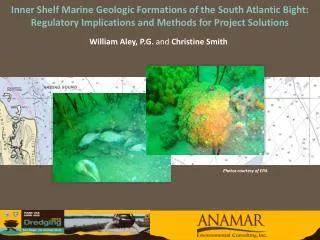
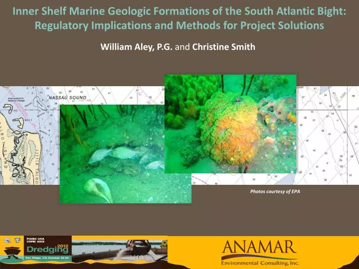
William Aley, P.G. and Christine Smith. Inner Shelf Marine Geologic Formations of the South Atlantic Bight: Regulatory Implications and Methods for Project Solutions. Photos courtesy of EPA. Background and Survey Benthic Communities Regional Geology Conclusion. Outline.

E N D
William Aley, P.G. and Christine Smith Inner Shelf Marine Geologic Formations of the South Atlantic Bight:Regulatory Implications and Methods for Project Solutions Photos courtesy of EPA
Background and Survey • Benthic Communities • Regional Geology • Conclusion Outline
Habitat used by recreational divers and fishermen • Record review indicated reconnaissance level only screening performed • Today screening procedures more rigorous Background and Survey of Fernandina Beach ODMDS
Attached organisms: Sponges Gorgonians Tunicates Hard coral (Oculina varicosa only) Fish species: Black Sea Bass Slippery Dick Porgy Cubbyu Belted Sandfish Sheepshead Whitespotted Soapfish Blue Angelfish Tomtate Flounder Red Snapper Gag Benthic Communities
Text Heading
Text Heading
Text PM / PG Artificial Reef AreaJacksonville, Fl Scale: ~ 1 Mile2
Side Scan Mosaic Close-up Text Heading “potholes”
Text Heading
NE Florida Offshore Sedimentary Units Fernandina (Study Area) Cape Canaveral St. Augustine Daytona
Typical Seismic Profiles South of Study Area
Buried Sinkhole Near Mayport, Fl
2002 Seismic Survey Northeastern Florida USGS/FGS Text Heading Study Area
Karst Features Observed at Sea Floor Study Area: Offshore Fernandina, Fl
Karst Features Observed at Sea Floor Study Area: Offshore Fernandina, Fl Text
Channels Eroded into Shallow Tertiary Sediments Study Area: Offshore Fernandina, Fl Text
Text Paleo-River ChannelsMapped by FGS Nassau Sound Fernandina, Fl St. Johns River Mayport, Fl
Geologic Conclusions Text NE Fl Ledge complexes encountered NOT wave cut platforms /relict shorelines like inner shelf reefs of S Fl. Seismic profiles provide a unique perspective when characterizing inner shelf marine sediments and benthic environments. Heading Karstic features may be covered by a thin layer of recent sediments or may be directly exposed. Relict braided stream channels have been mapped within these units.
Applications for disposal area siting, borrow area screening, offshore energy studies, or other similar projects • How ephemeral are these features and how does this affect biota? • Questions? Applications and Future Considerations