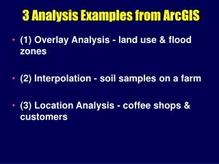
NR 322: Interpolation
NR 322: Interpolation. Jim Graham Fall 2008 Chapters 7 and 8. US Temperature Range. Map of Species Richness. Interpolation. Interpolation is a method of constructing new data points within the range of a discrete set of known data points. Interpolation (IDW). Simple Interpolation. 50.

NR 322: Interpolation
E N D
Presentation Transcript
NR 322: Interpolation Jim Graham Fall 2008 Chapters 7 and 8
Interpolation • Interpolation is a method of constructing new data points within the range of a discrete set of known data points.
Simple Interpolation 50 40 35 Measured Values 20 Spatial Cross-section
Simple Interpolation 50 40 35 Measured Values 20 Spatial Cross-section
Simple Interpolation 50 40 35 Measured Values 20 55 47 42 36 36 37 38 40 34 28 21 Spatial Cross-section
Spline Interpolation 50 40 35 Measured Values 20 55 48 42 35 35 37 38 40 36 28 22 Spatial Cross-section
First law of Geography • Everything is related to everything else, but near things are more related than distant things • TOBLER, W. R. (1970). "A computer movie simulating urban growth in the Detroit region". Economic Geography, 46(2): 234-240.
Process • Obtain points with measurements • Interpolate between the points using: • Inverse Distance Weighting • Kriging • Splines • Convert the raster to vector using contours
Vector (Points) to Rater • Interpolation • IDW • Kriging • Splines • Density
Inverse Distance Weighting • Points closer to the pixel have more “weight”
Spline • Spline type: Tension • Increase “Weight” or decrease the “Number of points”
Kriging • See the Geostatistical Analyst • NR/ST523 - Quantitative Spatial Analysis • NR512 - Introduction to Spatial Statistical Modeling of Natural Resources
Geostatistical Analyst • Provides much more control over interpolation