Download
1 / 25
250 likes | 272 Vues
This document discusses the policy and standards for collecting and publishing precipitation data by the US Geological Survey (USGS). It covers issues such as data quality assurance, documentation, siting, instrumentation, recording intervals, calibration procedures, and more.

E N D
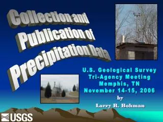
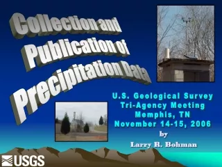
Collection and Publication of Precipitation Data U.S. Geological Survey Tri-Agency Meeting Memphis, TN November 14-15, 2006 by Larry R. Bohman
Why USGS needed a policy… • Our data collection infrastructure is already in place! • Uses: • Internal USGS flood operations • Real time flood warning networks • Many others? • Not published before about 1990, but number of published sites has greatly increased and the number of gages displaying data over the Internet had shot through the roof!
USGS Office of Surface Water Technical Memorandum 2006.01 • Water Science Centers had been left to develop their own policies. • Result: policy/standards not consistent between WSCs or within a WSC over time • OSW Technical Memo 2006.01 set in place December 28, 2005 • Sets minimum standards
OSW Memo 2006.01 does not: …apply to sites where data is to be collected to NWS standards. …cover other meteorological parameters or snowpack/snow depth measurement.
Step 1 – Break USGS tradition • Normally, daily values in our networks are published and available to anyone. • Two “classes” of precipitation data: • Permanent – data subject to archival and retrieval, must be QA/QC’d, and published in the annual data report. Calibration annually within specified criteria. Station analyses required. • Temporary – data not intended for archival, publication, or later retrieval outside of USGS. Can be displayed for 31 days with a qualifier on the Internet.
Some internal issues… QA/QC • Every WSC that publishes precipitation data must have a pertinent section in their Surface Water Quality Assurance Plan that details procedures to be used to collect, process, review, and archive the data.
Some internal issues… Documentation • Station description documents must be developed and kept current for all sites (temporary or permanent). • A separate station analysis (apart from streamflow) must be written each year for stations providing permanent data. • Station visit notes must be kept and archived.
X 450 300 X X Other highlights….. Siting • Avoid proximity to buildings or trees: IDEAL
Other highlights….. Siting • Avoid windy sites. Use wind shields only when >20% of annual precip falls in the form of snow. Must consider vandalism…approximately 1% potential error introduced per 10 feet above ground
Other highlights….. Siting • Avoid severely comprising conditions such as roadway splash or drip from vegetation or utility lines (do not publish).
Types of instrumentation • No single type of instrument recommended for all conditions. • Generally, tipping buckets with heaters are best, but if no AC power, a weighing bucket (spring, strain or wire strain) can be used.
Other highlights….. Recording interval • The recording interval for gages providing permanent data will be 15 minutes or less. • The interval for temporary gages can be established according to cooperator or WSC objectives.
Other highlights….. Station descriptions, naming, and numbering conventions • A station description document will be maintained for both temporary and permanent rain gages. • New rain gages will have separate 15-digit station numbers and names, even if associated with a streamflow gage
Other highlights….. Field procedures • 6-8 visits per year • Inspection form noting: • 45-degree clearance • Funnel/screen conditions, level, leaks, heater turned on or working and so forth • Repairs made, tip tests • Calibrations made, if any • Site conditions, etc.
Other highlights….. Calibration procedures • Annually for permanent and temporary gages using a 2-inch per hour nozzle (other intensity tests encouraged but not mandated). • Remedial actions taken when: • PERMANENT: Errors exceed 5 percent (tipping bucket), or 0.1 inch (weighing bucket) • TEMPORARY: Errors exceed 10 percent (tipping bucket), or 0.2 inch (weighing bucket) • Documented on a separate form and archived.
Other highlights….. Estimation of Missing or Erroneous Record • Long periods with multiple events – Generally, period should be deleted and record classified as missing. If a complete record is needed, a widely accepted method (e.g. reciprocal-distance-squared equation, NWS) can be used. • Short periods (up to 2 or 3 days) – Volume known but timing is uncertain. Use nearby gages to get daily distribution and mark estimated values with an “e” remark code.
Other highlights….. Data Corrections Discouraged – usually insufficient data to support how and when such corrections should be applied.
Other highlights….. Station Analysis • A separate analysis narrative must be written each year for permanent data sites. Describes current equipment, problems noted, missing record, calibrations, estimate computations, extremes, comparisons with nearby stations, and any recommendations.
Other highlights….. Annual Data Report • Data used in interpretive investigations, distributed formally to cooperators, or stored in the NWIS database must be quality-assured and published in the WSC’s annual data report. • Monthly/annual sums only provided when record is complete. • IDF statistics spanning more than one day are encouraged. Daily value extremes using ADAPS calendar days are discouraged.
Other highlights….. Annual Data Report (cont.) • Qualification of records: • Describe site conditions that might assist user in assessing data accuracy. • No quality ratings based on calibration test results. An “e” flag is sufficient notice of missing or poor accuracy. • >10 percent calibration errors (or 0.1-inch) – DO NOT PUBLISH
Other highlights… Internet display – permanent data • Obviously erroneous data should be screened from public display using ADAPS threshold tools.
Other highlights… Internet display – permanent data • Threshold criteria • Incremental precipitation: • Very High – just above max/recording interval (e.g. 3 in./15 min) • Very Low -- -0.01 • Do not use rapid increase or decrease thresholds. • Cumulative precipitation: • Very High and low – Set beyond range of counter • Very Rapid Increase – set to max possible rate in inches/min., e.g., 0.2 inches/min = 3 inches in 15 minutes
Other highlights… Internet display – temporary data • Displayed for up to 31 days using same screening thresholds as permanent data. • Standard disclaimer: The X-hour precipitation data for this station are temporary and will only be displayed for 31 days. Time series of X-hour or cumulative daily values will NOT be available for retrieval following the 31-day display period. Although the instrumentation is calibrated at least once/year, the temporary classification means that documented routine inspections and other quality assurance measures are not performed that would make the data acceptable for archival, retrieval, or future use in general scientific or interpretive studies.
Full implementation date?? Supposed to have been done by end of 2006WY…