Closing Report on WTF-CEOP Project Team
100 likes | 252 Vues
Closing Report on WTF-CEOP Project Team. Satoko Horiyama MIURA/JAXA. Contents. Project History Lessons & Learned. Purpose of WTF-CEOP.

Closing Report on WTF-CEOP Project Team
E N D
Presentation Transcript
Closing Report on WTF-CEOP Project Team Satoko Horiyama MIURA/JAXA
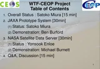
Contents • Project History • Lessons & Learned
Purpose of WTF-CEOP • To provide assistance to the CEOP (Coordinated Energy and water cycle Observations Project ) science community in the development of data services associated with CEOP data integration.
Goals and how they relate to WGISS • Develop a WTF-CEOP system, based on existing CEOS WGISS member tools and technology, for distribution of CEOP data, including: • Support gathering satellite data from providers (JAXA, NASA, ESA, EUMETSAT) • Support data discovery (search for CEOP data) • Support data selection (through menu selection) • Provide basic functions: plotting, viewing data, comparing data, downloading data • Provide data integration functions: methods of integration of in-situ, model output and satellite data.
Distributed Data Integration Services Data sources Spatial and Temporal Data Integration -In-situ, MOLTS, Satellite, Model Output • Data location • Standalone physical location • Distributed sites reference by links • Data types • Model output data • Insitu data • Satellite data • Services • Metadata keyword search • Data value search • File format translation • Reprojection • Regridding • Data Interpolation Integrated datasets Multiple files from individual member datasets Intercomparison Of Integrated Datasets Spatial Temporal rectification Spatial Subsetting
JAXA Prototype: “Distributed Data Integration Prototype System for CEOP ” WTF-CEOP Prototype CSDIC Archive [Satellite] (Japan) NCAR Archive [In-situ] (U.S.) Perl Module Ferret Web Browser MPI Archive [MOLTS, Model Output] (Germany) CEOP Data Archives WCS Handler OPeNDAPInterface IDL Live Access Server GrADS Ferret Custom Interface Matlab IDV WCS Server (satellite data) OPeNDAPServer NCO Analysis / Display Tools NASA Prototype: Enable OPeNDAP client access to WCS Servers to facilitate access to satellite data
Development Schedule CEOP Phase1 CEOP CEOP Phase2 2001 2002 2003 2004 2005 2006 2007 2008 2009 WTF-CEOP Task Team WGISS-26 (Septemebr, 2008) Task Team Closed JAXA Prototype Development March, 2008 Final version released Development Completed June, 2005 1st version released NASA Prototype Development Inputs from NASA needed
Outreach Activities • Presentation at • IGARSS-06 & 07 • AGU-06 & 07 • CEOP Science Meeting in March 2007 • CEOP Satellite Data Server proof of concept demo at eGY booth at 2006 Dec AGU meeting
GEO Related Status & Issues • CEOS/GEO Task • WA-07-01_2 : Release final version the WTF-CEOP JAXA Prototype system • Closed in March, 2008 • GEOSS Registries • JAXA Prototype • Registered on October 11th, 2007 • NASA Prototype • To be registered soon
Lessons & Learned • Transition • Prototype activities completed. • The target of WTF(WGISS Test Facility) is now satisfied. • So what is the next step ? to be explained in JAXA/NASA status. • Data Quality in meta data • Other details will be also reported in JAXA/NASA status.