Alternative Database System
The Highway Safety Information System (HSIS), combined with Geographic Information Systems (GIS), integrates various essential databases, including crash, roadway, and traffic signal inventories. The user-friendly interface allows for data editing, analysis, and export, along with graphical displays and interactive menus. HSIS facilitates comprehensive crash analysis through multiple methods like spot, strip, cluster, and corridor analyses. A case study on New Kent illustrates the system's capability to compare accident frequencies across routes and assess guardrail inventory, aiming to improve road safety and resource allocation.

Alternative Database System
E N D
Presentation Transcript
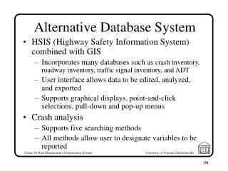
Alternative Database System • HSIS (Highway Safety Information System) combined with GIS • Incorporates many databases such as crash inventory, roadway inventory, traffic signal inventory, and ADT • User interface allows data to be edited, analyzed, and exported • Supports graphical displays, point-and-click selections, pull-down and pop-up menus • Crash analysis • Supports five searching methods • All methods allow user to designate variables to be reported
Crash Analysis • Spot/Intersection Analysis • Evaluate accidents at a user designated spot or intersection • Strip Analysis • Examine crashes along a designated length of roadway • User enters a route and length of segment • Program automatically searches consecutive strips
Crash Analysis (cont.) • Cluster Analysis • Study accidents around a given roadway feature • Sliding-Scale Analysis • Identify high accident roadway segments • Program memorizes all strips that exceed accident threshold • Corridor Analysis • Locates high crash areas within a corridor
New Kent Case Study • Initial Data Collection • Routes 609-622 • Corridor Analysis • Corridors for which guardrail inventory is available • Routes 33, 106, 249, 273
Corridor Analysis • Compare routes for frequency and severity of accidents • Select routes that have greatest accidents/miles • Compare results with current guardrail inventory • Advantages • Reduce random chance associated with accidents • Use summary statistics available in HTRIS
Corridor Analysis (cont.) • Disadvantages • Overlooks role of hazardous locations • Many locations of mediocre severity vs. one location of very high severity
Initial Analysis (cont.) • Route 249 (Using Total Accidents as measure) • Route 106 (Using FO accidents/miles and FO accidents/DVMT as measure)
Initial Analysis (cont.) • Route 273 (Using Total FO accidents as measure)
Future Work • Conclude screening • Comprehensive corridor analysis • Examine evaluation methods • Risk assessment and safety evaluation • Examine the safety state model • Suggest Safety alternatives
Motivation • Ability to compare multiple projects with a graphical user interface (GUI) • Assist resource allocation • Decision support • More evidence to the table, sooner • Demonstrate with New Kent County’s guardrails
Mission Statement Develop a GUI for a guardrail and hazard inventory system for resource allocation and decision making
Visualization of New Kent • Graphically represent what resident engineers know using an electronic map indicating the locations of: • Guardrails • Obstacles • Accidents • Complaints, etc.
Electronic Map • Map of New Kent/route 249 area • Similar to the zoomed in view on standard maps • Only concerned with guardrail sites, candidate sites, and accident data
Legend • R, L, R*, L* • Side of road on which guardrail is located, * indicates substandard guardrail • C1, C2, C3, Cn • C = citizen complaint • n = number of complaints
Legend (cont.) • O • Obstacle • A1, A2, A3, An • A = Accident • n = number of accidents
Legend • Same functionality as the New Kent County map’s legend with different symbols • Guardrails • Obstructions • Complaints • Accidents
Integration of Map and Catalog • The data visualized on the map comes from the catalog • Users able to retrieve the data they want via the map
Example Functionality • When a user selects a guardrail site, the information in the catalog about that site is displayed • Location, type, direction, length, etc. • When a user selects a route, that information is displayed • Guardrail prevalence, ADT, accidents, etc.