Download
1 / 37
370 likes | 562 Vues
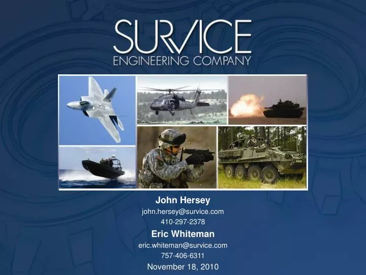
John Hersey john.hersey@survice.com 410-297-2378 Eric Whiteman eric.whiteman@survice.com 757-406-6311 November 18, 2010. Autonomous Remote Global Underwater Surveillance. argus.survice.com. ARGUS Overview. Plugs into your chartplotter Records position and water depth 100% of the time

E N D
John Hersey john.hersey@survice.com 410-297-2378 Eric Whiteman eric.whiteman@survice.com 757-406-6311 November 18, 2010
Autonomous Remote Global Underwater Surveillance argus.survice.com
ARGUS Overview • Plugs into your chartplotter • Records position and water depth 100% of the time • Extended-range marine WiFi provides for autonomous offloading • Provides vessels with WiFi connectivity • Collective processing provides statistical confidence for depth estimates You never have to touch ARGUS 3
SURVICE Engineering is a small business with a core focus on applying systems engineering to support the design, development, testing, and fielding of US combat systems that are safe, survivable, and effective. SURVICE currently employs 300 personnel in 10 offices across the United States which includes recognized experts in a wide range of engineering disciplines. About SURVICE 4
The SURVICE Metrology Division was established to support our core business, providing precision measurement services required for survivability modeling. The Applied Technology Operation (ATO) is focused on the development of custom applications involving 3D measurement solutions. ARGUS is a custom solution developed in response to a NOAA RFP. About SURVICE 5
History NOAA research grant 2008-2009 Dredged channel depth monitoring Demonstrated breadboard hardware, piecewise processing to achieve Order 2 accuracy Navy (SPAWAR) research grant 2009-2010 Optimal seafloor mapping technologies Developed autonomous UUV integration approach for Teledyne Benthos C3D Optimized sensor suite ARGUS as integration platform and processing baseline Application of high performance computing to path planning and onboard data processing SURVICE IR&D funding 2010 Deployed 10 ARGUS beta units using local Sea Tow and private vessels
Data Acquisition Approach • ARGUS records NMEA chartplotter output • Routine vessel activity provides depth and location measurements at COTS chartplotter accuracy
ARGUS Process Flow ARGUS Environmental Sampling Unit GPS Input (Position) ARGUS Onboard Unit Environmental Compensation Module Commercial Chartplotter MADISON Network Interface Sonar Input (Depth) Central Processing Data Harvesting Station Wireless Receiver Internet Interface Data Transmission Interface Central Data Processing Facility Data Users 8
Beta Testing Ten units deployed July 2010 Sea Tow Annapolis, MD Baltimore, MD Galena, MD Toms River, NJ Washington College Chestertown, MD SeaNet Electronics San Diego, CA M/V Chez Nous ICW Annapolis to Daytona Beach Approaching 2 million soundings argus.survice.com/betatesting.html Barnegat Bay
New River Inlet 34°33.225'N,77°21.005'W http://earthnc.com/chartviewer/ On left-hand side, click on Charts. Turn on Argus Soundings. Zoom/Pan to view soundings. Salty Southeast Cruiser’s Net
Lockwoods Folly Inlet 33°55.272'N,78°14.209'W http://earthnc.com/chartviewer/ On left-hand side, click on Charts. Turn on Argus Soundings. Zoom/Pan to view soundings. Salty Southeast Cruiser’s Net
Tide Corrections Tide correction can use combination of available tide stations and ARGUS self-generated water level data
Can ARGUS provide depths meeting IHO Order 1 accuracy standards? Not yet* Can ARGUS provide depths meeting IHO Order 2 accuracy standards? Yes *GPS, sonar, and data processing developments will allow the solution to approach Order 1. 18
Can ARGUS show where depths don’t appear to be as indicated on the charts? 4.00 3.00 2.00 1.00 Depth (m) 0.00 -1.00 0 50 100 150 200 250 300 350 400 -2.00 -3.00 Time Clearly 19
Need “Like it or not, they’re going to build these ships bigger and bigger. It’s like squeezing ten pounds of ship into a five pound channel. We’ve got to get better systems in place to do this safely. That’s my job, and I can’t do it without the technology that’s out there. The problem is we’re not getting the funding to get this thing going. We’re not getting the charting, not getting the observation systems, and it’s because it’s not coming out of NOAA. We want the ounce of prevention instead of the pound of cure, and we’re not getting that.” Capt. Andrew McGovern, Sandy Hook Pilot HSRP 2007 20
Need • There are 13 million registered recreational boaters in the U.S., and 500,000 square nautical miles of navigationally significant waters Obvious need for supplemental charting using a cost-effective approach 21
Athos I, Delaware River, 2004 265,000 gallons of oil into the Delaware River 115 miles of shoreline affected The Athos I collided with three uncharted and undetected submerged obstructions in the channel and anchorage. The Athos I incident alone has cost the ship owner and his insurer over $165 million. The true value of wildlife lost and port commerce delayed or deferred cannot be calculated. 22
Athos I, Delaware River, 2004 How many vessels passed over these before the Athos I did? What one vessel passes over, without knowing, or caring for that matter, will potentially be of significance to any vessel with a deeper draft. 23
Equivalent Cost ARGUS Coverage 14 x Redirect multibeam resources to where better resolution is most required 25
Cost Model Bottom Line No. of Boats, No. of Networks ARGUS represents a win/win for the entire marine community. 26
A typical harbor and approach: continuously surveyed, for next to nothing This is a common opportunity in most ports and harbors. 27
ARGUS as an Environmental Monitoring Tool Additional analog, digital, and serial inputs available to simultaneously record other sensor data of interest All data is time- and geo-referenced via the vessel’s existing GPS input SURVICE and Washington College presenting Chesapeake Bay Environmental Studies teaming effort today at the 2010 Maryland Water Monitoring Council (MWMC) Conference
Deepwater Horizon/Oil Spill Response ARGUS and Teledyne Profiling Float-equipped Sea Tow vessels proposed for Deepwater Horizon and similar future response efforts • Sea Tow vessels to deploy, retrieve, and service APEX Profiling Floats equipped with fluorescence sensors • Floats to acquire oil plume concentration data throughout the water column • To, from, and during active float deployments, Sea Tow vessels to passively acquire shallow-water subsurface environmental water quality data
Drawing Board: MarineSA Handheld app to provide local mariner alerts Development leveraging Sea Tow’s Sea Smart VHF™ and EarthNC mobile apps Speech-to-text recognition of Mayday, Pan, Securité Provide USCG access to nearby search and rescue assets Module to supplement Rescue-21 DHS: Lack of commercialization potential
Recommendation 1: The HSRP recommends that NOAA aggressively survey and map the 500,000 square nautical miles (SNM) of navigationally significant areas and 95,000 miles of shoreline by: • Expanding NOAA’s in-house and contract survey capabilities to acquire and process more hydrographic and shoreline mapping data; • Developing and implementing more efficient surveying, mapping, and processing techniques and technologies; and • Replacing aging single-purpose hydrographic ships with modern, multi-purpose vessels to further maximize the use and reach of NOAA resources. 32
“At the current pace, it is expected to take NOAA 166 years to survey the 500,000 square nautical miles (SNM) of navigationally significant waters using in-house and contract surveying vessels.” ARGUS is not intended to replace, but rather to supplement multibeam surveys. ARGUS sets priorities for directing multibeam resources to where higher resolution is most required. “The marine community is encouraged to submit information to NOAA to assist in prioritizing the Nation's hydrographic survey needs.” PRUDENT SPENDING 33
Navigation Data Users Finding 2: Federal agencies must accelerate efforts to integrate data in order to conserve resources, minimize duplication and inconsistency, and maximize taxpayer investments. 34
As the consumer market for marine electronics, GPS navigation systems, and chart plotters explodes, boaters presume that the data they can zoom in and out on is as accurate as the GPS systems in their cars. The information could be years, even decades out of date. Collisions account for 80% of recreational boating accidents – 100,000 claims, $450 million in losses. A major cause of claims is “striking a submerged object” and groundings. Recommendation 5: The HSRP recommends that NOAA expand efforts to deliver its navigation products and services more quickly, and increase outreach to make navigation and non-navigation users more aware of the NOAA mapping and data resources available to them. 35
ENVIRONMENTALLY FRIENDLY 36
Ron Brooks Depths in Remote Areas Gunkholers know how deep the water is. 37