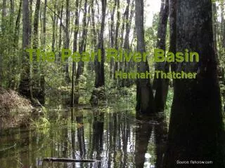
The Nelson River Drainage Basin
460 likes | 930 Vues
The Nelson River Drainage Basin. Craig Christensen Julie Nitsche Olsen Astrid Mathilda Arvidson. Contents. Profile of the Nelson River Drainage Basin Water Resources and T heir Usage in Western Canada Challenges in River Management. Profile of the Nelson River Drainage Basin.

The Nelson River Drainage Basin
E N D
Presentation Transcript
The Nelson River Drainage Basin Craig Christensen Julie Nitsche Olsen Astrid MathildaArvidson
Contents • Profile of the Nelson River Drainage Basin • Water Resources and Their Usage in Western Canada • Challenges in River Management
Factors Affecting The River Basin • Climate • More arid in southern regions • Majority of precipitation in summer months • Over 5 months of daily mean temperature below freezing allows for build-up of snow • Southern regions thaw sooner than larger. The Nelson river and the Red River both flow from South to North, meaning snow and ice build up can cause flooding.
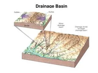
Factors Affecting The River Basin • Topography of the Basin • Rocky Mountains • Topography of the Praries • Glaciers created a flat, undulating landscape • Deep soils • Drainage pattern in Dendritic • Groundwater Sources • 3 different levels of the prairies
The composition of the Long Profile • Short Upper Course • The Saskatchewan River experience a rapid fall in altitude near their source (beginning at over 1900m at glacial sources) • Extended middle course • Rivers meander gently across prairies • No upper course proper in the Red River North • From source to base level, there is only 1m fall per 5km of river length • No river gorge or flood plain due to low erosion rates • Very prone to flooding.
Bow Glacier Source of one of the tributaries to the South Saskatchewan River
North Saskatchewan River in Edmonton, Alberta Notice the asymmetrical meandering
Confluence of the North and South Saskatchewan Rivers Notice the formation of more symmetrical meanders, and the high angle of incidence of the two channels. This is an indication of the slowing speed of the river.
The Red River The Red River lacks a river valley , cause by a low gradient and slow erosion rates
Assiniboine River Notice the steeper sides of the River
Fluvial features • Lake Winnipeg • Source of the Nelson River • 11th largest lake in the World • Winnipeg, capital of the province of Manitoba, lies at its southern shore. • Fifth largest lake in Canada, but still very shallow due to the deposition of material in it. • Mean depth of only 12m • Well know for many sandy beaches.
Winnipeg Beach, Manitoba One of the beaches along the shores of Lake Manitoba
Nelson River Mouth • Mesotidal Estuary • Mesotidal: “coastal ocean or waterway with a moderate mean tidal range (i.e. 2m to 4m)” • (Source: US National Oceanic and Atmospheric Administration (NOAA) ) • Hudson’s Bay is frozen most of the year • Sediment form river has different aldebo, speeding up sea ice melting
Sources • http://www.ags.gov.ab.ca/publications/wcsb_atlas/A_CH26/CH_26.html • http://en.wikipedia.org/wiki/Nelson_River • http://earthtrends.wri.org/maps_spatial/maps_fullscale.php?mapID=395&theme=2 • http://www.salinesystems.org/content/figures/1746-1448-1-10-2-l.jpg • http://earthobservatory.nasa.gov/images/imagerecords/1000/1821/HudsonBay.A2001138.1720lrg.jpg • http://www.wildernessspirit.com/assiniboine%20river%20L.jpg
Main usages • Irrigation • Idustry (oil) • Hydro-electricpower • Drinking water
Irrigation • 5000 km2< irrigatedof South Saskatchewan River drainagebasinannualy
Oil industry Must separate sand bitumen
Oil industry • No clearquantitative data • Enviromentalists makes claims • Groundwaterdecreasing • ½ ofnaturalflow must enter Saskatchewan
Hydro-electricpower • Lake Winnipeg 3rd largestresevoirglobally • Finalized 1979 • Large surface area (24514km2)waterleveldoes not changemuch • 23.3TWh annualy in Nelson River • Complaints from localowners • Operator: Manitoba Hydro • WorriesaboutCree (Churchill River)
Sources • http://www.safewater.org/PDFS/resourcesknowthefacts/Cdn_Prairie_Drink_Water.pdf • http://www.sicc.sk.ca/saskindian/a77mar07.htm • http://en.wikipedia.org/wiki/Nelson_River_Hydroelectric_Project • http://findarticles.com/p/articles/mi_7111/is_3_33/ai_n32067867/ • http://www.albertawater.com/index.php?option=com_content&view=article&id=80&Itemid=78 • http://en.wikipedia.org/wiki/Lake_Winnipeg • Craig William Christensen’s presentation about “Athabasca Tar Sands”
Challenges in Management • CASE STUDY : • Floodprone area • 1950, 1997, 2009 • Red River of the North • Dakotas and Manitoba
Flood in May 1950 • Causes: heavy precipitation in winter/spring • 100 000 peopleevacuated • 6 peopledead • Damage: 600 – 1000 million CAD • Worstdamaged: Winnipeg
Result • Red River Floodway • 1962 - 1972 • 73.5 million m³ earth • 47 km channel • 63 million CAD • Savedestimated 10 billion CAD in potential damages
Flood in April and May 1997 • ”The Flood of the Century” • 12 m abovewinterlevels • 5 km inland • 1820 km² inunded • Grand Forks & East Grand Forks • 500 million CAD in damages • Winnipeg saved by RRF
Flood in 2009 • Causes: • High wintersnowfall • High temperaturesnowmelt rate • Rainstorm on March 22 -25 (20 cm) of ppt • Ice jams
Volunteereffortsreducedamage • Sandbagging • 2 million bags • Salvationarmy • Ring dikes • Red River Floodway
Sum up of ManitobanFlood Management Plan • Red River Floodway • In 2003, the province announced plans to expand the Floodway, increasing its flow capacity from 2,550 m³/s to 4,000 m³/s. It was decided to widen the Floodway as opposed to deepening it because of the soil and ground conditions in the area. • Ring dikes aroundcommunities • Shellmouthreservoir • Promotion of non-structuralplanning: • Emergency preparation • Floodproofing • Land regulation
Fun stuff to end with • The Last Saskatchewan Pirate • http://www.youtube.com/watch?v=8G_L9tXEwmc • http://artists.letssingit.com/arrogant-worms-lyrics-the-last-saskatchewan-pirate-c73bzxw • Norway House, Manitoba • http://en.wikipedia.org/wiki/Norway_House
Sources • http://www.thecanadianencyclopedia.com/index.cfm?PgNm=TCE&Params=M1ARTM0011336 • http://en.wikipedia.org/wiki/Red_River_Floodway • http://watertreatment.ca/2009/manitobas-flood-management/ • http://www.apfm.info/pdf/case_studies/canada.pdf • http://www.syntexgeo.com/images/a_newimages_may08/_400pixels/bag%20drop_400.gif • http://www.noaanews.noaa.gov/stories2009/images/redriver.jpg • http://www.thecanadianencyclopedia.com/customcode/TCEMediaPopup.cfm?Language=E&ArticleID=M0011336&MediaID=6063&TB_iframe=true&height=612&width=885&modal=true • www.ndsu.edu/fargo_geology/fldphotos2009.htm