Download
1 / 30
300 likes | 481 Vues
A comparison of the performance of various digital aerial photography systems in an aerial surveys of large territories. Sergey Kadnichanskiy Chief Technologist.

E N D
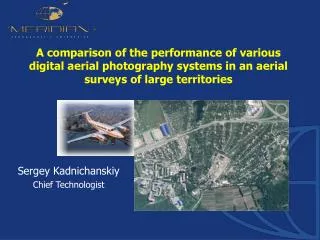
A comparison of the performance of various digital aerial photography systems in an aerial surveys of large territories Sergey Kadnichanskiy Chief Technologist
Survey of large territories, counted in the thousands, tens and hundreds of thousands of square km, is usually carried out for the creation or updating of maps of scale 1:2000 -1:25000 depending on the nature of the territory
Under performance of aerial survey system is understood as the area of the territory, aerial photography of which is performed in a unit of time. It is expedient to relate this area to one hour of flight time
Performance can be considered only in relation to certain conditions: • the type and characteristics of the aircraft • specific requirements to aerial photography - the scale of the map (plan) - the appointment of the aerial survey and the specific constraints to effective angle of the field of view of aerial camera
The scale of the map sets the required spatial resolution of aerial photo defined, as a rule, as the ground pixel size
Under the effective angle of the field of view will understand, angle, limiting the part of aerial photo image in the cross on the line of flight direction, which will be directly used in the end product, for example orthophoto
β H By The effective angle β of the field of view is associated with the distance between the flight lines By and the height of flight H fligft line footprint fligft line footprint fligft line footprint
Analog aerial survey with camera 23 x 23 cm Side overlap 30% ; f=15 cm; f=30 cm
β Effective Image Size H By The effective image size is the number of pixels corresponding to the effective field of view β fligft line footprint fligft line footprint fligft line footprint
Research and production aerial survey and geodetic company "Meridian+" owns and uses in its work aerial survey systems of fundamentally different type, which can be effectively used for surveying large areas
Framedigitalmapping aerial cameras DMC(Z/I Imaging)
Aerial survey system with CCD linear arrays ADS40 (LeicaGeosystems)
Scanning aerial survey system with CCD matrixes А3(VisionMap)
The productivity aerial survey systems is largely supported by the use of a specially equipped for aerial photography aircraft King Air 350, (Beechcraft)
Next will be the analysis of performance for the above listed cameras as well as new cameras DMCII 250 and UltraCam Eagle using the aircraft King Air 350 The most important characteristics of the cameras
The productivity of aerial survey for area2500 кm2 for map scale 1:2000 and effective field of view ≤30° ,including turns and transit flights
The productivity of aerial survey for area2500 кm2 for map scale 1:5000 and effective field of view ≤ 30° ,including turns and transit flights
The productivity of aerial survey for area250000кm2 for map scale 1:10000 and effective field of view ≤ 53° ,including turns and transit flights
The productivity of aerial survey for area250000кm2 for map scale 1:25000 and effective field of view ≤ 53° ,including turns and transit flights
When estimating the expenditure of time, have been used the following conditions of flight
Productivity and Effective Image Size Map scale 1:2000, GSD=18 cm
Productivity and Effective Image Size Map scale 1:10000, GSD=50 cm
All mentioned aerial cameras provide reception of stereo pairs of images for the stereoscopic interpretation and precise spatial measurements Each of aerial cameras type has its advantages and opportunities
DMC Spectral type of images: RGB,R,G,B, NIR Absence of necessity in control points Absence of necessity in aerial triangulation for scales1:5000 and 1:25000 Possibility of simultaneous execution of air laser scanning to capture DTM for spatial resolution photos ≤ 50 cm.
ADS 40 Spectral type of images: RGB,R,G,B, NIR Absence of necessity in control points Absence of necessity in aerial triangulation for scales1:5000 and 1:25000 Possibility of simultaneous execution of air laser scanning to capture DTM for spatial resolution photos ≤ 50 cm. The possibility of obtaining options stereo pairs of images with different ratio В/Н
А3 Spectral type of images: RGB Absence of necessity in control points for scales 1:5000 и 1:25000 The highest performance of aerial survey The spatial resolution is 28 cm (nadir) and limited by the flight altitude.Such high resolution provides higher image interpretation properties that makes possible to use the results of aerial survey in creation of maps at scale 1:2000 covering, for example inhabited localities
Conclusions Productivity of aerial survey of large territories is proportional to effective size of image in pixels provided by digital aerial camera • (for specified GSD)
Conclusions Modern digital aerial cameras provide high performance and efficiency of aerial survey, opportunities and significant advantages in aerial image processing for production of maps covering large areas
Conclusions 250000 km2 for map scales 1:5000, 1:10000 in 12 days !