Download
1 / 24
240 likes | 352 Vues
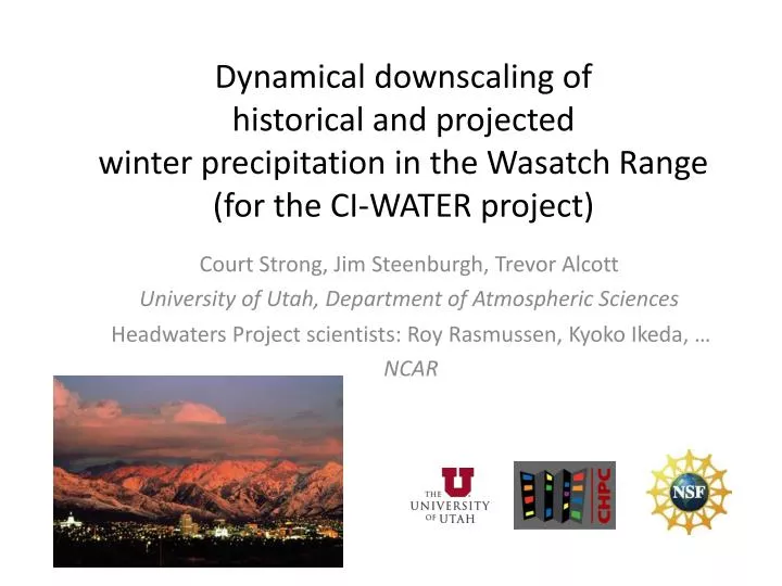
Dynamical downscaling of historical and projected winter precipitation in the Wasatch Range (for the CI-WATER project). Headwaters Project scientists: Roy Rasmussen, Kyoko Ikeda, … NCAR. Court Strong, Jim Steenburgh , Trevor Alcott

E N D
Dynamical downscaling of historical and projected winter precipitation in the Wasatch Range (for the CI-WATER project) Headwaters Project scientists: Roy Rasmussen, Kyoko Ikeda, … NCAR Court Strong, Jim Steenburgh, Trevor Alcott University of Utah, Department of Atmospheric Sciences
Outline • Background • The CI-WATER project • Wasatch Range precipitation • Regional modeling using WRF • Model configuration • Historical validation for water year 2008 • Future research plans • Summary
CI-WATER Project • Purpose is to advance cyberinfrastructure for high performance water resource modeling • Goal is to enhance the capacity for water resource planning and management in the Utah-Wyoming region • Utah-Wyoming collaboration funded through the NSF Experimental Program to Stimulate Competitive Research (EPSCoR) • http://www.uwyo.edu/ci-water/
CI-WATER Project • My research goals for the Wasatch Range: • Quantify the spread and central tendency of projected orographic precipitation to 2060 • Different global climate models • Different greenhouse gas scenarios • Different initial conditions • Provide software that civil engineers can use to quickly generate realistic future precipitation and temperature scenarios
CI-WATER Project: my study region I am currently focused on the Wasatch Range, and I plan to extend the study region to include portions of Wyoming and Colorado wikipedia.org
Wasatch Range precipitation Mountain versus valley floor annual cycles
Wasatch Range precipitation Spatial variability Salt Lake Valley Mean Annual Snowfall (inches) >600” Mean Annual Snowfall (inches) <150” 50” Steenburgh, unpublished
Wasatch Range precipitation Lake effect snow Yeager et al. (Submitted, J. Appl. Meteor. Clim.) Alcott et al. (Submitted, Mon. Wea. Rev.)
Wasatch Range precipitation Sensitivity to initial conditions • The Large Ensemble Project • One model: CCSM3 (T42) • One forcing: A1B 2000-2061 • 40 simulations Trends in precipitation [% per 55 years] expressed as a percentage of the model’s ensemble-mean climatology for 2005-2060. Deser et al. (submitted)
Regional modeling: model configuration • The Weather Research and Forecasting (WRF) regional weather and climate model Version 3.3.1 (Skamarock et al. 2005) • Configured following Headwaters Project (Rasmussen et al. 2011): • Noah land surface model • Mellor–Yamada–Janjic planetary boundary layer scheme • Community Atmosphere Model’s (CAM) longwave and shortwave schemes • Thompson et al. (2008) cloud microphysics scheme
Regional modeling: model configuration • Prescribed a mean annual cycle for the Great Salt Lake surface temperature (TG) based on first harmonic of monthly median observations 36 km 12 km 4 km
Regional modeling: model configuration • Adjusted the saturation vapor pressure to account for salinity of Great Salt Lake Gunnison Bay 28% salinity 36 km 12 km 4 km Gilbert Bay 12% salinity Steenburgh et al. (2000), Mon. Wea. Rev.
Regional modeling: model configuration • Lambert conformal projection, three domains 36 km Boundary conditions: 6-houlry NCEP Climate Forecast System Reanalysis (38-km resolution). Water year 2007-2008 12 km 4 km
Regional modeling: model configuration • Resolution of topography 12 km Wasatch Oquirrh 4 km Stansbury Cedar Uinta Salt Flats Salt Lake City
Precipitation (mm) Regional modeling: historical validation WRF Snotel 15 km
Regional modeling: historical validation Precipitation (mm) WRF Snotel 15 km
250-mb geopotential height 2008 28 Jan 12Z 28 Jan 18Z 29 Jan 00Z 29 Jan 06Z NCEP / NCAR Reanalysis
28 Jan 2008 12Z mesowest.utah.edu
Sites where WRF overestimated Ben Lomand Louis Meadow Brighton Hardscrabble
Future research plans • Additional historical validation runs • Boundary force WRF with climate model projections (CMIP5 runs) • Develop software that civil engineers can use to quickly generate realistic future precipitation and temperature scenarios
Future research plans Software will generate stochastic precipitation and temperature scenarios that 1) are consistent with downscaled climate projections 2) exhibit realistic spatial correlations among basins Parley’s Big Cottonwood Mill Creek Red Butte Emigration Little Cottonwood Neffs City creek Bells Richardson et al. (1984) Wilks (1999) Khalili et al. (2011) http://www.hiddenwaters.org/
Summary • Within CI-WATER project, my goals are • quantify the spread and central tendency of projected Wasatch Range precipitation to 2060 • develop stochastic hydrology scenario software for engineers • Regional modeling: first results • WRF configured following Headwaters Project • Modifications for the Great Salt Lake • Historical validation for 2008 water year: overestimates at four sites, realistic at seven sites
Snowfall Sensitivity +1°C +2°C +3°C +4°C PC Base PC Base PC Base PC Base PC Top PC Top PC Top PC Top Alta Base Alta Base Alta Base Alta Base Mt. Baldy Mt. Baldy Mt. Baldy Mt. Baldy Percent of snow that will instead fall as rain with warming 10% 20% 30% 40% 50% Courtesy: John Horel and Leigh Jones, Univ. of Utah
Wasatch Range: temporal variability Dettinger et al. (2011) Water