Download
1 / 20
260 likes | 637 Vues
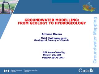
GROUNDWATER MODELLING: FROM GEOLOGY TO HYDROGEOLOGY Alfonso Rivera Chief Hydrogeologist Geological Survey of Canada GSA Annual Meeting Denver, CO, USA October 28-31 2007. GROUNDWATER MODELLING: FROM GEOLOGY TO HYDROGEOLOGY. OUTLINE Modelling

E N D
GROUNDWATER MODELLING: FROM GEOLOGY TO HYDROGEOLOGY Alfonso RiveraChief Hydrogeologist Geological Survey of Canada GSA Annual Meeting Denver, CO, USA October 28-31 2007
GROUNDWATER MODELLING: FROM GEOLOGY TO HYDROGEOLOGY OUTLINE • Modelling • Geology mapping-Groundwater modelling links • Approaches to Groundwater Modelling • Examples of Models developed by the GSC • Groundwater Analysis & Simulation types • Towards an integrated hydrogeological approach • Summary and Conclusions
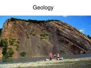
MODELLING So what do we mean? Modelling is a very broad term; we have: • Geological Models • Conceptual Models • Hydrogeological models • Mathematical models • Analytical models • Numerical models • Deterministic models • Stochastic models • …
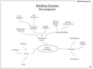
Geology Mapping-Groundwater Modelling Links • Groundwater investigations depend on the process of developing aconceptualflow model as a precursor to developing amathematicalmodel • … leading to the development of a numerical approximation model • Assumptionsmade in the development of the conceptualmodel • depend heavily on thegeologicalframework (or model) defining • the aquifer Thus, the link between geological mapping and groundwater Modelling is the building of a conceptual model
Hydrogeological model Geological survey Conceptual Model Hydrogeologist Geologist Geology Mapping-Groundwater Modelling Links
Geological model Define Objective Conceptual Model Mathematical Model Numerical Formulation Analytical Solution Pre- Processing Computer Program Code verified? no Code Solution yes Field data Model design Calibration Comparison with Field Data Modelling/ Simulation Verification Prediction Presentation of results Post- Processing Field data Postaudit Overview of the Hydrogeological Modelling Process
Approaches to Groundwater Modelling The flow of GW through fractured rock aquifers is modelled using one of two types of conceptual models: • Equivalent Porous Medium (EPM) If the length scale of interest is large compared with the scale of heterogeneities, such as fracture lengths • Discrete Fractured Network (DFN) When the structure of the rock is highly heterogeneous on the scale of interest The structure of the rock is described in terms of statistics of the fracture sets, i.e., fracture density and orientation
Approaches to Groundwater Modelling Types of approaches, models • Equivalent Porous Medium (EPM) • Discrete Fractured Network (DFN) • A combination of the two (Serco, 2000)
G, Hg G G G, Hg G, Hg G G, Hg G Hg G, Hg Hg Hg G G Hg G, Hg Hg Hg Hg G Example of Methodology for Developing Conceptual and numerical models (Rivera et al., 2001)
Examples of Models developed by the GSC
Groundwater Analysis & Simulations Types • Two different “schools” of groundwater scientists developing the science of hydrogeology: • fundamental hydrogeologists, and • environmental hydrogeologists. • Fundamental hydrogeologists study and develop laws and methods to quantify groundwater flow from a theoretical perspective. • Environmental hydrogeologists use those laws and methods to study real aquifer systems, that is, geological formations containing and conducting water. • The second group is the one that most closely interacts with geologists
Types of Environmental (water) models
Pre-Processors ISATIS SVM GoCAD MAGICS FRACMESH GIS MAPINFO RASTELM Simulators : Variables 1D FEFLOW, SUTRA, GUI/ ESRI P, C, P, 2D y, q, t, N T, a, H, T MODFLOW,TOUGH,etc. 3D TRACK AVS FED TECPLOT MATHLAB ILLUSTRATOR PHOTOSHOP Post-Processors Towards an integrated hydrogeological approach
Towards an integrated hydrogeological approach • Pre-processors include information from GIS (MAPINFO) and are used to facilitate data synthesis, analysis, and visualization • Simulators aboundin the second phase, but the link with pre-procesors is still lacking to a large degree. Graphical User Interfaces (GUI) have become a necessity in this phase. • The third phase, post-processing, has become perhaps the most important part of the modelling process, i.e., • Strong need for understanding GW from water managers and public, thus visualization is a key element in modelling. • In the future we should be able to virtually “walk” the client through and inside the simulated aquifer • Future: integration of disciplines and processes
Differences and Issues HM have a very different ontology as compared to geological models! Model Boundary conditions: Dirichlet (specified h or c); Neumann (specified c- or q-gradients); Cauchy (combined) Medium conditions: Heterogeneity, Isotropy, Anisotrophy Porous media, Fractured Media, discrete, EPM, Hybrid 1D, 2D, 3D Set of parameters: Hydraulic, Transport, Mechanic, Heat: P, H, C, T, K, Ss, σ, Nα, qi, t Type of modelling: Deterministic, stochastic Coupling: Hydro-transport (solute transfer); Thermohaline (flow, solute, heat); Hydro-mechanic (subsidence)
We should distinguish: Geological model --►Conceptual model --► Hydrogeological model SUMMARY • To build a HG Model, you need: • A numerical code to solve for a set of equations • Discretization of space (FDM, FEM) and time • Boundary conditions • Initial conditions • Set of model parameters, per node, per element or per layer • Set of data of the stresses in the system (pumping) • Set of data for calibration (heads, conc., subsidence) If the geological model is wrong, the conceptual model could be wrong and the HG model will not be successful
SUMMARY • Thus, geologists and hydrogeologists need to enhance cooperation at all levels: • Geologists need to learn to listen to hydrogeologists • Hydrogeologists need to ask geologists and learn form their input/insight
CONCLUSIONS • Increased emphasis in geological mapping and groundwater applications is observed in interrelated disciplines of Earth sciences • A clear link between geological mappers and groundwater modelers is still lacking • More serious efforts of communication are needed in three interrelated disciplines: geology, hydrogeology and geomatics when dealing with GW models • Technology and tools abound but the three domains do not take full advantage to benefit each other
CONCLUSIONS • Most important issues: differences between practitioners, e.g., HM have a very different ontology as compared to GM • Integrated and automated platforms for modelling 3D processes in hydrogeology using experts systems and standard ontologies are the future and should be pursued in close cooperation between the three domains