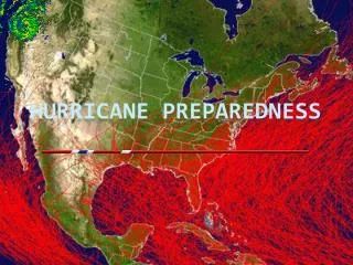
USDA Forest Service Hurricane Preparedness
50 likes | 170 Vues
USDA Forest Service Hurricane Preparedness. Data Sets Developed Southern Wildland Fire Risk Assessment GIS data sets for use during emergency response Developed a “GeoBook” that provides local emergency contacts in a spatial layers context Completed scanned State transportation maps for

USDA Forest Service Hurricane Preparedness
E N D
Presentation Transcript
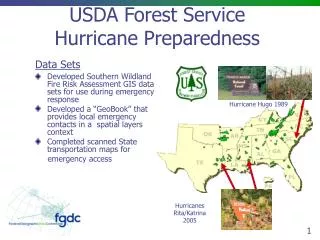
USDA Forest ServiceHurricane Preparedness Data Sets • Developed Southern Wildland Fire Risk Assessment GIS data sets for use during emergency response • Developed a “GeoBook” that provides local emergency contacts in a spatial layers context • Completed scanned State transportation maps for emergency access Hurricane Hugo 1989 Hurricanes Rita/Katrina 2005
USDA Forest ServiceHurricane Preparedness Services and Products • Enhancing Forest Service Internet for All Hurricane/Hazards web site at http://www.fs.fed.us/r8/hurricaneguide/ for managers dealing with a disaster from a unit managers perspective • Integrated coastal imagery and GIS data sets for Forest Service response teams • Provided training to state and local agencies for damage assessment and utilization of woody materials for debris estimates, initial clean-up, and evaluations for restoration of community urban forests. • Established a national clearinghouse of urban forestry storms related literature at www.urbanforestrysouth.org • A Forest Service and National Arbor Day Foundation sponsored National Storms over the Urban Forest conference in May. To provide communities the tools necessary to plan, respond and recover from catastrophic events (in the context of their urban forests)
USDA Forest ServiceHurricane Preparedness Models and Tools • Implemented a systematic assessment tool for storm damage models, an in-state and regional capacity to respond to disasters by providing effective, practical, and comprehensive urban that in consistent with the Incident Command System (ICS) • Developing a gross rapid assessment of vegetation change model using MODAS and Landsat imagery to locate potential vegetation damage • Developed a storm damage prediction model based on wind speed & precipitation in cooperation with NOAA
USDA Forest ServiceHurricane Preparedness Collaboration • Developed a method for estimations of damaged areas and potential wood volume losses within days in order to be presented to Congress • Collaboration with the National Interagency Fire Center’s FTP site to exchange GIS data sets • Collaboration with American Forests to develop a Damage Assessment Model for wildland/urban interface areas damaged by Katrina. This provides information for recovering communities with air quality, watershed quality, and energy and to restore vital service. • Technical collaboration with USDA-FSA (Farm Service Agency) and State Foresters for storm damage restoration of private lands
USDA Forest ServiceHurricane Preparedness GAPS and NEEDS • Funding for Required Programs is being redirected for Hazard Assessments & Preparation • Data and Information on Long-term Salt Water Damage to Vegetation