Download
1 / 13
130 likes | 263 Vues
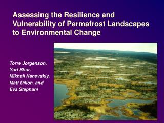
Using the Landscape to Mitigate Vulnerability and Enhance Resilience. B. L. Turner II Arizona State University Central Arizona Phoenix. Solutions for Sustainability. Theme: b ehavioral modification extremely difficult geoengineering /infrastructure development extremely costly

E N D
Using the Landscape to Mitigate Vulnerability and Enhance Resilience B. L. Turner II Arizona State University Central Arizona Phoenix
Solutions for Sustainability Theme: • behavioral modification extremely difficult • geoengineering/infrastructure development extremely costly • design/redesign of landscape undervalued • already shapes human-environment outcomes & thus vulnerabilities and resilience • de facto part of adaptation • thus can mitigate as well
Land Architecture Definitions • mosaic of land covers/uses (or land systems) • amount, shape, pattern, connectivity of land covers/uses • urban core to wildlands
Multiple Birds with One Architecture Land(scape) architecture affects tradeoffs • among multiple environmental services • between services and human outcomes/conditions • among multiple human outcomes/conditions water quality desired housing UHI health carbon storage
Thus… • IPCC Fourth Assessment & Americas Climate Choices (NAS) • Land systems for mitigation and adaptation noted • International Council of Science • Land systems = a grand challenge • NAS America’s Climate Choices
So What is the Science? • know little about LA-multiple tradeoffs by biome or environment • know even less about shape and pattern • minimal examinations of services to human outcomes • virtually no attention to scalar dynamics on tradeoffs • can get one LA scale (local) “right” but is offset by that of the ascending scale
Regressions = increased significance when land configuration (architecture) included. 240m 240m Xeric Residential Industrial/Comm. Mesic Residential
Area_MN = mean ED = edge density PD = patch density PLAND = % of given cover FRAC_AM = fractal dim. LSI = landscape shape index Only beginning to explore LA on land system/ecosystem/landscape function, environmental services, and human outcomes, their tradeoffs, and use in designing sustainable HE systems. Pearson’s correlations between LST and class metrics. * p < 0.05 ** p < 0.01
Rudimentary Example • Accounting for kind, amount, shape, pattern of land-use/cover + spatial dynamics – on ecosystems, services, and human outcomes Local pattern A Local pattern B Ascending Scale PD, ED, LSI Forest structure Biomass Carbon Biodiversity P Capture Bracken fern Evapotrans. Farm income Degrad. fram land. Req. off farm income PD, ED, LSI Forest structure Biomass Carbon Biodiversity P Capture Bracken fern Evapotrans. Farm income Degrad. Farm land Req. off farm income Biodiversity Habitat restriction Precipitation ? Ecotrourism Farm Yields pattern and scalar interactions matter and must be treated more concretely with human outcomes B Turner 2010. Land Use Policy.
Are We Ready? Huge advances in • remote sensing • GIS • spatially explicit agent-based to econometric modeling • tradeoff assessment
Are We Ready? Huge advances in • remote sensing • GIS • spatially explicit agent-based to econometric modeling • tradeoff assessment • but need to be made spatially explicit
We Can Do This • Capacity to create spatially dynamic and explicit model to handle multiple tradeoffs/outcomes • Prove important for a large number of science problems • Variants of the model planning/decision making tool (co-produce from start)