Spatial Cadastral Database (SCDB)
Welcome to Landgate. Landgate / 1Spatial Meeting. Spatial Cadastral Database (SCDB). www.landgate.wa.gov.au. Landgate / 1Spatial Meeting. Landgate. Introduction to Landgate and the SCDB. Statutory Authority – commercial powers
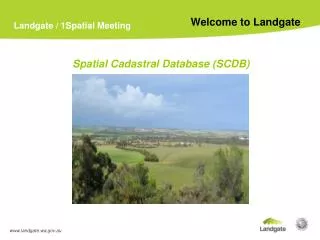

Spatial Cadastral Database (SCDB)
E N D
Presentation Transcript
Welcome to Landgate Landgate / 1Spatial Meeting Spatial Cadastral Database (SCDB) www.landgate.wa.gov.au
Landgate / 1Spatial Meeting Landgate Introduction to Landgateand the SCDB • Statutory Authority – commercial powers • Responsible for Western Australia’s land and property information and provision of: • A secure land titles system – the official register of land ownership • Valuation services for the States land and property • Survey information in support of ownership and land development - SCDB • Development of a common platform to improve access to a range of government information - SLIP www.landgate.wa.gov.au
Introduction to Landgateand the SCDB Landgate / 1Spatial Meeting Spatial Cadastral Database - SCDB • One part of Landgate’s corporate GIS • Stores topologically related point, line, polygon, angle, azimuth, arc and string data, with attribute information for a range of cadastral and administrative datasets including • Surveyed & Un-surveyed cadastre • Unapproved surveys (Lodged Layer) • Control Marks (from GESMAR) • Easements • Surveyed Mining Tenements (Mines data stored in SCDB) • Administrative Boundaries (LGAs, Localities, Port Authorties etc) www.landgate.wa.gov.au
Introduction to Landgateand the SCDB Landgate / 1Spatial Meeting Spatial Cadastral Database - SCDB • Points, Lines & Polygons • Unique numeric identifiers • Can have multiple usages • Various derivations & accuracies • Time stamps for create, modify, retired www.landgate.wa.gov.au
SCDB Data Attributes(External Linkage Keys) Landgate / 1Spatial Meeting www.landgate.wa.gov.au
Introduction to Landgateand the SCDB Introduction to Landgateand the SCDB Landgate / 1Spatial Meeting Landgate / 1Spatial Meeting SCDB Business Drivers • Daily Maintenance • Average of 500 new surveys/month • 70% automatically integrated • New Topographic Boundary Definitions • Water marks – HWM, LWM, MHWM • Spatial Upgrade Program • Replacement of digitized values with surveyed dimensions www.landgate.wa.gov.au www.landgate.wa.gov.au
Introduction to Landgateand the SCDB Landgate / 1Spatial Meeting Spatial Cadastral Database - SCDB • Seamless database held in GDA94 coordinates • Original data captured from digitized cadastral map sheets of various scales ( 1:2K to 1:250K) • 86% of SCDB now upgraded to survey accuracy • Accuracy of upgraded areas is approximately: • Metro - +/-0.25m • Rural – +/-2m • Pastoral - +/-10m • Environment is client/server with data stored in Oracle and managed in conjunction with SDE www.landgate.wa.gov.au
Introduction to Landgateand the SCDB Introduction to Landgateand the SCDB Landgate / 1Spatial Meeting Landgate / 1Spatial Meeting SCDB Data Dissemination Formats • ESRI Shape Files • SDE • DGN • DXF • DWG • NORM Files (in-house format) www.landgate.wa.gov.au www.landgate.wa.gov.au
WALIS PAIG Landgate / 1Spatial Meeting Landgate / 1Spatial Meeting WALIS Positional Accuracy Improvement Group (PAIG) • PAI issues more evident in 2008 • SLIP highlighted positional difference between Landgate’s SCDB compared to Clients Data • 12 Core Agencies • Terms of Reference • Identification of common SCDB user issues • Investigation of possible changes to SCDB maintenance and data dissemination to better assist users • Investigate integration improvement opportunities for fundamental WALIS datasets • Share ideas, collaborate and raise awareness across agencies • Subgroup – Landgate subject experts www.landgate.wa.gov.au www.landgate.wa.gov.au
Spatial CadastralDatabase Landgate / 1Spatial Meeting • Cadastral Maintenance • Approach depends on the area to be updated • Special Survey Areas • Least Squares Adjusted Areas • Digitized Areas • Spatial Upgrade Program • Replacement of digitized dimensions with surveyed measurements • Improvement of relative and absolute coordinate accuracy by linking to Geodetic Control and Least Squares Adjustment • Program is the primary cause of coordinate shifts that concern SCDB data customers • Will not be completed for 3-4 years www.landgate.wa.gov.au
SCDB Spatial UpgradeProgress 1 August 2009 Landgate / 1Spatial Meeting www.landgate.wa.gov.au
Least Squares Adjustment Landgate / 1Spatial Meeting Before “Red” is adjustment hotspot area. Indicating errors in the network from possible incorrect observations – angles & distances www.landgate.wa.gov.au
Least Squares Adjustment Landgate / 1Spatial Meeting After “Blue” is Least Squares Adjusted (Point Accuracy Statements approx 0.030 metres) Other is Image “Digitised” (Point Accuracy Statements 50.0 metres) www.landgate.wa.gov.au
Least Squares AdjustmentResults Table Landgate / 1Spatial Meeting www.landgate.wa.gov.au