Download
1 / 42
420 likes | 666 Vues
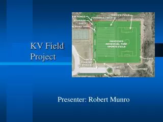
Sammamish-Juanita 115 kV Project Route Siting Project November 2012. Gene Lohrmeyer GeoEngineers. GeoRoute Selection Model. GeoRoute Selection Model. GeoRoute Selection Model. Help determine preferred route between substations – need alternatives

E N D
Sammamish-Juanita 115 kV ProjectRoute Siting ProjectNovember 2012 Gene Lohrmeyer GeoEngineers
GeoRoute Selection Model • Help determine preferred route between substations – need alternatives • Demonstrate and defend route selection process in public meetings PSE Needs
GeoRoute Selection Model • Multiple competing values • Engineering • Community • Environment • Other non-GIS efforts by PSE resulted in no consensus • Professional Judgement • Criterium Issues
GeoRoute Selection Model How would you help PSE with this problem?
GeoRoute Selection Model • Develop a geoprocessing model • Combine datasets using weighted overlay tool • Least cost path analysis using distance tools • Accumulated Cost GeoEngineers Solution
GeoRoute Selection Model • Allows you to automate GIS tasks and perform spatial analysis and modeling • Everything in the toolbox can be used in a geoprocessing model What is Geoprocessing?
GeoRoute Selection Model • 20 datasets from various sources • Reproject and clip each dataset to a project boundary Geoprocessing Example
GeoRoute Selection Model • Allows you to combine rasters of varying importance • Why rasters? • Scale (in = 10, out = 0) Weighted Overlay Tool
GeoRoute Selection Model • Collect existing jurisdictional GIS Data • Kirkland, Redmond, Dept of F&W • Clip to project boundary and convert to raster • Assign data to either Built, Natural Environment, Engineering or Opportunity groups • More flexibility for analyzing alternatives • Weighted Overlay Tool • Weight and combine datasets in each group • Weight and combine Built, Nat Env and Eng groups (Avoidance Areas) • Weight and combine Avoidance Areas with Opportunities • Distance Tools • Least Cost Path Analysis GeoRoute Tasks
GeoRoute Selection Model • Conceptual Model Overview
GeoRoute Selection Model Built Environment
GeoRoute Selection Model • Built Environment Data Layers
GeoRoute Selection Model • Single Family Residential Zoning
GeoRoute Selection Model • Schools and Parks
GeoRoute Selection Model Natural Environment
GeoRoute Selection Model • Natural Environment Data Layers
GeoRoute Selection Model • Wetlands Wetlands
GeoRoute Selection Model • Landslides
GeoRoute Selection Model Engineering
GeoRoute Selection Model • Engineering Data Layers
GeoRoute Selection Model • Street Curves
GeoRoute Selection Model • Steep Slopes >40%
GeoRoute Selection Model • Built Environment Data Layers Weights
GeoRoute Selection Model • Combined and weighted avoidance groups 34% 33% 33%
GeoRoute Selection Model • Built Environment Criteria 100% 0% 0%
GeoRoute Selection Model Model Overview
GeoRoute Selection Model • Opportunities Data Layers
GeoRoute Selection Model • Arterial Streets
GeoRoute Selection Model • Industrial/Commercial Zoning
GeoRoute Selection Model Model Overview
GeoRoute Selection Model • Least Cost Path Model
GeoRoute Selection Model • Full Model
GeoRoute Selection Model • Alternatives can be created by adjusting weights of avoidance rasters • Built = 50%, Nat Env = 30%, Engineering = 20% • Built = 20%, Nat Env = 70%, Engineering = 10% • Or by adjusting combined avoidance and opportunities • Avoidance = 50%, Opportunities = 50% • Avoidance = 80%, Opportunities = 20% • Route Examples Alternate Routes
GeoRoute Selection Model • Model works but has lots of moving parts and can be confusing to an audience • Need to simplify interface • Solution • Export model to Python • Develop ArcMap extension using C# • Extension hooks in to Python Public Involvement
GeoRoute Selection Model • Model allows PSE to easily compare alternate routes • Model is transparent and reproducible • Data is from authoritative sources and defensible • Solution allows for public input and allows public to see the results immediately Conclusion
GeoRoute Selection Model Questions? Gene Lohrmeyer GeoEngineers glohrmeyer@geoengineers.com 425-861-6000