Extreme Storms and Climate Change
560 likes | 704 Vues
Rachel G. Mauk Geography 8901 1 October 2012. Extreme Storms and Climate Change. Kunkel et al. (in press), Bulletin of the American Meteorological Society. Monitoring and Understanding Trends in Extreme Storms: State of Knowledge. Motivation.

Extreme Storms and Climate Change
E N D
Presentation Transcript
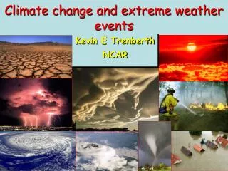
Rachel G. Mauk Geography 8901 1 October 2012 Extreme Storms and Climate Change
Kunkel et al. (in press), Bulletin of the American Meteorological Society Monitoring and Understanding Trends in Extreme Storms: State of Knowledge
Motivation • 2011: 14 weather/climate disasters exceeding $1B in damage • Climate is changing • Means AND extremes • How are extreme storms changing? • How well can we detect changes? • How well do we understand the changes? • Next step: are the impacts changing?
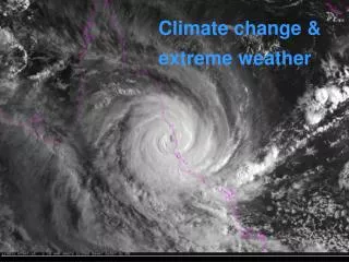
Extreme storms • Short-duration events with levels/types of wind and/or precipitation that are uncommon for a particular place and time of year • Severe convective storms • Tornadoes, hail storms, severe thunderstorms • Extreme precipitation • Tropical cyclones • Winter weather • Snowstorms, ice storms
Overriding Issues • Climate model resolution • Knowledge of physical mechanisms • Data heterogeneity • Changes in observing practices and technologies • Changes in station location • Definitions of phenomena • Analysis procedures • Often, changes are improvements….but still impact validity of long-term trends
Severe Thunderstorm Criteria • A severe thunderstorm has at least one of the following features: • Hail ≥ 2.5cm (1”) in diameter • Wind gusts ≥ 95 km/h (58 mph) • Tornado • Assess trends in severe thunderstorms in two ways • Reports (trend in observations) • Environmental conditions (trend in probabilities)
Tornado Reports • Tornadoes: increased number of tornado reports since 1954 • No trend in F1+ tornadoes since 1954 • All of trend due to F0 tornadoes ? Fig. 1
WSR-88D: doppler radar enables detection of radial motion (toward/away from radar) • Identify mesocyclones (tornado precursor) • Send NWS survey teams to areas with radar-indicated tornadoes
Tornado Reports • Upward trend in tornado frequency over last 50 years due to increase in (E)F0 reports • F0 are weak and short-lived tornadoes • Prior to Doppler era, damage likely attributed to straight-line winds or never observed
Tornado damage reporting • Fujita (F) scale replaced by Enhanced Fujita (EF) scale in May 2007 • Adjusted damage ratings for construction quality and maintenance (28 structures) • Cannot directly compare F-scale ratings to EF-scale ratings • No plans for conversion • Changes in damage assessment over the decades (subjective/objective)
Severe weather ingredients are well-known • Lower-troposphere wind shear: self-supporting thunderstorms; induce mesocyclones • Instability: deep convection (tall cumulonimbus)
How well are severe thunderstorm environments modeled? • Trapp et al. (2011), Clim. Dyn. • Downscaled NCEP/NCAR Reanalysis data (2.5°) using WRF to 4.25 km grid spacing • Identified severe thunderstorms as events exceeding minimum thresholds in updraft helicity (vertical motion + vorticity) and radar returns
[Clim. Dyn., 2011] • Too few events in May/June • Too many in N. Gr. Plains in June, too few in E. US
How will GHGs affect severe weather frequency? Trapp et al. (2009; GRL, L01703) • 5-member ensemble of CCSM3 (NCAR) • Ran simulation from 1951-2099 • Examined changes in parameters known to be conducive to severe thunderstorm formation: • CAPE (instability—vertically summed difference between parcel & env. temp) • Wind shear (0-6 km)—rotation • Water vapor content (convection)
Time series of regionally averaged: (a) CAPE2000, the number of days on which CAPE > 2000 J kg-1, (b) NDSEV, the number of days on which severe convective storms and associated significant surface winds, hail, and/or tornadoes could occur in the vicinity of a grid point, (c) NDSEV,P, the number of days with the joint occurrence of severe convective storm forcing and convective precipitation at a grid point (Trapp et al. 2009, GRL, L01703)
Time series of regionally averaged: (d) S06, the magnitude of the vector difference between the horizontal wind at 6 km AGL and the wind at the lowest model level (m s-1), (e) CAPE (J kg-1), and (f) q, the surface specific humidity (x 10-3 kg kg-1) (Trapp et al. 2009, GRL, L01703)
Summary: Severe Convective Storms • Data heterogeneity limits confidence in trends based on reports • Trends in favorability of environmental conditions over last century are not statistically significant now • Limited modeling of future conditions suggests increase in frequency of favorable environments • More studies needed
Extreme precipitation: data • US observing network well-suited to assessing changes in heavy precipitation • NWS Cooperative Observer network has used same 8” nonrecording precipitation gauge • No time-dependent instrumentation bias • Minimal wind-driven bias and gauge undercatch for large amounts of precipitation • Network of observers relatively dense • Does not distinguish convective from non-convective events
Extreme precipitation: causes • Factors • Abundant atmospheric water vapor • Strong upward motion • Associated with various systems • Extratropical cyclones • Tropical cyclones • Mesoscale convective systems • North American monsoon
Extreme precipitation: metrics • Analyze using statistics • Empirical (distribution, trends, threshold exceedance) • Theoretical (extreme value theory—maxima, return levels) • Choice of metrics involves tradeoff • Low-probability events are most societally relevant • Less extreme but more frequent events minimize sampling uncertainty • Recurrence interval thresholds used for runoff control structures
Extreme precipitation: trends • Many studies have found statistically significant increases in extreme precipitation events of hours to days • Number and intensity • Change in tails of distribution, not shift • +0.6% / decade in mean precipitation • +2% / decade in extreme precipitation • What about spatial trends?
Figure 3. Time series of decadal values of an index (standardized to 1) of the number of 2-day precipitation totals exceeding a threshold for a 1 in 5-yr occurrence for 7 regions and the U.S. as a whole. This was based on an individual analysis of 930 long-term stations. Station time series of the annual number of events were gridded and then regional annual values were determined by averaging grid points within the region. Finally, the results were averaged over decadal periods.
Extreme precipitation: trends • U.S. as whole: more events in last 30 years • Considerable spatial variation on decadal scale • Less consistency in trends in west, more in east • Trend is significant for U.S. as whole, Midwest and Southeast • No significant trends in western U.S.
Extreme precipitation: trends • Estimated 1948-2010 change in 20-year return values at individual stations calculated • 76% of all stations experience increases in extreme precipitation • 15% statistically significant (station-specific)
Figure 4. Changes in observed twenty year return value of the daily accumulated precipitation from 1948 to 2010. Units: inches. Only locations for which data from at least 2/3 of the days in the 1948-2010 period were recorded are included in this analysis. The change in the return value at each station is shown by a circle whose relative size portrays its statistical significance: the large circles indicate the z-score (estimated change in the return value divided by its standard error) is greater than two in magnitude, medium circles indicate the z-score is between one and two in magnitude, and the small circles indicate the z-score is less than one in magnitude.
Extreme precipitation: attribution • Changes in extreme precipitation have been linked to: • Human-induced changes to atmospheric composition • Increased temperatures • For same annual or seasonal precipitation total, warmer climates generate more extreme events • Increased water vapor concentrations
Water vapor and extreme precipitation • Study documented significant increases in water vapor associated with extreme precipitation events • Extreme precip event assigned precipitable water value: maximum value from any radiosonde station within 300 km and 24 h of event • Increase in water vapor in environment of precipitation-producing systems may be physical cause of increase in intense events
Other causes: Physical changes to meteorological systems • Possible upward trend in number of extreme precipitation events associated with TCs (2 of 3 recent studies) • Upward trend in number of extreme precipitation events in the vicinity of fronts • Temporal redistribution of EN/LN events, land use changes • Possible changes to characteristics of meteorological systems?
Summary: Extreme Precipitation • Evidence of increasing frequency of extreme precipitation events • Data quality is good • Water vapor content of air increasing • Likely factor in extreme precipitation trend • More research needed to assess changes to meteorological systems producing extreme precipitation
Winter storms • Quantifying trends in frequency, duration, and severity of winter storms requires ability to accurately and consistently measure: • Amount of snow that falls • Ice that accumulates • For individual storms and throughout entire season • Data are complicated by changing observing practices and technologies and reporting procedures
Winter storm data heterogeneity • The following cause “artifacts” in data series: • Transition from primarily afternoon to morning observation times • Move to direct measurement from previous estimation of precipitation by “10:1” snow to water ratio • Periodic changes in observer training practices
What constitutes a winter storm? • Characteristics vary regionally • 10” in NE is fairly regular occurrence • 10” in SE could cripple region for 1+ week • ILN just changed criteria for winter weather advisory
What constitutes a winter storm? • Regional Snowfall Index (RSI) • Combines population, snowfall amount, and spatial extent • Thresholds differ for different regions http://www.ncdc.noaa.gov/snow-and-ice/rsi/
Winter storms: Influences • Winter storm trajectories, frequency, and intensity are affected by: • El Nino/Southern Oscillation (ENSO) • North Atlantic/Arctic Oscillation (NAO/AO)
Winter storms: ENSO • El Nino/Southern Oscillation (ENSO) • La Nina: northerly storm track (more snow to northern/central Rockies) • El Nino: southerly storm track (rain/snow to desert SW, rain to SE) • Regime changes over last century • Low activity from 1930s-1940s • EN favored early in 20th century, mid 1970s-late 1990s • LN favored in 1950s- mid 1970s
Winter storms: (N)AO • (N)AO dominates eastern U.S. weather patterns • Positive phase: mild winter weather • Negative phase: strong storms • Also a regime change: • Positive phase in early/late 20th century • Negative phase in mid 20th century • Last 15-20 years more even split • Negative in 2009-2010, 2010-2011 winters • Positive in 2011-2012 winter
Figure 6. Number of extreme snowstorms (upper 10 percentile) occurring each decade within the six U.S. climate regions in the eastern two-thirds of the contiguous U.S. (Based on an analysis of the 50 strongest storms for each of the six climate regions from October 1900-April 2010). The inset map shows the boundaries of each climate region. These regions were selected for consistency with NOAA’s monthly to annual operational climate monitoring activities. The map includes standardized temperature anomalies and precipitation departures from the 20th century mean calculated across all snow seasons in which each storm occurred. The snow season is defined as December-March for the South and Southeast regions and November-April for the other four regions.
Extreme snowstorms: trends • Based on RSI: • From 1961-2010, 21 extreme regional snowstorms • From 1900-1960, 9 extreme snowstorms • Extreme storms occurred more frequently in colder and wetter winters (Fig. 6) • 35% were warmer than average • 30% drier than average • Even if temperatures continue to warm, for at least next few decades record storms are still possible
Seasonal totals • Assessed variation of seasonal snowfall at 425 stations across contiguous U.S. • No significant century-scale trends in either high or low totals • Areal coverage of extremely low seasonal snowfall has been steady or slightly increasing since mid 1970s
Figure 7. (a). Area weighted annual percentage of U.S. homogenous snowfall stations exceeding their own 90th percentile seasonal totals, 1900-01 to 2010-11. Reference period is 1937-38 to 2006-07. Adapted from Kunkel et al. (2009c). Thick blue line: 11-year running mean of the percentages. Dashed line: Number of grid cells with active stations each year.
Figure 7(b). Area weighted annual percentage of U.S. homogenous snowfall stations below their own 10th percentile seasonal totals, 1900-01 to 2010-11. Reference period is 1937-38 to 2006-07. Adapted from Kunkel et al. (2009c). Thick blue line: 11-year running mean of the percentages. Dashed line: Number of grid cells with active stations each year.
Winter storm modeling • Number of extreme snowstorms could increase in latter half of 20th century • Areal coverage of extremely low seasonal snowfall totals constant or increasing • Contradiction? • No: comparing short-term extreme events versus sum of all events over a season • Northern areas of U.S.: not uncommon for extreme snowstorm to occur in year with below-average snowfall totals