
Comparative Water Quality Study in Pasquotank Watershed, North Carolina
Explore 2011/2013 water quality assessments in Pasquotank Watershed, comparing pH, salinity, dissolved oxygen, and more. Analyze data variations.

Comparative Water Quality Study in Pasquotank Watershed, North Carolina
E N D
Presentation Transcript
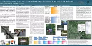
A Comparative Study of the 2011/2013 Water Quality Assessments in the Pasquotank Watershed in Northeastern North Carolina Dorothy Brice (VUU), Robin Brice (FSU), Anthony Lynn (WSSU) Mentor: Mr. Jeffrey A. Wood (ECSU) Principal Investigator: Dr. Linda B. Hayden (ECSU), 1704 Weeksville Rd, Box 672, Elizabeth City, North Carolina 27909 Abstract The Pasquotank River Watershed is found in Northeast North Carolina beginning in the Great Dismal Swamp at the Virginia/North Carolina border and flows into the Albemarle Sound. The watershed provides a transition between spawning grounds and the waters of the Albemarle Sound. Tributaries enclosed by various landforms such as swamp, farmlands, and increased housing development supply the watershed. The 2013 Research Experience for Undergraduates Pasquotank River Watershed Team completed tests of five tributaries and the river itself. These test points were derived from the 2011 Watershed Team research project in order to compare the results. Tests performed on this year’s samples included pH, salt, total dissolved solids, and conductivity. Air/water temperature, dissolved oxygen, wind speed/direction, and turbidity/clarity measurements were taken in the field. The data were then compared to the 2011 project data and analyzed for any variations or similarities. Keywords: Water Quality, Pasquotank, Watershed, dissolved oxygen, pH, salinity, conductivity, clarity, turbidity Analysis Dissolved Oxygen The stream measurements for 2013 roughly paralleled the measurements for the 2011 project. Dissolved oxygen, the largest factor in stream health, varied from low levels at the head of each waterway to much higher levels at the intersection of the waterway with the Pasquotank River. The Pasquotank River readings also replicated this pattern from the intersection of the Dismal Swamp Canal to the town of Elizabeth City. Factors influencing this include wind, water depth, and width of the waterway. Newbegun Creek came in at the top of the Water Quality Index mainly due to the high dissolved oxygen readings. These high readings may have been shaped by persistent northerly winds entering the mouth of the river creating greater wave action. TDS, Salinity, and Conductivity TDS, salinity, and conductivity readings remained high as in 2011 in Mill Dam Creek, Areneuse Creek, and Newbegun Creek. These waterways are well below the Elizabeth City where the Pasquotank River narrows greatly, increasing the influence of the brackish water brought in during the summer months. The testing points for the Pasquotank River start at the city and work north towards Knobbs Creek and Sawyers Creek yielding less of an influence by the brackish water in the lower Pasquotank River. From this it can be derived that salt is the main solid in these waterways. Another check of these waters during the cooler months could possibly prove or disprove this conjecture. pH The pH readings for this year’s sampling were higher than the 2011 tests. The almost neutral state of this year’s readings was unexpected due to historic records of very low pH. Factors that may have caused this were a dry period without much runoff from the area swamps and a period of extreme heat during the sampling period. The comparison between the two years may also have been influenced by a change in testing methods. The 2011 team utilized test strips with which the color must be interpreted and the 2013 team put into use a digital pH meter that could be calibrated to basic, neutral, and acidic. Clarity/Turbidity At the recommendation of Mr. Jeff Schloss of the University of New Hampshire, a separate test for turbidity was initiated. Using this black side of the Secchi disk, the team was able to compare the color of the water (clarity) to the suspended particles in the water (turbidity). The readings paralleled each other with clarity having approximately a ten inch greater reading at each test point. The Secchi disk is a very subjective test, greatly affected by the user’s perception and other factors such as water reflection and the amount of sunlight during a test. Conclusion In this project, the data show that the overall health of the Pasquotank Watershed, as determined by the Water Quality Index Calculator, has remained consistent compared to the previous 2011project. Though minor variations were found in the WQI, the overall health of the Pasquotank and its tributaries remain around the medium range. Once again, very little association was made between the landforms surrounding these waterways and the test results. This may have been as a result of a low rain period during the testing. One of the major correlations discovered was the relationship between Areneuse Creek, Mill Dam Creek, and Newbegun Creek. These creeks are well downstream of the other waterways tested (Pasquotank River, Knobbs Creek, and Sawyers Creek) and were found to have much higher concentrations of salt. This affected both the conductivity and the TDS tests. These results were also noted when the 2011 project data were analyzed. Better equipment and drawing on the experience of the 2011 team allowed this year’s project to make two samplings of each waterway doubling the amount of data acquired. Increased documentation with each project should establish a firm base from which to gather increased data and increase the type of tests performed for a more accurate assessment of the watershed’s well-being. Future Work For future testing of water samples it is suggested that a more advanced meter be acquired that would be able to perform multiple tests. The YSI Professional Plus Multi-Parameter Meter is capable of measuring dissolved oxygen, conductivity, salinity, total dissolved solids, pH, and temperature. This meter could increase the number of tests completed and provide improved accuracy through its internal database management. The acquisition of a small, flat-bottomed, boat with a small engine would decrease the amount of time needed to cover each waterway. This boat should be light enough to carry into locations that do not have launching ramps and have a secondary source of power such as a trolling motor. It is also suggested that the addition of nitrogen, nitrate, and fecal coliform tests be studied. These are just a few of the many tests that the Environmental Protection Agency calls for, but are major factors in determining the health of the water being tested. While these tests are essential parts of water quality tests they may be beyond our abilities to test at this level of research. • Introduction • A watershed describes a range of land that includes a common set of streams and rivers that all drain into a single larger body of water, such as a superior river, lake, or ocean. [1]. Watersheds can come in all shapes and sizes. They divide counties, states, and national boundaries [2]. “In the continental US there are 2,110 watersheds; including Hawaii Alaska, and Puerto Rico, there are 2,267 watersheds.” [2] All streams, tributaries, and rivers are associated to a watershed. In most cases small watersheds gather together to become larger watersheds. Watershed activity that affects the water quality, quantity, or flow at any location, can also alter the features of the watershed at downstream locations. A watershed has four important functions, collecting water from rainfalls, storing water, releasing water, and providing a home for fauna and flora. [3] Watersheds support life, in more than one way. According to the Environmental Protection Agency, “more than $450 billion in foods, fiber, manufactured goods and tourism depend on clean, healthy watersheds.” The Earth consist of 70% of water and out of that seventy 40-50% of our land's waters are impaired or endangered. This could lead to insufficient water. Meaning that the water will be inhabitable leaving no drinking water or produce. “Watershed protection is a means of protecting a lake, river, or stream by managing the entire watershed that drains into it.” To ensure a healthy watershed the community must get informed on how humans can impact a body of water. [4] • In the 2013 project the following factors that were evaluated includes dissolved oxygen (DO), clarity, turbidity, pH, total dissolved solids, salinity and conductivity. All of these parameters can affect the overall quality of a watershed. • Dissolved oxygen was tested using the Milwaukee Dissolved Oxygen Meter MW-600. • Clarity and Turbidity were tested using a Secchi disk. The black and white side was for clarity and the black side was for turbidity. • pH was tested using an Aquarium PortableDigital pH meter. • Total Dissolved Solids (TDS), Conductivity and Salinity were tested using the LaMotte Tracer PoeckeTester. 2011 Water Quality Index 2013 Water Quality Index • References • [1]Missouri Botanical Garden. (2004) What Is a Watershed? [Online]Available. http://www.mbgnet.net/fresh/rivers/shed.htm. • [2]United States Environmental Protection Agency. (2013). What Is aWatershed? [Online]. Available. http://water.epa.gov.type.watersheds.whatis.cfm • [3]Sanjay, S. (2006).Watersheds - Functions and Management U.S. Department of Agriculture[Online]. Available.http://edis.ifas.ufl.edu. • [4]The Nature Conservancy.(2013). Journey with Nature Watersheds 101.[Online]. Available. http://www.nature.org/ourinitiatives/regions/northamerica/unitedstates/indiana/journeywithnature/watersheds-101.xml. • [5]Environmental Monitor.(2013). What Is Dissolved Oxygen in Water? [Online]. Available. http://www.fondriest.com/news/whatisdissolvedoxygen.htm. • [6]Nixon, Jay, Pauley, Sara .Water Quality Parameters.[Online]. Available. http://www.dnr.mo.gov/env/esp/waterquality-parameters.htm July 17, 2011 • [7]USGS Georgia Water Science Center.(2013).Water Resources of Georgia.[Online].Available. http://ga.water.usgs.gov. • [8] How Does TDS (Total Dissolved Solids) Affect Water Purification?" (2013).[Online].Available. http://www.tdsmeter.co.uk/abouttds.html • [9]Srinivas, H. “An Introduction to Urban Watersheds.”[Online]. Available. Wind Meter Compared Graph Results Secchi Disk Pocket Tester Dissolved Oxygen Meter


