Enhancing 9-1-1 Services through Rural Addressing on the Navajo Nation
This presentation by Rachelle Silver-Tagaban highlights the challenges and current state of 9-1-1 services on the Navajo Nation, where there is no dedicated system in place. Instead, calls are forwarded to external Public Safety Answering Points, causing delays and frustrations for emergency responders. The importance of implementing a rural addressing system is emphasized, including its role in enhancing the effectiveness of 9-1-1 services. The presentation also discusses the need for unique addresses for homes, businesses, and public facilities to improve emergency response efficiency.

Enhancing 9-1-1 Services through Rural Addressing on the Navajo Nation
E N D
Presentation Transcript
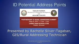
ID Potential Address Points Presented by Rachelle Silver-Tagaban, GIS/Rural Addressing Technician Partnership to Rural Addressing Summit, 7/24/13
No 9-1-1 • Presently, there is no dedicated or Basic 9-1-1 system on the Navajo Nation. • There is only call forwarding which means your call is NOT priority and it continues to sit in queue until someone at the Police Department answers it. Partnership to Rural Addressing Summit, 7/24/13
…continue • Currently, all 9-1-1 calls when dialed will get answered by an outside Public Safety Answering Point (PSAP) facilities particularly the surrounding Counties and/or border towns. These calls will generally get forward back to the Navajo Nation Police Districts. Partnership to Rural Addressing Summit, 7/24/13
…continue • As a result, frustration, more time, and confusion will be placed on our emergency responders • Then criticism for their slow response time, so how do you find a needle in a haystack? Partnership to Rural Addressing Summit, 7/24/13
Navajo Nation & Rural Addressing • Currently, there is only one Navajo Nation Chapter that is actively 9-1-1 Enhanced. That is Tohajiilee Chapter and they are being serviced with the Bernalillo County PSAP. • In 2006, a Pilot Project between the former Navajo Nation E9-1-1 office, Bernalillo County’s PSAP, and Spatial Data Research (SDR) performed rural addressing efforts. Partnership to Rural Addressing Summit, 7/24/13
Tohajiilee Community Partnership to Rural Addressing Summit, 7/24/13
Tohajiilee Close-up Partnership to Rural Addressing Summit, 7/24/13
What is a 9-1-1 Address? Rural addressing or house numbering is a system of giving a unique number to a structure on a street or area, with the intention of making it easier to locate a particular structure; therefore, rural addressing must be completed first in order to Enhance 9-1-1. A 9-1-1 address contains a unique number, name of street, city, state, and zip. Which is typically a physical or shipping address. Partnership to Rural Addressing Summit, 7/24/13
How does an address relate to 9-1-1? In an emergency, when the call-takers or dispatcher receives a 9-1-1 call, they need to be able to locate the Person Reporting (PR), so they can guide the emergency responders to that location. Rural addressing is a prerequisite to E 9-1-1. Partnership to Rural Addressing Summit, 7/24/13
So, what is a potential address point? Partnership to Rural Addressing Summit, 7/24/13
Home Structures Partnership to Rural Addressing Summit, 7/24/13
Industrial Structures Partnership to Rural Addressing Summit, 7/24/13
Business Structures Partnership to Rural Addressing Summit, 7/24/13
Government/Public Facilities Partnership to Rural Addressing Summit, 7/24/13
School Structures Partnership to Rural Addressing Summit, 7/24/13
What is Rural Addressing? • A collection of information necessary for enabling Enhanced 9-1-1 or E9-1-1 • It is the “physical” location of an addressable structure, e.g., house, business, Government facility, etc. • When the lat/long coordinates of the physical address are known and 9-1-1 is dialed, an Automatic Location Identifier (ALI) lets the call taker/dispatcher know where the location of the call is coming from. Partnership to Rural Addressing Summit, 7/24/13
How it works? Partnership to Rural Addressing Summit, 7/24/13
Why do I Need an Address? • Because Emergency Responders need to be able to locate the PR of an emergency • The 9-1-1 dispatcher/call-taker has a visual computer map display of the origin of the call to guide the responders to the emergency location • The address is linked to a unique record in the ALI databases so the location information is available to the dispatcher/call taker Partnership to Rural Addressing Summit, 7/24/13
What Do Addresses Do? • Addresses help people navigate through urban and rural environments because they provide highly visible guides, such as street name signs and posted numbers • An address is a common geospatial aid to navigation and most commonly used identifier of places for most people • An address can be use as a shipping address by all parcel couriers Partnership to Rural Addressing Summit, 7/24/13
How Should I Display my 9-1-1 Address? • Road signs should be posted on the right hand side of each road and driveway • Currently, “Navajo Nation Rural Addressing Standards” has been finalized and implemented • Upon the finalization, the physical addresses within the Navajo Nation communities should be displayed accordingly. Partnership to Rural Addressing Summit, 7/24/13
Examples of an Address Partnership to Rural Addressing Summit, 7/24/13
How Will My Address Be Created? • Creation of an address is based of geographical location determined by Global Positioning Systems (GPS) coordinates. • GPS can point locations of houses and create polylines for roads and driveways leading to residents • If there are multiple driveways, a GPS point is taken from the main dwelling with an existing landline (telephone line) Partnership to Rural Addressing Summit, 7/24/13
Equal Interval Addressing The NNAA will utilize this addressing method because of irregular reservation roads It is sometimes called the “mile marker” method and most used in the rural New Mexico environments Every road begins with “1” and increments at a standard interval per mile of roadway There will be 100 potential addresses with a mile stretch; 50 on both sides of the road; left side odd and right side even numbers Partnership to Rural Addressing Summit, 7/24/13
Arizona Road Network Partnership to Rural Addressing Summit, 7/24/13
Ex: Equal Interval Addressing Method • Example of an written address of “Equal Interval Addressing Method” • Mr. Willie Beagle • #220 Navajo Route 112 • Window Rock, AZ 86515 Partnership to Rural Addressing Summit, 7/24/13
Geographic Information Systems (GIS) • After GPS data is collected, e.g., road centerlines, house dwellings, proposed sign locations, the geo-spatial coordinates generated by the GPS (UTM, Latitude and Longitude) can be downloaded into a GIS software to be used to create addressing. • With GIS, creation of databases for PSAPs and telephone companies to be used in Enhanced 9-1-1 system Partnership to Rural Addressing Summit, 7/24/13
Who Assigns Addresses? • Depending on the Centerline Data availability, NNAA will be assigning the addressing structure signs with the assistance of an ArcGIS Extension called Address-It • Our office will be responsible for assigning structure signs on your community Partnership to Rural Addressing Summit, 7/24/13
Maintaining an Addressing System • Rural Addressing is not a one time project • Addressing is a continuous process by updating and adding new addresses • All new addresses must be GPS’ed, added to GIS databases, synchronized with MSAG/ALI databases, have road signs installed, and be photographed Partnership to Rural Addressing Summit, 7/24/13
Partnership with Apache County • When addresses are completed, voters may register their new physical address to satisfy the HAVA with Apache County • Response times from Apache County Emergency responders will respond at a faster time. • Business will flow smoothly between entities Partnership to Rural Addressing Summit, 7/24/13
Common Organizational Failures of Rural Addressing • Territorial or Turf issues (usually means a lack of leadership or coordination) • No Information or Data • Insufficient Understanding of Addresses • Lack of Planning and Coordination between departments and agencies --especially in terms geo-spatial technology and local government planning Partnership to Rural Addressing Summit, 7/24/13
Advantages to the cooperation • Potential dangers are pre-identified. • Potential legal action reduced. • County saves money; taxpayers dollars are saved. • Receive a UPS/FedEx package at your door. • Most importantly: Lives are saved !!! Partnership to Rural Addressing Summit, 7/24/13
Training • Our office provides Local Rural Addressing Committee (LRAC) training every month. • Sign up for training via our website or request for training registration form. Partnership to Rural Addressing Summit, 7/24/13
If you have would like questions, please visit us at our booth for more information. Partnership to Rural Addressing Summit, 7/24/13
Contact Information The Navajo Nation Division of Community Development Navajo Nation Addressing Authority PO Box 1904 Window Rock, AZ 86515-1904 Phone: (928) 871-7091 Email: rstagaban@nndcd.org Website: www.nnaa.nndcd.org Partnership to Rural Addressing Summit, 7/24/13