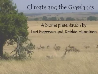
Download
1 / 32
320 likes | 454 Vues
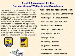
A Joint Assessment for the Conservation of Wetlands and Grasslands. WLI Technical Assessment Team.

E N D
A Joint Assessment for the Conservation of Wetlands and Grasslands WLI Technical Assessment Team Last summer, the leadership of the Fish and Wildlife Service and MN DNR, responding from a request from the Governor, directed certain personnel from within the MN DNR and USFWS to develop science-based priority areas for wetland and grassland conservation. At that time, we agreed that whatever we came up with would be a living strategy that would be continually updated and refined as more partners joined the Working Lands Initiative (WLI) and more and better information becomes available. Rex Johnson – Co-Chair, USFWS-HAPET Ray Norrgard – Co-Chair, MN DNR Diane Granfors – USFWS-HAPET Peter Buesseler – MN DNR Dan Hertel – USFWS-HAPET Steve Benson – MN DNR Mark Oja – NRCS Bill Penning – MN DNR Doug Norris – MN DNR Kurt Haroldson – MN DNR Jon Schneider – Ducks Unlimited
The juxtaposition of wetlands (of different water regimes) and grasslands determines benefits to breeding, wintering and even migrating wildlife Efficiently restoring habitat complexes demands a targeted and coordinated approach to conservation This is the state of our landscape! South Central Swift County
We should think about creating habitat complexes by complexing multiple programs RIM GRP WMA CREP WRP WPA FWP
Our Goal: The conservation of wetland and grassland habitat complexes • Our definition of a satisfactory habitat complex: • 4 to 9-mi2 in extent • >= 30 duck pairs/mi2 or 20% wetlands • >=Half temporary or seasonal • Maximum of 40-60% grassland • >= half permanently protected • >= 1 pheasant core wintering area • 1 winter food plot
Ducks >30 pairs/mi2 >40% Grass in a 5-mi2 Landscape >20% Protected Grass in a 5-mi2 Landscape
Existing Habitat Complexes >30 pairs/mi2 and >40% grass and >20% protected grass in a 5 mi2 landscape
Our Planning Area – The Prairie Pothole Region, Aspen Parklands and intensively farmed counties in the Prairie-Hardwood Transition Zone
Where should we focus our collective actions to restore grassland and wetland habitat complexes to meet the needs of grassland and wetland wildlife, including: • Upland nesting ducks • Pheasants • Other native wildlife species that depend on these habitats?
Focal species represent the habitat needs of a broader array of species that are usually less sensitive to landscape and local habitat features and to management and the habitat structure that results from management. The suite of focal species should represent the relevant range of landscape types and disturbance/management. Core ranges of focal species should cover the planning unit. Landscape/Site/Management Focal Species Black Terns Upland-Nesting Ducks Migrant Shorebirds Grassland Birds -GBCAs Marbled Godwits Pheasants Matrix of large wetlands embedded in grassland landscapes – disturbed habitats (hayed, grazed or burned periodically) Wetland Complexes (small and shallow to larger and deeper) – tall, rank grasslands (that are generally idled) Grassland landscapes with embedded small wetlands – disturbed (grazed or hayed) Landscapes with numerous shallow wetlands – disturbed (hayed, grazed or tilled annually) Large blocky grasslands with mosaic of disturbance Low relief grasslands with embedded wetlands – disturbed – haying or grazing Grassland-wetland complexes – idled in most years
Wetlands • Targeted protection and restoration are based on the same criteria – • Potential to impact populations of focal species based on • Integrity of the surrounding wetland complex • Juxtaposition of grassland and wetland • Potential for significant water quality enhancement benefits for shallow lakes
Shallow Lake Watersheds weighted by 1.5 if they comprise part of a Ducks Unlimited Emphasis Area, and 1.0 if they do not.
Relative Potential for Breeding Black Terns on a 25 ac Semipermanent Wetland P = exp(-8.27+(0.93*ln hectares) + (6.25*Grass) + (0.32*SemiA) / 1+exp(-8.27 +(0.93*ln hectares) + (6.25*Grass) + (0.32*SemiA) Where: Grass = proportion of grass in 2 mi focal radius; and SemiA = natural log of semipermanent area within a 2 mi focal radius. (Naugle et al. 2001. Wetlands 21:1-17)
Landscapes for Upland Sandpiper, Hudsonian Godwit, Dunlin, and White-rumped Sandpiper during Spring Migration Average slope Percent grass Percent palustrine (ln) Proportion of temporary and seasonal
Wetland Priority for Breeding Ducks (SWAP) Wetland Complex Integrity +
Pheasants – Wetland Protection and Restoration Available Wintering Cover Access to Nesting Cover PHIP Ratings: Undisturbed Habitats Land Use Patterns Current Population Index Winter Severity Index
Shallow Lakes WQ + Black Terns + Migrant Shorebirds (wetland) + Wetland for Ducks + Wetlands for Pheasants Priority Landscapes for Wetland Conservation Priority Landscapes for Wetland Conservation (Wetfin)
Grasslands • Targeted protection and restoration are based on – • Potential to impact populations of focal species based on • Integrity of the dimensions of the grassland patch • Surrounding landscape context (percent grassland and terrain relief) • Juxtaposition of grassland and wetland • Potential for significant water quality enhancement benefits for shallow lakes • Restoration is also based on the potential to create large, “blocky” patches with a minimal additional cropland retirement
Shallow Lake Watersheds weighted by 1.5 if they comprise part of a DU Emphasis Area, and 1.0 if they do not.
Duck Pair Access to Grassland Nesting Habitat (aka. Thunderstorm Map)
Landscapes for American Avocet, Marbled Godwit, and Willet during Spring Migration Average slope Percent grass Percent palustrine (ln) Proportion of temporary and seasonal
Relative Potential as Marbled Godwit Habitat (Breeding Shorebirds)
Grassland Bird Conservation Area- based Priority for Protection and Restoration
Pheasants – Grassland Protection and Restoration Available Nesting Cover Access to Wintering Cover PHIP Ratings: Undisturbed Habitats Land Use Patterns Current Population Index Winter Severity Index
Shallow Lakes WQ + Grasslands for Ducks + Migrant Shorebirds (grass) + Marbled Godwits + Grassland nongame birds (GBCAs) + Grasslands for Pheasants Priority Landscapes for Grassland Conservation Priority Landscapes for Grassland Conservation (Grassfin)
Native Prairie Tracts • An “open-ended” assessment process • integerate water quality • flood damage reduction priority areas • soil productivity or erodibility indices • etc.
Priority Landscapes for Wetland Conservation Priority Landscapes for Grassland Conservation +
Priority Landscapes for Wetland and Grassland Conservation Priority Landscapes for Wetland Conservation + Priority Landscapes for Grassland Conservation Priority Landscapes for Wetland and Grassland Conservation (Combfin2)
Each spatially-explicit element of the Conservation Strategy should be accompanied by its underlying data, that is, • for each 40-ac parcel, • Overall Wetland Index • Shallow Lake Index • Black Tern Index • Upland Nesting Waterfowl (Wetland) Index • Migrant Shorebird (Wetland) Index • Pheasant (Wetland) Index • Overall Grassland Index • Shallow Lake Index • Upland Nesting Waterfowl (Grassland) Index • Grassland Nongame Bird Index • Breeding Marbled Godwit Index • Migrant Shorebird (Grassland) Index • Pheasant (Grassland) Index • Native prairie tracts • Overall Conservation Index This will enable managers to make appropriate site-scale management decisions from an ecoregional perspective
The juxtaposition of wetlands (of different water regimes) and grasslands determines benefits to breeding, wintering and even migrating wildlife Efficiently restoring habitat complexes demands a targeted and coordinated approach to conservation This is the state of our landscape! South Central Swift County
Moving forward – • Potential Technical Assistance from HAPET • New spatial data – e.g., restorable wetlands data, land cover data South Central Swift County
2) Management Decision Support Tools tailored to your area Rock County, MN