Download
1 / 7
70 likes | 84 Vues
This presentation delves into defining open and closed estuaries, coastal erosion and accretion regulations, and the Coastal Protection Zone in Fish Hoek. Critical for boundary law and environmental preservation. Contact Jennifer Whittal for details.

E N D
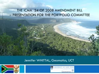
The ICMA 24 of 2008 Amendment Bill– presentation for the Portfolio Committee Jennifer WHITTAL, Geomatics, UCT
Estuaries • Definition of estuary open to the sea and closed to the sea: • Legal vs environmental definitions • Critical for defining the HWM and set backs such as CPZ extents • Unless there is a definition which will stand up in boundary law, I suggest: • Open estuary: an estuary which has been open to the sea for any period of time in the previous 10 year period • Closed estuary: an estuary which has not been open to the sea in the previous 10 year period
Sections 14(5)(c) – Erosion • If the high-water mark moves inland of the boundary line of a land unit due to the erosion of the coast, sea-level rise or other causes, the owner of that land unit ….. REPLACE WITH: • If the high-water mark is landward of a straight line boundary of a coastal land unit when this Act took effect,or if the high-water mark moves landward of that boundary line[inland of the boundary line of a land unit] due to the erosion of the coast, sea-level rise or other causes, the owner of a coastal [that] land unit …
Sections 14(6) - accretion • If the high-water mark moves seaward [of the boundary line of a land unit] due to the accretion of the coast— • the owner of a [that] land unit bounded by the high-water mark [or a stated distance from the high-water mark] when this Act took effect, gains ownership of any portion of that land unit that is situated above the high-water mark; or • the owner of a land unit bounded by a straight line boundary when this Act took effect, gains ownership of that portion of the land unit which is above the HWM and inland of the straight line boundary.
Coastal Protection Zone in Fish Hoek • Flood Prone areas • 61 land units, 15 fully inside • Agricultural zoning/not zoned/not township or urban within 1000m of HWM • 10 land units, 9 fully inside • Areas within 100 m of HWM • 219 land units, 151 fully inside • Total 290 land units in the CPZ • Only 175 fully inside


![PRESENTATION TO THE PORTFOLIO COMMITTEE ON MINERALS AND ENERGY PETROLEUM PIPELINES BILL [B22-2003] BY: CHARL M Ö LLER &a](https://cdn0.slideserve.com/384346/slide1-dt.jpg)


![Firearms Control Amendment Bill [B12-2006]](https://cdn3.slideserve.com/5894711/firearms-control-amendment-bill-b12-2006-dt.jpg)