Download
1 / 16
160 likes | 286 Vues
ISRO. AO OCM-2; 14 March 2008 . LARA. IIA. Application of satellite technology for characterizing seasonal behaviour of sea pigment concentration in the West Indian Ocean and analyzing its relationship with environmental parameters - STIOS -. P.I. Giovanni Laneve.

E N D
ISRO AO OCM-2; 14 March 2008 LARA IIA Application of satellite technology for characterizing seasonal behaviour of sea pigment concentration in the West Indian Ocean and analyzing its relationship with environmental parameters - STIOS - P.I. Giovanni Laneve Università degli Studi di Roma “La Sapienza”, CRSPM E-mail: laneve@psm.uniroma1.it Italian National Research Council Institute of Methodologies for Environmental Analysis E-mail: pignatti@imaa.cnr.it Italian National Research Council Institute of Atmospheric Pollution E-mail: rosa.cavalli@lara.rm.cnr.it Workshop OCEANSAT 2; Rome June 25, 2009
Project Theme: • The proposal falls in the following broad category: • Synergistic studies using multi-sensor data to understand processes. • More specifically, the proposal cover the following areas of interest: • Validation of OCM derived geophysical parameters • Inter-sensor data comparison and data merging • Algal bloom detection • Ocean color and sustainable fisheries management • Synergistic use of ocean color and scatterometer winds
Outline This proposal aims at studying the seasonal characteristics of the West Indian Ocean from the point of view of the water parameters, and circulation conditions. This purpose will be achieved by combining water quality data from OCM-2 sensor, sea surface temperature information from MODIS sensor and wind data from Oceansat-2 Scatterometer. This seasonal behaviour will be compared with results obtained by using data acquired in the past or simultaneously on the same region by using different sensors (SeaWiFS, MODIS).
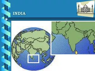
Western Indian Ocean (WIO) area of interest. The acquisition circle of the BSC ground station (-2.99° S. lat. and 40.19° E. long.) in yellow
10-m antenna operating in S,X,L bands of the TT&C station. Remote Sensing Station (RSC) - BSC 6m antenna in X band of the RSC station. Acquisition circle of the RSC station for a Remote Sensing satellite. 2 m antenna L-band of the RSC station. (CRPSM) Profile 30 April - 2 May, 2008 Maracaibo (Venezuela)
Western Indian Ocean (WIO) WIO has been described as a biological ‘desert’ for its very low nutrient levels and its impoverishment in upwelling systems. There is no doubt that overall it is an oligotrophic region where the average monthly chlorophyll concentration is found between a minimum of 0.1 mg/m3 and a maximum of 0.3 mg/m3. Even though from previous studies results that it presents some notable exceptions such as the periods around August and January.
Southeast Monsoon (May-August) Northeast Monsoon (October-April)
Chla mounthly mean content mg/l 0.9 0.8 0.6 0.4 0.2 Area 1 Area 2 Area 3 Area 4 Area5
“Kusi” South-East wind regime produces a water circulation able to drive a cooler water upwelling along the continental shore, this in turn generates the Chla increase in Jan-Feb and July-Aug. This is confirmed by the SST seasonal behavior showing a minimum in these periods. Chla distribution from SeaWiFS for day 15 Feb. 2002. In occasion of “Red Tides”
High values of Chla are also present near the coasts of the Horn of Africa. This can be explained taking into account the sea water currents in the region, but also recalling the phenomenon relating the iron rich dust of desert origin. This phenomena could be also associated to the occurrence of proliferation of toxic algae (causing the so-called “red-tide” phenomenon) results into mass death of fish in the area of interest, as observed and reported by Kenyan authorities in the last few years. Therefore, for these characteristics STIOS Team stress that this part of the ocean is not well documented (in terms of observations) and still conceals in itself phenomena and features of scientific interest that may be worthwhile subjects for studies and research.
STIOS objectives • Enhancing the knowledge on the seasonal cycle of the pigments in the Western Indian Ocean • Observations from satellite data will be used to explain and clarify the observed physical and biochemical seasonal dynamics of the pigments in WIO. • Scatterometer for providing the surface wind vectors; • MODIS sensor providing the sea surface temperature (SST) daily; • OCM-2 sensor for providing information on the biological activities thorough the ocean colour • Relate the local production with oceanic circulation To what extent are local/regional variations in production (biomass or Chl-a) related to variability in oceanic circulation, frontal dynamics and extreme weather conditions?
STIOS objectives • Algae bloom detection During last few years a red tide phenomenon accompanied by an high fish death appeared along Kenya coasts and it can be easily detected through increased Chla content exhibited by SeaWiFS data. The availability of the OCM data will make possible to formulate an hypothesis on the reason/precondition of the appearance of this phenomenon very detrimental for the local economy. From the study results that West Indian Ocean is a primarily oligotrophic region with some notable exceptions such as the periods around August and January. Atmospheric information on the peculiar nature of the aerosols present in the region are also needed in order to quantify the role of these inputs in fertilizing the photic zone that is not yet well understood.
STIOS objectives • Compare MODIS and OCM chlorophyll data using appropriate existing algorithms. Comparison with the SeaWiFS historical data series analysis (1999-2005) The values of water quality products provided by OCM-2 images will be compared with those provided by MODIS images, acquired at Broglio Space Center (BSC) whereas the seasonal variation of the pigment water content will be compared with the analysis performed previously, based on a time series of SeaWiFS images acquired at BSC.
STIOS objectives • Impact of Ocean Dynamics on the economies of coastal countries Large ocean currents are important to African economies. Somali Current in the northeast, are associated with upwelling processes that stimulate high marine productivity and support considerable fisheries. • Integrating both SST, chlorophyll and wind data to test methods of production of maps of high potential fishing zones (PFZ). Analyzing wind data and SST information some peculiar oceanographic features occurring in the Kenya – Tanzania - Seychelles can be tracked. These features would be related to the occurrence of seasonal productive areas especially during the transitional from one monsoon to another (April to May and from October to November). Since plankton proliferate in moving water masses and are subject to a maturation process from the initial enrichment zone, tuna species concentrate along the nearest convergences.
University of Nairobi, Department of Physics, Nairobi, Kenya National Environment Management Authority (NEMA) Popo Road off Mombasa Road Nairobi, Kenya