Download
1 / 24
400 likes | 1.94k Vues
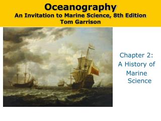
Oceanography An Invitation to Marine Science, 8th Edition Tom Garrison. Chapter 2: A History of Marine Science. Early Peoples Traveled the Ocean for Economic Reasons Ocean transportation offers people the benefits of mobility and greater access to food supplies.

E N D
OceanographyAn Invitation to Marine Science, 8th EditionTom Garrison Chapter 2: A History of Marine Science
Early Peoples Traveled the Ocean for Economic Reasons Ocean transportation offers people the benefits of mobility and greater access to food supplies. Any coastal culture skilled at raft building or small-boat navigation would have economic and nutritional advantages over less-skilled competitors. The first direct evidence we have of voyaging, traveling on the ocean for a specific purpose, comes from records of trade in the Mediterranean Sea. The Egyptians organized ship-borne commerce on the Nile River. The first regular ocean traders were probably the Cretans, or the Phoenicians who inherited maritime supremacy in the Mediterranean after the destruction of the Cretan civilizations around 1200 B.C.E. Phoenicians traveled through the Strait of Gibraltar to markets as distant as Britain and the west coast of Africa. Understanding the Ocean Began with Voyaging for Trade and Exploration
Natives of Alaska’s Aleutian Islands fish in kelp forests. Settlers able to exploit offshore resources had nutritional and strategic advantages over their landlocked competitors. Understanding the Ocean Began with Voyaging for Trade and Exploration
The Greeks began to explore outside the Mediterranean into the Atlantic Ocean around 900–700 B.C.E. Cartographers, or chart makers, recorded information about locations and landmarks and currents. Today, charts are detailed graphic representations of water and water-related information. The Library at Alexandria, in Egypt, was founded in the 3rd century B.C.E. This library stored information on every area of human endeavor. Eratosthenes of Cyrene was the second librarian at Alexandria. He was the first to calculate the circumference of Earth and also invented a system of longitude and latitude. The principles of celestial navigation were invented at the Library at Alexandria. Systematic Study of the Ocean Began at the Library of Alexandria
Eratosthenes Accurately Calculated the Size and Shape of Earth A diagram showing Eratosthenes’s technique for calculating the circumference of Earth. As described in the text, he used simple geometric reasoning based on the assumptions that Earth is spherical and that the sun is very far away. Using this method, he was able to discover the circumference of Earth to within about 8% of its true value.
Latitude and Longitude (LEFT) A third century B.C. chart showing the system of latitude and longitude developed by Eratosthenes. (RIGHT) Diagrams showing the calculation of lines of latitude and longitude.
North Pole North Pole North Pole Prime meridien 60°N 60°N 30°N 30°N 0° 0° 30°E 60°W 60°W 0° 30°S 30°W 0° 30°S South Pole South Pole South Pole Latitude Longitude Equator Stepped Art p37
Ocean Seafarers Colonized Distant Islands The Polynesian triangle. Ancestors of the Polynesians spread from Southeast Asia or Taiwan to New Guinea and the Philippines by about 6,000 years ago. Central Polynesia was settled around 1000 B.C.E., but the explosive dispersion that led to the settlement of Hawai’i occurred about 450 - 600 A.D. ThePolynesiancolonization's are an example of knowledge of oceans and marine science used to colonize a vast number of islands. “Red Arrows” show a possible direction and order of settlement.
Viking Raiders Discovered North America • Vikings were bands of Scandinavian adventurers and treasure seekers who had remarkably fast, strong, and stable ships. • By 1000 A.D., the Norwegians had colonized part of North America (probably the northeastern tip of Newfoundland). • Although the colonists initially tried to cooperate with the locals, when battles ensued, they lacked the resources to make the colony a success. A reconstruction of a Viking settlement in North America.
The Chinese Undertook Organized Voyages of Discovery Chinese navigators set out in the 1400s to explore the Indian Ocean, Indonesia, Africa and the Atlantic. Their ships were laden with gifts designed to show China’s wealth and degree of civilization. The Chinese invented the compass (lower left), the central rudder, water-tight compartments, and sails on multiple masts (lower right).
Europeans explored the world by sea during the Renaissance. Henry the Navigator – Explorers under his patronage compiled detailed charts and explored the west coast of Africa. Christopher Columbus – Although he never saw the mainland of North America, his stories inspired other explorers to follow. Ferdinand Magellan – Although Magellan died en route, the small surviving portion of his crew circumnavigated the globe. European Age of Discovery
European Age of Discovery Prince Henry of Portugal, the Navigator, looks westward from his monument in Portugal. In the mid-1400s, Henry established a center at Sagres for the study of marine science and navigation “. . . through all the watery roads.”
European Age of Discovery The Waldseemüller Map, published in 1507 – the first map to name America and to show the New World as separate from Asia. This is an image of the only known copy to survive of the 1,000 printed from 12 wood blocks. It was purchased in 2007 by the U. S. Library of Congress for US $10,000,000.
Magellan Expedition The journey of the Magellan expedition, the first voyage around the world. Only 18 out of 260 sailors managed to return after three years of dangerous travel.
James Cook, a commander in the British Royal Navy, is credited with leading voyages that greatly contributed to scientific oceanography… First Marine Scientist (not the Father of Oceanography). Some of the accomplishments of James Cook and his scientists include: Verification of calculations of planetary orbits Charting of New Zealand and the Great Barrier Reef, Tonga and Easter Island Initiation of friendly relations with many native populations Sampling marine life, land plants and animals Recording data concerning the ocean floor and geological formations Voyaging Combined with Science to Advance Ocean Studies
The First Scientific Expeditions Were Undertaken by Governments The United States Exploring Expedition launched in 1838 was a naval and scientific expedition. The HMS Beagle, on which Charles Darwin served as a naturalist, voyaged to South America and some Pacific Islands. (BELOW) HMS Challenger expedition of 1872-1876 was the first oceanic expedition dedicated to scientific research.
Notable Contributions to Ocean Sciences John Harrison - Designed and built a clock that was accurate enough to determine longitude. Ben Franklin - Noticed, and with the help of his cousin, charted and published the first chart of an ocean current, the “Gulph Stream” (BELOW RIGHT). • Matthew Maury - The first person to sense the worldwide pattern of surface winds and currents. Based on his analysis, he produced a set of directions for sailing great distances more efficiently. (The Father of Oceanography) • Charles Wyville Thomson and John Murray - Proposed the Challenger Expedition which took a variety of physical oceanographic measurements, collected information on ocean currents, meteorology, the distribution of sediments, the locations and profiles of coral reefs and discovered 4,717 new species.
Contemporary Oceanography Makes Use of Modern Technology What advances in oceanic exploration occurred in the 20th century? Polar Exploration –explorers reached both the North and South poles in the twentieth century The Meteor Expedition – first expedition to use modern optical and electronic equipment (echo sounding) for oceanographic investigation The Atlantis – investigations on this research vessel confirmed the presence of the Mid-Atlantic Ridge. The Trieste – a blimp-like bathyscaphe which descended into the Challenger Deep area of the Mariana Trench Glomar Challenger –samples obtained by scientists on this drilling ship provided confirming evidence for seafloor spreading and plate tectonics.
Contemporary Oceanography Makes Use of Modern Technology Echo sounders sense the contour of the seafloor by beaming sound waves to the bottom and measuring the time required for the sound waves to bounce back to the ship. If the round-trip travel time and wave velocity are known, distance to the bottom can be calculated. This technique was first used on a large scale by the German research vessel Meteor in the 1920s.
( ) T — 2 Depth = V Beam of sound waves travels to bottom and is reflected back to ship Stepped Art Figure 2-28 p58
The Rise of Oceanographic Institutions Three of the most prominent oceanographic institutions in the United States: Woods Hole Oceanographic Institution (Massachusetts) Scripps Institution of Oceanography (RIGHT)(California) Lamont-Doherty Earth Observatory of Columbia University (NY)
Robot Devices Are Becoming More Capable ROVs are revolutionizing marine science. Some robots are autonomous; they carry out instructions programmed into them before they are released. Among the most capable of these is HROV Nereus, the deepest-diving vehicle now in operation. Satellites Have Become Important Tools in Ocean Exploration TOPEX/Poseidon - a satellite orbiting above Earth that allows coverage of 95% of the ice-free ocean every 10 days. Jason-1 - its primary task is to monitor global climate interactions between the sea and the atmosphere. AQUA - a project to collect a large amount of information about Earth’s water cycle Contemporary Oceanography Makes Use of Modern Technology
HROV Nereus HROV Nereus from the water during its second expedition in 2009 to investigate hydrothermal vents along Earth’s deepest mid-ocean ridge in the Cayman Trough. On May 31, 2009, the robotic vehicle successfully reached the deepest part of the world’s ocean—the Challenger Deep in the Mariana Trench in the western Pacific Ocean. The one-of-a-kind vehicle can operate either as an autonomous, free-swimming robot for wide-area surveys, or as a tethered vehicle for close-up investigation and sampling of seafloor rocks and organisms. (Photo courtesy Advanced Imaging and Visualization Laboratory, Woods Hole Oceanographic Institution)
Chapter 2 in Perspective In this chapter you learned that science and exploration have gone hand-in-hand. Voyaging for necessity evolved into voyaging for scientific and geographical discovery. The transition to scientific oceanography was complete when the Challenger Report was completed in 1895. The rise of the great oceanographic institutions quickly followed, and those institutions and their funding agencies today mark our path into the future.