Download
1 / 29
290 likes | 427 Vues
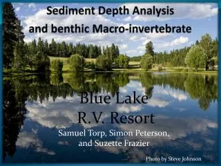
Comparison of Benthic Invertebrate Communities Upstream and Downstream of Proposed Culvert Installations in Alabama. Amy C. Gill USGS, Alabama Water Science Center. Problem.

E N D
Comparison of Benthic Invertebrate Communities Upstream and Downstream of Proposed Culvert Installations in Alabama Amy C. Gill USGS, Alabama Water Science Center
Problem • Concerns have arisen concerning the use of culverts at highway crossings of streams. The primary concerns are the culvert’s impact on: • Stream Geomorphology • Suspended Sediment Concentrations • Turbidity • Stream Biology/Ecology
Study Design • ALDOT and USGS are conducting a scientific investigation to determine the impacts of culverts on streams. • Evaluate 8 to 10 proposed culvert construction sites. • Before, during, and post construction • Coastal Plain sites • Basins having little to no anthropogenic influence (stable streams) are targeted. • Data will be used to improve culvert installation, if possible.
Site Selection Eight sites located in Lamar, Tuscaloosa, Bibb, Russell, Choctaw, and Clarke Counties. • Drainage areas range from • 0.39 to 16.4 mi2 • Channel slopes range from • 9 to 65 ft./mi • Channel widths range from • 12 to 35 ft. Stream Ecology Site
Potential Effects of Poor Culvert Design or Placement • Barriers to animal passage • Fish • Invertebrates • Loss of riparian and instream habitat complexity • Reduced downstream movement of large woody debris • Scouring due to increased velocities • Thermal differences • Increased algal growth in response to loss of riparian cover • Shifts in invertebrate communities to scrapers and grazers
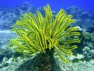
Benthic Macroinvertebrates • Sampled as indicator of stream biological/ecological health • Important for food chain • Indicator for measuring sedimentation impact • Both population and diversity important • Site specific – upstream vs. downstream comparison • For pre-construction and post-construction sampling periods
Approach • Collect & identify benthic invertebrates at cross-sections above and below the culvert. • Use functional feeding group information to look at community changes caused by existence of the culvert • Spring/summer collections before and after culvert construction
Methods • Visual survey of available instream habitats both upstream & downstream. • Collection of invertebrates by netting, scraping, brushing from the richest habitats available.
Methods • 500-micron mesh nets and sieves • Composite sample into 5 gallon buckets • Reduced sample volume as much as possible by inspection and removal of larger woody debris • Attempt to keep upstream and downstream sampling efforts comparable • Same number of woody snags, length of root/bank, etc. • Similar amount of sampling time
USGS National Water Quality Laboratory Biological Unit 100-counts of invertebrates were identified from each sample by the USGS National Water Quality Laboratory in Denver, Colorado
The Invertebrate Data Analysis System – IDAS • Summarizes invertebrate data • Calculates sample metrics • Self-archives settings and stores output in Excel files
Analysis • Comparison of upstream and downstream reaches at each site • Are differences observed at all or some of the sites?
Community Metrics • Abundance – numbers of individuals • Total Numbers of Taxa • EPT Taxa – Ephemeroptera, Plecoptera, Trichoptera • Tolerance to impaired water quality • Functional Feeding Groups • Similarity Indices
Preliminary Findings • Most sites have relatively pollution intolerant communities, good abundance and taxa richness values. • Upstream and downstream samples did not reflect nearly identical communities like we had expected. • Feeding group structure seems to show promise as a way to identify changes in the site pairs.
Next Steps • Continue working with this data to see if we can find better ways to see differences and similarities. • Summarize taxa in different ways (ambiguous taxa, metrics at a different taxonomic level) • Look at the changes in this data along with geomorphology and sediment transport data. • Prepare to do post-construction sampling using what we have already learned about these sites.