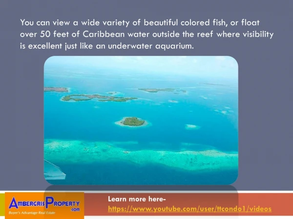
You can view a wide variety of beautiful colored fish
Ambergris Caye is a tropical paradise with outstanding natural beauty, like most of Belize. However, the island has all the conveniences you would expect in a modern city u2013 that is a rare combination. Our island has potable water cleaner than most bottled water, fiber active cable for turbo speed internet, dozens of restaurants offering specialties from the Caribbean and around the world. Charming over the water u2013 bistros and a few night clubs add to the excitement. English is the official language and US dollars are accepted everywhere, we are # 1 because Ambergris Caye is fun, and easy! BELIZE IS BOOMING! Statics of Ambergris CayeFor 3 years in a row, Belize has been experiencing double u2013 digit growth as more people discover the natural beauty of Belize, our warm year-round climate, the kindness of our people and a lifestyle full of fun activities are just some of the reasons millions of people dream about living in Belize. Visitors to Belize have excellent demographics, capable of paying higher rates for condos, vacation homes and hotels. More than 75% of all Belize visitors arrive on airline flights. Ambergris Caye receives many distinguished visitors including Bill Gates, Prince Harry, and Tiger Woods. Celebrities owning property in Belize include Gates, Leonardo DiCaprio, Francis Ford Coppola and many others. Real estate prices in Belize are very reasonable, taxes are low as is maintenance cost. For these reasons, when being compared to the cost of owning resort property in the U.S., a higher ROI or cap rate will almost always be realized on property in Belize. Now is the time to buy in Belize, Island time is now! Where is Belize? - YouTube VideoProperty on an island is limited by definition, but Ambergris Caye is a highly sophisticated island with 100 restaurants, dozens of water activities, adventure tours and festivals to light up the night sky over San Pedro Town u2013 the center to island commerce and culture. Water front properties on our island are becoming scarce as more expats invest or retire in our island paradise. TOM TAYLOR Licensed Real Estate Broker www.AmbergrisProperty.com Toll Free International 800.238.4848 WhatsApp 501.604.4886 AmbergrisProperty@gmail.com https://www.facebook.com/ambergrispropertybelize/
69 views • 5 slides