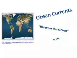
Ocean Currents
Ocean Currents. The Coriolis Force. The Coriolis force deflects objects (wind) moving toward the Equator to the west. The Coriolis force deflects objects (wind) moving toward the poles to the east. The Coriolis force deflects objects (wind) moving toward the Equator to the west.

Ocean Currents
E N D
Presentation Transcript
The Coriolis Force The Coriolis force deflects objects (wind) moving toward the Equator to the west The Coriolis force deflects objects (wind) moving toward the poles to the east.
The Coriolis force deflects objects (wind) moving toward the Equator to the west The Coriolis force deflects objects (wind) moving toward the poles to the east. 60o 30o 0o
Ocean Surface Temperature 40o F 90o F 40o F
Surface Currents Deep Water Currents Thermal currents (90%) The upper 400 meters of the ocean (10%). Ocean Currents
Surface Currents Forces 1. Solar Heating (temp, density) 2. Winds 3. Coriolis
Solar Heating and Density Density Mass (g) Volume (cm3)
High density 4 D = m V Expanding water (increasing volume) low density Ice density Water expands as it is heated.
Solar Heating Heat expands water near the Equator equator N S
General Circulation pole Sun’s rays Ocean Earth equator
General Circulation (North) Surface Water
Winds Guide the Direction of Surface Water Winds blow eastward between 0o and 30o latitude. Rotation 30o 0o 30o
General Circulation (North) wind Surface Water
The Coriolis force deflects objects moving toward the poles to the east.
Winds plus Coriolis Force East wind
West wind Winds plus Coriolis Force The Coriolis force deflects objects moving toward the poles to the east. East wind
West wind Circulation The Coriolis force deflects objects (wind) moving toward the Equator to the west East wind
Gyres Clockwise current in Northern Hemisphere Counter clockwise current in S. Hemisphere
Temperature/Energy Transfer Heat Capacity cool warm cool
Deep Water Currents 300 ft Low density 3000 ft • Temperature • Density 90% total volume High density
General Circulation pole Sun’s rays Ocean Earth equator
Rising and Sinking pole Equator Density Sinking
Thermal Conveyor Red = surface Mixing time of the Atlantic ocean: 1000 years
Two Major Currents Gulf Stream Humbolt Current
The Gulf Stream 1769
The Gulf Stream “a river in the ocean” 1000 x more water transported than the Mississippi. 20 – 40 miles wide ½ mile deep 4 miles per hour
Ireland England Spain cornwall
Easterlies desert Cool water Cool air Westerlies 7-8 C° cooler than the ocean at similar latitudes Dry conditions near the coast.
Upwelling wind productive Nutrient Source for Food Web Basis for a rich fishing industry off Peru.
Surge of Nutrients: Food Chain Phytoplankton constitute the food base of all marine animals, are microscopic organisms that inhabit only the sunlit uppermost oceanic layer, using sunlight to photosynthetically combine carbon dioxide and dissolved nutrient salts. Zooplankton marine animals that rely mainly upon water motion for transport. Zooplankton subsist on phytoplankton and smaller zooplankton. Nekton free swimmers, are dominated by the bony and cartilaginous fishes, molluscans, and decapods, with rarer mammals and reptiles.
Normal Conditions ½ meter Cool water Dry air Low ppt. Warm water Moist air High ppt.
Sustained Abnormal Conditions Rain in desert areas Warm water surge
Abnormal Conditions El Niño: Spanish name for the male child Sustained sea surface temperature anomalies across the central tropical Pacific Ocean. Initially referred to a weak, warm current appearing annually around Christmas time along the coast of Ecuador and Peru and lasting only a few weeks to a month or more.
Local Consequences (East) El Nino normal Low Nutrient Levels High Nutrient Levels
Other Consequences Floods Mosquitoes Disease Droughts Fires Peru Chile Interior Indonesia Australia
El Niño is driven by slackening of easterly winds off the coast of Peru. This results in less upwelling of cool nutrient-rich water. Persistent El Niño allows warm moist air to persist near Peru leading to high rainfall in an area that typically receives little rain. Conversely, Australia and Indonesia experience drought.
Surface currents are driven by solar heating, winds and the Coriolis force These forces produce gyres that rotate clockwise in the N. hemisphere. The Gulf Stream is off the coast of N. America flowing toward Europe. It bring warm waters to the north attenuating the effects of latitude. The Humbolt current is off the West coast of S. America It brings cool, nutrient-rich water northward. Easterly wind off Peru push water away from the coast producing upwelling. The general result is high nutrient contents and cool water near Peru. The water is warmed as it moves west eventually supplying warm water