Download
1 / 14
140 likes | 156 Vues
Learn about the Louisiana Geographic Information Systems Council's role in the Louisiana I-Team Initiative, including their responsibilities, framework data structure, and key partnerships. Understand the funding proposal and the LouisianaMAP initiatives for geospatial data management.

E N D
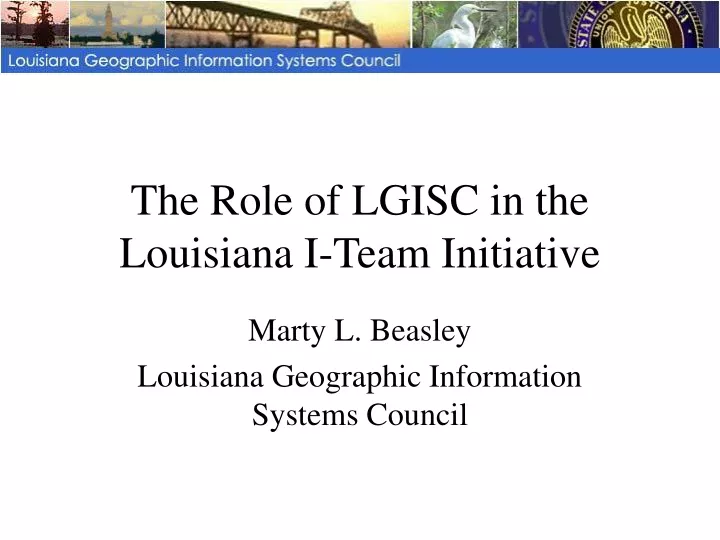
The Role of LGISC in theLouisiana I-Team Initiative Marty L. Beasley Louisiana Geographic Information Systems Council
The Louisiana GIS Council • Created in 1995 to guide the sound development of geographic information systems and geographically related technology. • Comprised of representatives from State and Local governments. • Responsibilities include the establishment of GIS policies, procedures, and guidelines for the sharing of data and technology and to coordinate acquisition of statewide data sets.
Framework Data Structure Application Data Traditional databases with geographic reference Traditional Databases Utilities and Critical Infrastructure Flood Plains/Wetlands State Designated Themes Demographics Land Use/Land Cover Cadastral Geospatial Framework Hydrography Federal Geographic Data Committee (FGDC) Themes Transportation Boundaries for State, Parishes, Municipalities, Precincts, Legislative and Planning districts Governmental Units Geodetic Control Foundation Elevation and Bathymetry Orthoimagery
But who’s responsible for • Needs Assessment • Data Collection • Data Maintenance • Quality Control • Data Distribution
Framework Data Implementation Initiative TeamorI-Team • Office of Management and Budget • Federal Geographic Data Committee • Council for Excellence in Government • National States Geographic Information Council • National Association of County Government • Other strategic partners
Executive Order • The Louisiana GIS Council shall establish the Louisiana Spatial Data Infrastructure Team (Louisiana I-Team). • The LGISC is granted authority to extend membership in the Louisiana I-Team. • The LGISC shall designate an I-Team Coordinator. • The Louisiana I-Team shall create a master plan of development and management of the Louisiana Spatial Data Infrastructure. • The Louisiana I-Team shall submit a status report to the Governor every year.
Executive Order • The Master Plan shall include: • Definition and prioritization of framework data layers • Establishment of custodianship of data layers • Assess the needed enhancements to the framework data layers • Identification of resources needed for the implementation, maintenance and use of the Louisiana Spatial Data Infrastructure (LSDI)
I-Team Multi-agency Participation A data acquisition and management initiative to define the framework content and establish a process to guide creation and maintenance of the content • Consistent and aligned with the OMB and FGDC’s initiative to leverage standards, technology, assets, best practices and funding resources • Structured as an extension of the Louisiana GIS Council • 34 entities have committed to participate in I-Team • 16 state, 3 federal, and 4 local government organizations • 2 universities • 9 private sector partners
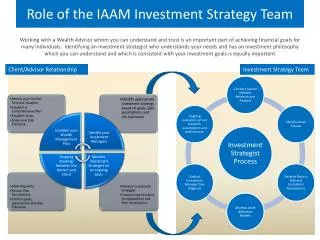
What about funding?? A Technology Innovation Fund Proposal to Implement LouisianaMAP A partnership between the Louisiana GIS Council and the Office of Electronic Services to provide reliable, consistent geographic information and services to all entities with a legitimate Louisiana interest
LouisianaMAP Initiatives Implementation Team (I-Team) Geospatial Data Framework Plan Access, Dissemination, & Analysis Data Acquisition & Management Program LouisianaMAP Geospatial Portal Outreach & Training LouisianaMAP Academy
GIS Council I-Team Coordinator and Steering Committee LAGIC Technical Advisory Subcommittee Requirements Subcommittee Geodetic Control Ortho Imagery Elevation/ Bathymetry Transportation Hydrography Governmental Units Cadastral Information Land Use/ Land Cover Demographics Flood Plains/ Wetlands Utilities & Critical Infrastructure
LouisianaMap PortalResponsibilities • Louisiana Geographic Information Center (LAGIC) is responsible for design, development, integration, and ongoing technical support for the portal • Product specific consulting assistance to LAGIC • I-Team Technical IPT provides advice and guidance to the portal initiative • Portal will contain the geographic framework and other high interest data layers • Portal will provide services for discovery, access, dissemination, and use of geographic information as well as training and outreach • Hosted in InfoLouisiana environment
LouisianaMap Academy Plan An outreach program focused on application of the LouisianaMAP portal capabilities by government, individuals, businesses, and communities with Louisiana interests • Both classroom and online delivery settings • Statewide in coverage • Developed and administered by LAGIC • Begins with initial launch of Portal
SUMMARY • The Louisiana I-Team is established through executive order. • The Louisiana GIS Council shall establish the Louisiana I-Team. • The I-Team Coordinator shall report to the LGISC. • The I-Team shall create a master plan for development and management of the LSDI.