Download
1 / 23
230 likes | 249 Vues
The Florida Marine Mapping workshop aimed to improve coordination, identify mapping needs, and seek innovative solutions for coastal mapping. With an established website and ongoing mapping projects, the workshop highlighted the importance of standardized terminology and data sharing. By prioritizing areas for mapping and fostering partnerships among agencies, the event emphasized the need for a common glossary and mapping strategies. Future plans include additional workshops and standardizing habitat classification in the southeastern U.S.

E N D
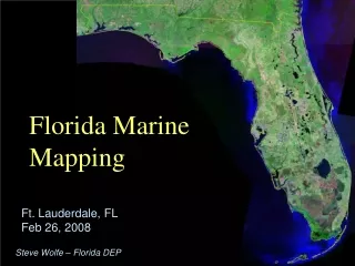
Florida Marine Mapping Ft. Lauderdale, FLFeb 26, 2008 Steve Wolfe – Florida DEP
Florida Marine Mapping • There is a concentration of marine and coastal mapping activity in Florida. • A joint USGS/FDEP/SERPPAS workshop in February 2007: • provided insight on the status and trends of these efforts; • sought means for better coordination; • prioritized Florida agency mapping needs by region, and; • identified obstacles to mapping efforts.
Workshop Goals: • Present the state-of-the-art of technology for collecting mapping data. • Present the mapping programs active in the waters off-lying Florida. • Present the mapping needs and priorities of the agencies and entities operating in Florida.
Workshop Goals: • Establish the State of Florida’s overall priority for areas needing mapping (as identified by those state agencies with coastal and ocean resource-management responsibilities). • Examine the need to standardize terminology and data collection/storage so that data, especially that concerning habitats, can be shared.
Workshop Goals: • Identify opportunities for partnering and leveraging mapping efforts among agencies/entities. • Identify impediments and organizational gaps that hinder collection of data for mapping. • Seek innovative solutions to the primary obstacles identified.
Workshop Goals: • Identify the steps needed to move mapping of Florida’s oceans and coasts forward, in preparation for a better coordinated, more cost-effective mapping program to allow state and federal agencies to make better decisions on coastal resource issues.
Workshop Results: • There were 86 registered attendees (plus unregistered from local agencies). Presentations and attendance had been capped because of the large response.
Workshop Results:Present the mapping programs active in the waters off-lying Florida. • Many attending were surprised at the amount of mapping of which they were unaware, even in locales where they were involved. New linkages among agency programs were obvious and common. • The most organized and active effort is the South Florida Shallow-Water Coral Ecosystems Mapping Project, a partnership between NOAA, FWC-FWRI, and SFWMD.
Florida Marine Mapping - Ongoing • Mapping underway by many state and federal agencies, NGOs, and some local agencies. • These efforts typically restricted in area and differing in types of data collected. • Lack of standard habitat-classification system hinders creation of maps using data from multiple sources. • Gained initial understanding of mapping needs of agencies and entities. • Florida Marine Mapping website established at: www.dep.state.fl.us/MarineMapping
Florida Marine Mapping – Needed • Improved linkage between mapping programs and agency needs. • Develop a common glossary of mapping terms. • Establish base map (w/projects and status). • Establish data portal/website • Establish mapping listserve/blog.
Florida Marine Mapping – Needed • Additional workshops to: • establish Baseline Mapping Data suite (breakout group only partly successful). • finalize bioregions mapping requirements (breakout group results excellent start). • Adopt habitat classification system.
Florida Marine Mapping – Planned • Workshop to standardize habitat classification in southeastern U.S. (via SERPPAS)
Workshop Results:Establish the State of Florida’s overall priority for areas needing mapping. • A State of Florida priority order for mapping Florida waters was created. 1 Big Bend 77 2 NW Florida 71 3 Indian River 59 4 Key/Tortugas 58 5* Charlotte Harbor 54 5* Springs Coast 54 7* NE Florida 46 7* 10,000 Islands 46 9 Florida Bay 40 10 SE Florida 35 11 Tampa 31 12 W Florida Shelf Break 30 13 Oculina Banks 19 * tie
Workshop Results:Establish the State of Florida’s overall priority for areas needing mapping.
Steve Wolfe Florida DEP More? Florida Shelf Bathymetry (courtesy USGS). Steven.Wolfe@dep.state.fl.us
Steve Wolfe Florida DEP Questions? Florida Shelf Bathymetry (courtesy USGS). Steven.Wolfe@dep.state.fl.us
Workshop Results:Present the mapping needs and priorities of the agencies and entities operating in Florida. • “Commonalities matrix” produced
Workshop Results:Examine the need to standardize terminology and data collection & storage so data can be shared. • Sharing of mapping data often a problem. • There was general consensus on the need to adopt a single habitat classification system. There was broad agreement at what this standard might be, but sufficient unresolved aspects remain that a separate workshop is needed to accomplish this goal.
Workshop Results:Identify impediments and organizational gaps that hinder collection of data for mapping. • Lack of central mapping coordination. • Poor linkage exists between some mapping programs and agency needs; suggests most funding not for applied science? • Need mapping data repository
Workshop Results:Seek innovative solutions to the primary obstacles identified. • Use GAME database to inventory mapping programs and help coordination and leveraging of funds. • Establish permanent organizing individual or group to maintain the communications established at workshop, serve as information clearinghouse, and maintain progress on the issues identified during the workshop.
Workshop Results:Present state of the art of technology for collecting mapping data. • “Best” choice depth and clarity dependent. • Aerial/satellite w/ground-truthing generally best to about 20m (limit of passive technologies) in S. Florida and ~ 10 m in north (at best time of year). • Acoustical best at deeper depths.
Workshop Results:Present state of the art of technology for collecting mapping data. • Technology “gap” in shallow, turbid waters. All methods less cost-effective than in other waters. • AUVs show promise for: • small areas • ground truthing • perhaps large areas in ‘solar fleets’. • potential to ground truth while mapping.
Steve Wolfe Florida DEP Questions? Florida Shelf Bathymetry (courtesy USGS). Steven.Wolfe@dep.state.fl.us