Download
1 / 15
150 likes | 174 Vues
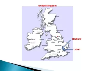
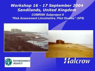
Workshop 16 - 17 September 2004 Sandilands, United Kingdom. COMRISK Subproject 8 “Risk Assessment Lincolnshire, Pilot Studies” (SP8). Location and Issues. 23km coastline between Mablethorpe and Skegness

E N D
Workshop 16 - 17 September 2004Sandilands, United Kingdom COMRISK Subproject 8 “Risk Assessment Lincolnshire, Pilot Studies” (SP8)
Location and Issues 23km coastline between Mablethorpe and Skegness Assets located within risk area include densely populatedareas and many smaller towns and villages
Existing standard of defence and Tidal Flood extents forpresent defence conditions
Design berm width 4.5mODN 1:15 beach slope Scale of Shortfall Existing and proposed defences at Ingoldmells (not to scale)
Aim • To provide an operational tool to assess the value (in terms of risk reduction) of various beach management scenarios. • Input variables to be: beach profile and available budget.
OutlineMethod • Divide study frontage into section. • Identify a range of permutations for beach volume change across each identified zone. • Determine mode of defence failure (overtopping and breach) for the range of beach volumes within each zone. • Run flood propagation model for scenarios. • Develop a user system to enable input information on beach volumes within each zone, as determined by annual surveys, to access a series of look-up tables identifying associated risk.
Divide study frontage into sections Wave Zones Coastal Cells Existing Seawall Structure and Beach Profile
2. Identify existing defence standard and beach volume change across each identified zone
3. Determine mode of defence failure (overtopping and breach) for the range of beach volumes within each zone. • Face Erosion • Toe Erosion • Overturning • Reduction in bearing capacity • Piping • Extreme Overtopping Failure modes Most prevalent structural failure mechanism for the Lincshore seawalls is due to extreme overtopping of the structure Low beach levels
BEACH PARAMETERS • Crest level, Berm width, Toe level, Slope • Sediment size VOLUME Overtopping = F (storm, water level, structure, beach volume) Overtopping and beach changes Overtopping = F (storm, water level, structure, beach)
OT1 OT3 OT2 Face back crest Dune OT1 Overtopping Face/CrestOvertopping Face/Crest is the actual overtopping rate over 1st return wall Overtopping OT2 Overtopping Crest/BackOvertopping Crest/Back is the (effective) overtopping rate over the splash wall onto dunes. Please note that it might be less than the actual overtopping rate but the effective overtopping determines the erosive force which cause structural damage property OT3 Overtopping Back/Property The Overtopping Back/Property is the actual overtopping over the final line of defence onto the property
Next Steps • Run flood propagation model for overtopping volumes. • Mapping of risks/damages as a result of flooding and overtopping. • Compare results with findings from other studies (RASP, Foresight etc)
Key lessons learnt • Difficult to link overtopping with beach profile: large number of beach variables. • Large number of modelling runs required to simulate scenarios in order to generate comprehensive look-up table. • Flood areas and economic damages are primarily influenced by breach occurrences. Very sensitive to overtopping limit selected. • Majority of economic damages concentrated in limited number of flood reservoirs. • Assumes the sediment supply continues as per the existing source.