Download

1 / 16
160 likes | 187 Vues
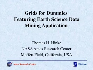
This presentation explores two parts of enhancing GIS capabilities for high resolution Earth science grids, including national hydrography dataset conservative regridding and chunked regridding. It discusses the motivation, data, implementation, performance, and next steps of each part.

E N D
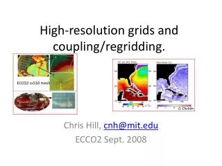
Enhancing GIS Capabilities for High Resolution Earth Science Grids (IN24B-05) Benjamin Koziol (ben.koziol@noaa.gov)1, Robert Oehmke1, Peggy Li2, Ryan O’Kuinghttons3, Gerhard Theurich4, Cecelia DeLuca1, Rocky Dunlap1 1NESII/CIRES/NOAA-ESRL, 2NASA-JPL, 3Cherokee Nation Technologies, 4Source Spring, Inc. AGU December 2017
A Presentation in Two Parts • Part 1 -National Hydrography Dataset Conservative Regridding • Motivation: Develop and profile a high performance regridding solution for complex, irregular meshes and fine resolution rectangular grids over large scales. • Data discussion • Implementation • Performance • Part 2 -Chunked Regridding • Motivation: Develop software infrastructure for grid manipulations that scale to high spatial resolutions and accuracies while accommodating arbitrary compute environments and grid structures. • Implementation • Next Steps
Part 1: National Hydrography Dataset Conservative Regridding
Here’s the Catch-ments • Conservatively regrid to hydrologic catchment polygons (unstructured) from an arbitrarily gridded field (structured) • High performance requirements • Reusability • Source Grid: CONUS exact test field - 250-meter (~2e-3 degrees), three timesteps • Destination Grid:NHDPlus hydrologic catchments for CONUS [1] • 7.7 GB of ESRI-based vector data • 2,647,454 Mesh Elements • 485,638,947 Nodes [1] http://www.horizon-systems.com/nhdplus/
Structure of an Element Hole / Interior Dangling Element • Holes/Interiors → Split geometry on interior center and use multi-geometry implementation • Multi-Geometries (Multiple Geometry Parts Counted as One Unique Feature) → Create weights for geometry parts then normalize for entire geometry • High Node Count → Split geometries based on node counts and use multi-geometry regridding
Results and Performance Conservative regridding result with CONUS NHDPlus catchments overlaid on analytical source field. • OCGIS Format Conversion - 8 cores, minutes • ESMF Regridding • Yellowstone Supercomputer - 512 cores, ~17 mins for weight generation • Weight application - ~17 seconds initialization, ~0.01 seconds SMM • Root-Mean-Square Error: 1.710e-3 • Normalized Root-Mean-Square Error: 0.2 %
Motivation for Chunked Approach • ESMF memory requirement for weight calculation and sparse matrix multiplication increases linearly with factor count • As grid resolution and complexity increases, factor counts will increase in-step resulting in potentially outsized memory requirements for regridding operations • Provided spatial mapping may be maintained for weight calculation, source and destination grids may be chunked (split) • “Maintaining spatial mapping” implies spatial relationships are indistinguishable inside the local chunks from the spatial relationships present in their global parent grids • An iterative, offline approach to weight generation and sparse matrix multiplication lifts grid resolution limitations on machine memory at the expense of computational time and ease of use • Ultimate goal is to wrap index-based decompositions within a spatial decomposition framework • Increasing the number of processors, and hence increasing the available total memory, will not always be a feasible solution.
Graphical Example with Structured Red = Destination grid slices Green = Example buffered bounding box used to subset source grid
Development Pathway • Integrate chunked regridding into the ESMF_RegridWeightGen CLI • Add spatial decomposition capability to the core ESMF library and expose in the ESMF Python interface ESMPy • “Out-of-core” memory paradigm (lazy evaluation) is a useful analog and there is considerable ongoing work in the Python community on how to address it (biggus, dask, lama/cf-python) • ESMF Homepage: https://www.earthsystemcog.org/projects/esmf/ • OCGIS Homepage: https://www.earthsystemcog.org/projects/openclimategis/ • Chunked Regridding Demo: https://sourceforge.net/p/esmf/external_demos/ci/master/tree/ESMF_FileRegridWFDemo/ • Suggestions? • Please email esmf_support@list.woc.noaa.gov if you’d like to try these workflows or have any questions
How to store? • Unstructured data stores use coordinate indexing (indirection) • Multi-geometry breaks may be included using a standard flag (may also be used for interiors) • Minimize indirection and indexing to accommodate parallelism • This approach used the ESMF Unstructured Format as opposed to UGRID. ESMF format uses a vector for coordinate indirection where UGRID uses a rectangular array. • Node thresholding, interior splitting, and multi-geometry flagging done in data conversion step node_connectivity = 0 1 2 3 4 2 coordinate_value = 10. 20. 30. 40. 50. node_connectivity = 0 1 2 -8 3 4 2 Masked, empty space in rectangular array
Subsetting / Spatial Decomposition Challenges • Maintain independent spatial mask - is it a masked value because of data issues or spatial position? • Coordinate indices must be re-indexed to persist a spatial subset - requires a flurry of communication in parallel • Label-based slicing and mask cascades is critical → Once a spatial slice and associated mask is created this must be applied across all subset targets with shared dimensions • Delayed loading of “payload” data greatly increases performance and lower memory usage • Difficult to calculate memory requirements except in very controlled conditions • MPI → More difficult to implement but offers the necessary communication solution for distributed slicing (slicing-in-parallel), re-indexing, and asynchronous IO