Download
1 / 17
170 likes | 276 Vues
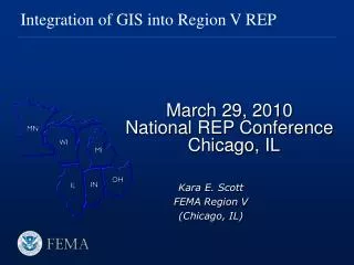
Integration of GIS into Region V REP. March 29, 2010 National REP Conference Chicago, IL. Kara E. Scott FEMA Region V (Chicago, IL). Overview. FEMA V Region V GIS User’s Group Moving Ahead…Next steps. Region V’s Integration of GIS into REP.

E N D
Integration of GIS into Region V REP March 29, 2010 National REP Conference Chicago, IL Kara E. Scott FEMA Region V (Chicago, IL)
Overview • FEMA V • Region V GIS User’s Group • Moving Ahead…Next steps
Region V’s Integration of GIS into REP • Map product illustrating base map and data layers available on REP staff work stations • Critical REP data layers • Integration of live data • Day to day planning for REP site specialists
Demonstration GIS for REP
Purpose of REP GIS User’s Group To enhance the coordination of stakeholders and to ensure that GIS can be used as a tool to effectively fulfill the mission of Radiological Emergency Preparedness
Main objective of User’s Group • Bring GIS users together to enhance day to day and response capabilities • To enable responders and decision-makers to operate more efficiently
Meeting Dates • Initial Meeting February 4th 2009 • Follow-up Conference Calls
What have we done? • GIS Assessment Surveys • Survey I—February 4th 2009 • Agency GIS capabilities • GIS Platforms, projections, etc. • Survey II—July 21st 2009 • Expectations • GIS REP needs for response • Data storage • Data sharing issues
REP GIS Data Assessment • Assessment of current REP data layers provided by members of the User’s Group • Generated a list of recommended REP data layers
Benefits of having a REP-GIS User’s Group • Members of User’s Group have access to HSIN portal for data sharing and posting maps • HSIN Region V GIS Portal access has been granted to each member • Single point of contact for GIS coordination for Region • Dissemination of Federal Standard Documents • Standard Operations Procedure for imagery request and available remote sensing products • DHS Geospatial CONOPS
…and more • Access to HSIP Freedom Data • The group has shared the methodology to participate in the HSIP Data Feedback • Coordination with other GIS partners at the local, state and federal levels that are involved with REP-related responsibilities
Moving Forward… • Enhance Federal GIS participation in REP • Ease of data sharing • Encourage common GIS picture for efficient response capability • Web-based mapping capability • Access GIS maps remotely from the internet
Upcoming meeting Region V GIS Meeting Chicago, IL Projected date: November 2010
What can you do to help? • Identify GIS POC within your Agency and outside • Keep GIS POC informed • Include GIS in the planning process • Utilize GIS for analysis
THANK YOU FOR YOUR ATTENTION! Kara E. Scott GIS Specialist Radiological Emergency Preparedness Division FEMA Region V 312-408-5377 (office) 312-505-5320 (blackberry) 312-408-5222 (fax) kara.scott@dhs.gov