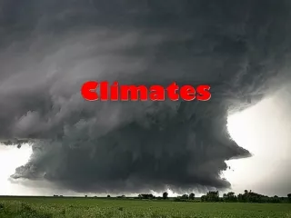
Climates: Patterns, Zones, and Impacts
Dive into the intricate world of climates, from the dynamic interplay of sun's rays to the impact on weather patterns. Explore Greek climate beliefs, Köppen classification, and climographs to unravel the Earth's climatic diversity.

Climates: Patterns, Zones, and Impacts
E N D
Presentation Transcript
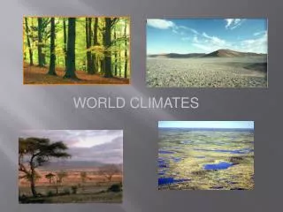
Climates Climate and Weather
Facts about Climate • The sun's rays hit the equator at a direct angle between 23 ° N and 23 ° S latitude. Radiation that reaches the atmosphere here is at its most intense. • In all other cases, the rays arrive at an angle to the surface and are less intense. The closer a place is to the poles, the smaller the angle and therefore the less intense the radiation. • Our climate system is based on the location of these hot and cold air-mass regions and the atmospheric circulation created by trade winds and westerlies.
Trade Winds and the Westerlies • Trade winds north of the equator blow from the northeast. South of the equator, they blow from the southeast. The trade winds of the two hemispheres meet near the equator, causing the air to rise. As the rising air cools, clouds and rain develop. The resulting bands of cloudy and rainy weather near the equator create tropical conditions. • Westerlies blow from the southwest on the Northern Hemisphere and from the northwest in the Southern Hemisphere. Westerlies steer storms from west to east across middle latitudes. • Both westerlies and trade winds blow away from the 30 ° latitude belt. Over large areas centered at 30 ° latitude, surface winds are light. Air slowly descends to replace the air that blows away. Any moisture the air contains evaporates in the intense heat. The tropical deserts, such as the Sahara of Africa and the Sonoran of Mexico, exist under these regions.
Seasons • The Earth rotates about its axis, which is tilted at 23.5 degrees. This tilt and the sun's radiation result in the Earth's seasons. The sun emits rays that hit the earth's surface at different angles. These rays transmit the highest level of energy when they strike the earth at a right angle (90 °). Temperatures in these areas tend to be the hottest places on earth. Other locations, where the sun's rays hit at lesser angles, tend to be cooler. • As the Earth rotates on it's tilted axis around the sun, different parts of the Earth receive higher and lower levels of radiant energy. This creates the seasons.
Greek Climate Classification • The Greeks of the first or second century B.C. believed that civilization was impossible for peoples who lived in the “Torrid” and “Frigid” zones. • They believed the Norsemen of the north were barbaric because of the extreme cold, and the Africans of the south were mindless because of the heat.
WladimirKöppen • The German meteorologist, botanist, and climatologist is best known for his delineation and mapping of the climatic regions of the world. He played a major role in the advancement of climatology and meteorology for more than 70 years. The climate classification system he developed remains popular because it uses easily obtained data (monthly mean tempera-tures and precipitation) and straightforward, objective criteria.
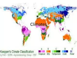
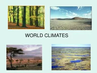
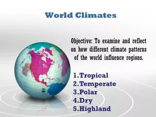
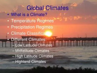
Major Climate Groupsof the Modified Köppen Scheme • A = Tropical humid • B = Dry; Evapo-transpiration exceeds precipitation • C = Mild mid-latitude • D = Severe mid/high-latitude • E = Polar • H = Highland
Climographs • Graphs temperature and precipitation for a given station • Helps to determine climate pattern for the area
Tropical Humid Climates- A • Exists between 15-20° of the equator • The only truly winterless climates of the world • Unique due to the prevalence of moisture • Tropical Wet Climate (Af) • Tropical Monsoon (Am) • Tropical Savanna (Aw)
Tropical Wet Climate • “f” stands for moist, from the German “feucht” • A monotonous, seasonless climate with endless repetition of rain and sun day after day (Avg. rain: 2.4” per month; avg. temperature is >64°F) “Night is the winter of the tropics.” • High humidity makes for high sensible temperatures • Is a poorly ventilated climate with the exception of thermal convection due to extensive heating.
Tropical Monsoon Climate • Found primarily on windward (west-facing) coasts of southeastern Asia • During high-Sun (i.e. wet) season there is extensive instability of air masses, which brings torrents of rain • During low-Sun (i.e. dry) season Am climate is dominated by offshore winds (from a Asiatic high pressure center) • Avg. rain is between 100-200” • During the rainy season insolation is effectively blocked, which results in temperature being slightly lower
Tropical Savanna Climate • The most extensive of the A climates, savanna has clear-cut seasonal alternations of wet and dry periods High-Sun season brings the ITCZ and pronounced rainfall Low-Sun Season brings drought, including 3 or 4 rainless months Three seasons: wet (w/ high sensible temperatures, muggy air, and frequent convective showers), dry (w/ clearing skies), and fire
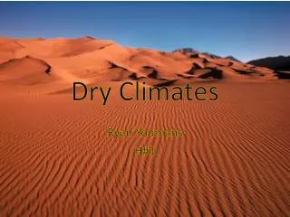
Deserts- B • Arid = 10 in. rain • BWk = Mid-latitude desert • BWh = Subtropical desert • Semiarid Steppes = 10-25” • BSk = Mid-latitude steppe • BSh = Subtropical steppe
Desert Climates • Temperature: Low latitude location and lack of cloudiness permits a high insolation and noc-turnal terrestrial radiation. • Precipitation: Deserts’ lack of moisture has three components: • Rainfall is scarce • Rainfall is unreliable • Rainfall is intense
Stages of Desertification • Deforestation (rangeland, firewood) Decline in vegetation (overgrazing) Loss of crop diversity (monoculture) Loss of animal population • Soil erosion • Soil nutrient and organic matter loss Substantial declines in crop yield Compaction and crusting soils
Mild-Mid Latitude C • Atmospheric disturbances affect this climate type, which lacks both the constant heat of the tropics and the almost-continuous cold of the polar regions. • Found between 30° to 60° North and South • Humid subtropical • Cfa (moist/summer hot); Cwa (winter dry/summer hot); Cwb (winter dry/summer warm) • Marine west coast • Cfb (moist/summer warm); Cfc (moist/summer cool) • Mediterranean • Csa (summer dry/hot); Csb (summer dry/warm)
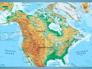
Cold High-Latitude D • Polar and arctic air masses dominate these regions. Canada and Siberia are two air-mass sources which fall into this group. A southern hemisphere counterpart to these continental centers does not exist. Air masses of arctic origin meet polar continental air masses along the 60th and 70th parallels
Tundra Climate- E • The tundra climate is found along arctic coastal areas. Polar and arctic air masses dominate the tundra climate. The winter season is long and severe. A short, mild season exists, but not a true summer season. Moderating ocean winds keep the temperatures from being as severe as interior regions. • Temperature Range: -22 °C to 6 °C (-10 °F to 41 °F). • Average Annual Precipitation: 20 cm (8 in). • Latitude Range: 60° - 75° N. • Global Position: arctic zone of North America; Hudson Bay region; Greenland coast; northern Siberia bordering the Arctic Ocean.
Highland Climate- H • Highland climates are cool to cold, found in mountains and high plateaus. Climates change rapidly on mountains, becoming colder the higher the altitude gets. The climate of a highland area is closely related to the climate of the surrounding biome. The highlands have the same seasons and wet and dry periods as the biome they are in. • Mountain climates are very important to midlatitude biomes. They work as water storage areas. Snow is kept back until spring and summer when it is released slowly as water through melting. • Temperature Range: -18 °C to 10 °C (-2 °F to 50°F) • Average Annual Precipitation: 23 cm (9 in.) • Latitude Range: found all over the world • Global Position: Rocky Mountain Range in North America, the Andean mountain range in South America, the Alps in Europe, Mt. Kilimanjaro in Africa, the Himalayans in Tibet, Mt. Fuji in Japan.