Download
1 / 19
190 likes | 377 Vues
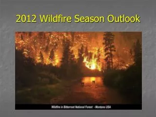
2013 Fire Season Considerations and Outlook SWCC Predictive Services. Updated May 15, 2013. Seasonal Fire Potential Main Factors. Drought Fine Fuels Condition Seasonal Temperature & Precipitation Spring & early Summer Weather Patterns Monsoon. Fire Season 2013: Drought.

E N D
2013 Fire Season Considerations and OutlookSWCC Predictive Services Updated May 15, 2013
Seasonal Fire Potential Main Factors • Drought • Fine Fuels Condition • Seasonal Temperature & Precipitation • Spring & early Summer Weather Patterns • Monsoon
Fire Season 2013: Drought • Severe+ long term drought ongoing across much of the region • Drought less severe over AZ high country & portions of west TX • Drought outlook calls for drought to persist/worsen through early summer • At this point, long term drought impacts are a “given” and the best we can hope for is temporary mitigation of drought impacts with any wetter periods • Impact: “Increased volatility & severity during fire season…especially in heavier fuels regimes”
Fire Season 2013: Fine Fuels • Overall drought means general lack of excessive, continuous fine fuels. • Wetter monsoon 2012 and winter 2012/2013 west of the divide leading to normal+ fine fuels availability, due to a combination of carryover from last summer and new growth this spring. • Below average fine fuel loading overall for west TX and much of NM. • Main fine fuels growing season over or winding down rapidly across much of the region. Growth through April into May helped hold the fire season onset back awhile, but also continued to add to the fine fuel loading. Area of some fine fuels compaction by snowfall General area where fine fuels availability is seen as near normal or slightly above ? Questionable conditions or impacts
Fire Season 2013: OCT>MAYTemperature & Precipitation • Overall dry, with fluctuating temperatures averaging on the normal to cool side. • Main impacts: Drought continuance, early loss of snowpack, prolongation of what growing season there was. TEMP PRECIP
Fire Season 2013: Spring & Early Summer Weather‘Big Picture’ – Potential Mean Upper Level Pattern • Models suggest west coast trough will return and linger from late May through June, before weakening and shifting northwestward in July • This argues for a potential continuance of late May conditions into or even through June, before the monsoon ridge begins to exert a controlling influence. • x MAY JUNE JULY
Fire Season 2013: Spring & Early SummerWeather Pattern Impacts • Changeable pattern based on average west coast trough position, strength and trends as we move towards the start of the monsoon season in July. • Along/east of NM central mountain chain: Warm, with periodic dryline moisture/storm activity interspersed with drier, more breezy conditions • Western half NM/eastern half AZ: Warm, with periodic lightning (with little/no moisture) followed by drying SW wind events of varying magnitude. • Western half AZ: Tendency towards more persistent breezy/windy conditions, less lightning potential (until July) and cooler temperatures…especially after wind events. L H = Dry environment lightning potential H L = Windy/Dry Tendency = Moisture Transport Tendency L H MOST LIKELY MEAN PATTERN – Late May through June
Fire Season 2013: Monsoon • Low confidence in general, especially considering lack of El Niño or La Niña (a.k.a. La Nada) as influencing factor • That said, long range climate models and analog years both show the monsoon setting up by mid-July with a potential swath of good monsoon rainfall west & drier conditions east: H FORECAST UPPER LEVEL PATTERN MID JULY POSSIBLE PRECIPITATION ANOMALIES: JUL>SEP POSSIBLE TEMPERATURE ANOMALIES: JUL>SEP
Fire Season 2013: Combined Fire Potential Factors ? • Drought • Fine Fuels Condition • Seasonal Temperature & Precipitation • Spring & early Summer Weather Patterns • Monsoon (not included here due to low confidence) ? • Only factors which would support above normal fire potential are highlighted. • A more complex/dynamic alignment of factors than some recent years.
Fire Season 2013: Number of Factors Aligning to Support Above Normal Seasonal Fire Potential 2-3 2-3 2-3 2.5 3-4 • Drought • Fine Fuels Condition • Seasonal Temperature & Precipitation • Spring & early Summer Weather Patterns • Monsoon 3 2-3 2-3 4 3-4 1.5 2.5 2-3 2 4 .5 • Monsoon factor excluded for now, so these numbers represent total out of first 4 factors. • Green shaded boxes indicate fine fuels dominated areas where #’s would be lower if fine fuels factor was given a higher weighting.
2013 Fire Season Potential Summary • Mid May> Mid June: Above Normal fire potential in & near mountain areas of NM and across much of central & eastern AZ. (Drought impacts on heavier fuels, available fine fuels, max potential for lightning interspersed with drying wind events). Potential improvement by late June for NM central mountain chain. (increased moisture, decreased drying & wind potential) • Mid June>Mid July: Expansion of Above Normal fire potential northwestward with additional heat, dryness& lightning potential. • Overall Monsoon: Timely onset with potentially wetter conditions west half & drier east. • Deciding Factor(s): Timing and alignment of drying wind events following lightning. Timing of transition to hotter/drier pattern that would rapidly increase fire potential northwestward. Rainfall potential with dryline storm activity east.
ENDSWCC Predictive ServicesPlease consult 7-Day and monthly fire potentialoutlook products for updated information throughthe remainder of fire seasongacc.nifc.gov/swcc/ Contact: Rich Naden, Chuck Maxwell, Predictive Services Meteorologists cmaxwell@fs.fed.us, 505-842-3419 rnaden@fs.fed.us, 505-842-3415
Fire Season 2013: DEC-FEBWinter Temperature & Precipitation • Cold & dry overall, with areas of above normal precipitation limited to parts of AZ and west TX. Very dry in NM. • Main impact some fine fuels compaction from snowfall and enhanced chance for spring growing season in moist areas. • Snowpack generally 50-80% of average TEMP PRECIP
Fire Season 2013: MAR>APRTemperature & Precipitation • Generally dry, with above normal temperatures west and near to slightly below normal temperatures east. • Main impacts: Fine fuels growing season western half with the warmth & prior moisture; general loss of snowpack due to dryness and/or warmth. • Snowpack well below normal most areas. TEMP PRECIP
Fire Season 2013: MAY – 1st HalfTemperature & Precipitation • Generally cooler and more humid than normal, with some areas of light rainfall from showers/storms due to unusual, slow moving MAY system • Fine fuels growing season prolonged a bit more and general peak fire season onset delayed… TEMP H L L L PRECIP UPPER LEVEL PATTERN – END OF 1st WEEK OF MAY
Fire Season 2013: MAY – 2nd HalfTemperature & Precipitation Outlook TEMP • Return to west coast tough pattern should result in a temperature trend flip (warmer central/east, cooler west) • Rainfall minimal, but potential lightning impacts western NM>eastern AZ • Few windy/dry events focused along or west of the continental divide PRECIP L H H L L All Told: The month of MAY should come out with below normal rainfall and near to slightly above normal temps (after the temp trend flip) H FORECAST MEAN PATTERN – LAST TWO WEEKS OF MAY
2013 Fire Season Factors Summary • Drought – Severe and ongoing. Increased volatility overall, with generally decreased potential in fine fuel regimes and increased volatility & potential in heavier fuels complexes. • Fine Fuels Condition – Normal+ west of the divide and generally below normal elsewhere. • Seasonal Temperature & Precipitation– Cold winter with dryness focused over NM. Dry spring overall across the entire region with a fluctuating temperature signal resulting in overall slightly above normal spring temperatures. • Spring & early Summer Weather Pattern– Mean west coast trough becoming re-established, but tending to drift further NW over time. Higher wind potential focused NW half of AZ, with dryline storm activity eastern plains, and potential for lightning interspersed with drying wind events in between. • Monsoon – Setup looks to occur by mid-July, with possible good moisture swath across the west and potentially dry conditions east.