Download
1 / 11
110 likes | 249 Vues
Kenston Campus Headwater Assessment. Larrin Stewart, Julia Ganz, Sean Doran, Kathryn Thomas, and Anton Blatnik. Introduction. Background: Kenston campus has 5 school buildings Two schools are new Timmons Elementary Kenston High School- less than 18 months old. Objective of Project.

E N D
Kenston Campus Headwater Assessment Larrin Stewart, Julia Ganz, Sean Doran, Kathryn Thomas, and Anton Blatnik
Introduction Background: Kenston campus has 5 school buildings Two schools are new Timmons Elementary Kenston High School- less than 18 months old
Objective of Project • To apply techniques and skills learned this past week to Kenston’s Campus • How we are going to apply it? We know we can obtain satellite and digital pictures along with mapping techniques to assess changes in landscape along with evaluation on our local watershed
Recent Development • A lot of developmental change recently occurred: • Tree clearing • Drainage basin • Landscaping • Retention ponds/ system • Parking lots • Sports fields • Well water/ septic system
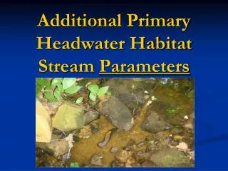
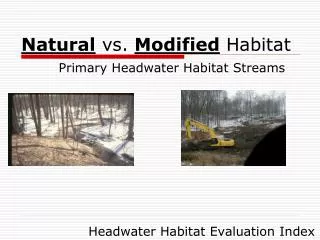
HHEI • Why use HHEI? • What are the Three Metrics? • How to determine the Three Metrics • How we can apply it?
Laser Leveling: Experience • What did we learn? • How to use the equipment • Determine vital points to measure • Interpret the data collected • How to incorporate HHEI with the information obtained • How to monitor the stream quality over time
Laser Leveling: Equipment • We learned how to properly use the laser leveling equipment, analyze the data, and determine important details of the area • The level sends out a signal that the laser eye-receiver then picks up and beeps to signify its position in relation to the level
Laser Leveling: Usage • How will we utilize this equipment and knowledge? • Continual monitoring of the streams and incorporation of what we’ve learned into the curriculum • Help determine the qualities of the stream and drainage pond, as well as the health and how we can improve it
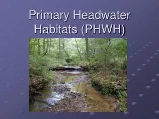
Wetlands • Determine if any wetlands exist on Kenston’s campus • Use the ORAM Field Form to determine the classification and quality of the wetland
Why classify wetlands? • Classification of the wetlands will give Kenston an estimate of how well the new drainage system is working • Presence of wetlands will determine future building projects and quality of campus habitat
Develop a basis for which the school can use to analyze its headwater habitats. • Help local officials to gear towards protecting, sustaining, and improving watershed quality. • Create new interest in working with the environment. • Make Kenston a role model for other school districts in the environmental field. Conclusion