Download
1 / 36
360 likes | 466 Vues
Explore the development of forest surveys and GIS applications on the Nez Perce Reservation, focusing on fire management planning and monitoring, data analysis and reporting, and future inventory needs.

E N D
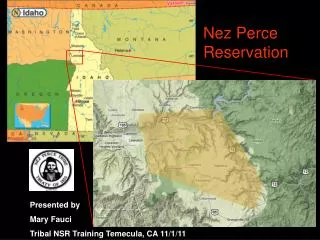
Forest Surveys and GIS Applications on the Nez Perce Reservation GIS on Fire! Worley - Plummer, Idaho May 11, 2005 Rich Botto, Nez Perce Tribe rbotto@nezperce.org
Development of Forest Surveys • Prior to 1970s – Appraisals • timber volume and value • 1974 – First permanent CFI plots installed • forest management plans • sustainable harvest rate • 1987 – Initiated stand based inventory system • silvicultural planning • harvest scheduling • 2004 - FireMon program • monitoring forest fuels • fire management planning
Annual Inventory Goals • Pre-harvest cruising • 1 or 2 timber sales • 3 to 5 cutting permits
Annual Inventory Goals • Pre-harvest cruising • 456 CFI plots measured every 10 years
Annual Inventory Goals • Pre-harvest cruising • 456 CFI plots measured every 10 years • 5,500 acres of stand exams to ensure 10% of land base updated
Annual Inventory Goals • Pre-harvest cruising • 456 CFI plots measured every 10 years • 5,500 acres of stand exams to ensure 10% of land base updated • WUI/HFR treatments
Data Analysis & Reporting • Forest Projection System (FPS) • Appraisals • Stand exams
Data Analysis & Reporting • Forest Projection System (FPS) • BIA Analysis Program, Northwest Regional Office • CFI plots
Data Analysis & Reporting • Forest Projection System (FPS) • BIA Analysis Program, Northwest Regional Office • FireMon Data Analysis Software • Fuels monitoring plots
Future Inventory Needs • What is the composition of forest fuels at the stand level? • Canopy, snags, ladder fuels, shrubs, nonwoody, litter-lichen-moss, and ground fuels • Fine scale vs. coarse scale assessments • What are the effects of WUI/HFR treatments on fire hazards at the landscape scale? • Fire Regime Condition Class (FRCC)
GIS Applications • FPS growth model calibration (clumpiness index) • Stem mapping CFI plots • Forest events geodatabase • Documenting forest management practices (current and historical) • Linking historical photographs • Fire hazard mapping using FVS (Forest Vegetative Simulator) • Fire and fuels extension model
Stem Mapping • Acquire a GPS location for all trees >5” Dbh on the fixed 1/5 acre plot (6627 live tree records) • XY coordinate of plot center pin • Distance to tree • Azimuth to tree • Calculate offset and GPS locations for each tree
Forest Management Geo-Database • Documenting forest management activities (historical, present, and planned) and creating Activity_IDs for your GIS shapefiles
Event Types • Plant • Thin • Harvest • Fire • SitePrep • HFR • Cruise Forest Events • Type of Event • Event Status • Contract Name • Contract Number • Administrator • Start Date • End Date • Approval Status • Map Status Practice Types • Planting • Precommercial thinning • Commercial thinning • Overstory removal/reduction • Sanitation/salvage • Prescribed fire • Mechanical site prep • Pruning • Mechanical brush reduction • Livestock grazing/browsing • Shelterwood • Seed tree • Clearcut • Free thin • Single tree selection • Group selection • Chemical application Forest Management Geo- Database Activities • Event • Activity_ID • Type of Practice • Unit • Year • Tract Name TABLES Activities ForestEvents EventTypes PracticeTypes TractNames PracticePoly
Activity_ID (s) for current projects • Summary Reports • Forest practices by tract and time period Reports • Activity_ID • Practice • Unit# • Year • Tract Name • Acres Forest Management Geo- Database GIS Shapefiles • Excel Spreadsheets Export Utilities
Fire Hazard Mapping (FVS-FFE) • Torching and Crowning Indices • Surface fire • Passive crown fire • Active fire • Attributes • Surface fuels, surface fuel moisture, canopy base ht, slope, wind effects • Canopy bulk density, slope, surface fuel moisture
Other Fire Hazard/Risk Mapping*(Coarse Scale) • Fire Severity • Proportion of above ground biomass removed • Fuel Hazard • Containment difficulty • Fire Regime Condition Class • Departure from historic baseline *Idaho Interagency Assessment of Wildland Fire Risks to Communities and Ecosystems, December 21, 2004
Future Inventory Needs • Integrate a fuels inventory program at the stand level • Canopy, snags, ladder fuels, shrubs, nonwoody, litter-lichen-moss, and ground fuels