Download
1 / 24
240 likes | 477 Vues
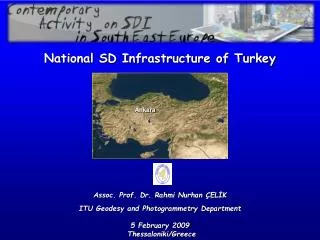
Ankara. National SD Infrastructure of Turkey. Assoc. Prof. Dr. Rahmi Nurhan ÇELİK ITU Geodesy and Photogrammetry Department 5 February 2009 Thessaloniki/Greece. S ystem. G eographic. I nformation. Specific GIS Applications. GIS. GIS. Urban Information Systems.

E N D
Ankara National SD Infrastructure of Turkey Assoc. Prof. Dr. Rahmi Nurhan ÇELİK ITU Geodesy and Photogrammetry Department 5 February 2009 Thessaloniki/Greece
System Geographic Information
Specific GIS Applications GIS GIS Urban Information Systems Land Information Systems Base Maps Geodetic Infrastructure
TKGM Governmental Ins. TCK, DSİ, DİE, ..., MTA HGK Municipalities Others SD Portal National Portal
Geodetic Infrastructure of TurkeyforSI/GI/GIS2D..? 3D..? 4D..?
TUTGATurkish National Fundamental GPS Network ITRF96 – TG99A (1997-1999) ED50 (1950s-2005)
SpatialData Providers • General Directorate of Land Registry and Cadastre • General Command of Mapping • Provincial Bank • Local Governments/Municipalities • Other Governmental Institutions • Private Companies
SpatialData Owners • General Directorate of Land Registry and Cadastre • General Commander of Mapping • Provincial Bank • Local Governments • Other Governmental Institutions
Legislation • All SI/GI data are protected by Turkish Republic Official Law. However the law is not well detailed, therefore comments might be necessary to clarify the usage. • New regulation was released in July 2005 for precise high resolution/large scale spatial data production. • Not yet special law for National SDI. It is under preparation. It is in government action plan (2003) as activity 47, activity 36 and activity 75 • Other governmental documents - Some of the institutions/organisations prepare their own official rules regarding their needs.
Main Actors of GIS Market • Central Government • Local Government • Municipality • Utilities • Defence and Military • Public Security • Disaster Management • Education/Research • Telecoms • Transport • . . . • Financial • Health • Environment • Property/Construction • . . .
Strengths • Spatial data have been collected using modern technology since beginning of 1900s in Turkey • Governmental institutions are responsible to archive the spatial data • Spatial data are protected by laws for public benefits • Spatial data are exchanged between the governmental institutions • Latest data collection technology is closely followed and technical regulations are modified regarding the scientific and technological developments. The new regulation was released in July 2005. Regarding this regulation spatial data collection for large scale applications are standardized for all governmental institutions, therefore for private institutions. • New 4D geodetic network has been established based on artificial satellite technology and regularly updated.
Weaknesses • Very old spatial data still exists, needs to be modernized. • Still no single standards in alllevel, governmental institutions apply institutional standards while collecting spatial information. • Cadastral works has not been completed for all over the country. Most existence ones need renewing. • Tectonic movements are very effective all over the country. Therefore spatial information is quickly getting out of date. • Existing cadastral laws do not fit the needs of modern digital information systems • Using small scale spatial data needs military permission.
Best Practices • Land Registry and Cadastre Information System – TAKBIS • Marmara Earthquake Region Land Information System – MERLIS • İstanbul Great Municipality Urban Information System • Bursa Great Municipality Urban Information System • e-government • Seddulbahir and Kumkale Fortresses Documentation Project
Land Registry and Cadastre Information System- TAKBİS - Main Components of TAKBİS Educated staff Powerful software Updated and reliable data Powerful hardware Precise applications www.tkgm.gov.tr/tapunet/atkgmgovtr/takbis/takbis.htm
External Users of TAKBİS www.tkgm.gov.tr/tapunet/atkgmgovtr/takbis/takbis.htm
Target of TAKBİSOnline Data Portal www.tkgm.gov.tr/tapunet/atkgmgovtr/takbis/takbis.htm