QOTD Answer
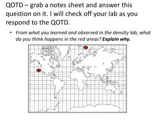
QOTD – grab a notes sheet and answer this question on it. I will check off your lab as you respond to the QOTD. From what you learned and observed in the density lab, what do you think happens in the red areas? Explain why. QOTD Answer.

QOTD Answer
E N D
Presentation Transcript
QOTD – grab a notes sheet and answer this question on it. I will check off your lab as you respond to the QOTD. • From what you learned and observed in the density lab, what do you think happens in the red areas? Explain why.
QOTD Answer The colder water in the arctic freezes. The salt stays in the liquid water, making it even more salty. More salt = denser = sinks. The warmer water will be less dense and rise Hey, just like your lab!
Learning Target • To understand role of density and movement of water in ocean circulation
current • mass of water moving from one place to another • like a river within the ocean
Importance of currents • moves drifting organisms from place to place – plankton, disperse young • carries eggs and larvae of organisms that have external fertilization • brings food, oxygen • carries away animal waste, pollutants
three types of currents • surface currents ( horizontal , wind-driven) • thermohaline circulation (vertical, caused by changing density of the water - by temperature and salinity) • upwelling (vertical, wind-driven)
Global Wind Patterns Due to air currents in the atmosphere (more on this in our last unit) and the Coriolis effect, we end up with 6 basic prevalent wind regions. Wind moves in these directions: South and West (easterlies) North and East (westerlies) South and West (northeast trade winds) North and West (southeast trade winds) South and East (westerlies) North and West (easterlies)
surface currents • occur at surface • horizontal currents • wind driven currents (wind pushes water) • Direction affected by Coriolis effect
Coriolis effect • Earth spins on its axis of rotation • spins faster at equator than at poles • Moving objects in the air go in straight lines while the earth spins underneath • Aerial objects appear to get “deflected” • causes moving objects in northern hemisphere to veer clockwise • causes moving objects in southern hemisphere to move counter-clockwise • RESULT: winds travel in curved paths! • These curved winds affect surface currents!
surface currents Coriolis effect
gyres • massive circular system of wind-driven surface currents • cover whole oceans • Coriolis effect causes gyres to rotate: • clockwise in Northern hemisphere • counter-clockwise in Southern hemisphere
thermohaline circulation • vertical currents • But vertically moving water pushes other water out of the way, causes deep ocean horizontal circulation • Temperature (thermo) and salinity (haline) cause water density differences • due to density differences, water masses rise and fall
thermohaline circulation (currents) REMEMBER THE DENSITY LAB? ↑ salinity = ↑ density = water mass sinks ↑ temp. = ↓ density = water mass floats
thermohaline circulation (currents) • when combined with surface currents, results in conveyor belt movement of wateraround globe • Wind blows surface currents to colder areas-> Water cools -> becomes dense and sinks -> Thermohaline circ. moves water to equator-> water warms and rises
Upwelling = wind driven vertical currents • wind blows, moves water away, causes colder water to rise up to replace it
Areas of Upwelling = Increased productivity • Colder, denser water from deep ocean is more nutrient rich than warmer water at surface. • Areas of upwelling usually higher levels of primary production • Higher primary production= more primary consumers, more secondary consumers, etc.
Areas of Upwelling = Increased productivity • There are 5 major areas of upwelling- on the west coasts of the continents (except Europe/Asia/Antarctica) • 25% of global fish catch come from these 5 areas of upwelling that equal 5% of ocean area!
Surface currents Some specific currents have appeared as AP questions before! (ex: California current (cold, south) , Gulf Stream (warm, north) - Peru current (cold, north) west Australian current (cold, north) WHY?
Why do these currents move the way they do? • Combination of: • coriolis effect (rotate clockwise in northern hemisphere and clockwise in southern hemisphere) Direction of prevailing winds • Uneven heating of earth’s surface (Cooler water toward poles, warmer near equator) • California current comes from north toward equator so it will be cool polar water but in northern hemisphere so it spins clockwise (and hence south) • Western Australian current moves toward equator so it will be cool polar water, but southern hemisphere means it spins counterclockwise (hence the northern direction)