Download
1 / 18
180 likes | 416 Vues
CONCAM All-Sky Maps of Airglow and Opacity. Robert J. Nemiroff & Lior Shamir. & The Night Sky Live Collaboration. The Night Sky Live Project. Abstract.

E N D
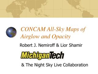
CONCAM All-Sky Maps of Airglow and Opacity Robert J. Nemiroff & Lior Shamir & The Night Sky Live Collaboration
The Night Sky Live Project Abstract A major goal of the global Night Sky Live (NSL) network is to deploy CONtinuous CAMeras (CONCAMs) to support astronomical observing sites with real-time all-sky images and information. To date, this aim has been fulfilled mostly by CONCAM's role as an optical cloud monitor -- creating rapid ground-truth fisheye images that can be visually inspected so that real-time observing decisions can be made. These images are available immediately over the web through http://nightskylive.net/, where they are also archived. The high quality of raw CONCAM data, however, allows us to go further and build a data pipeline from which automated stellar photometry can be done for a few hundred of the brightest stars. When combined with CONCAM all-sky brightness data, we show that a simultaneous solution for sky opacity and airglow (actually skyglow) is possible at stellar positions. These data can then be interpolated into all-sky maps. With current CONCAM3 equipment, maps with a broadband accuracy of about 0.1 magnitudes for altitudes above 12 degrees is demonstrated. Such maps might contribute to a more quantitative assessment of the brightness, clarity, and variability of the night sky background above the world's largest telescopes both in real time and in subsequent data reduction. Progress on creating these maps as part of the Night Sky Live data processing pipeline will be discussed.
The Night Sky Live Project All-Sky Maps of Airglow and Opacity • Popular Name: The Night Sky Live Project • Web address: • http://NightSkyLive.net • http://concam.net • Deploys CONtinuous CAMeras (CONCAMs)
The Night Sky Live Project Project General Objectives • Primary Science • Unprecedented temporal monitoring for GRB OTs, meteors, variable stars, comets, novae, supernovae • Support Science • Unprecedented ability to act as instantaneous cloud monitors, archival cloud monitors, generate real-time all-sky opacity maps and skyglow maps • Education / Outreach • Unprecedented ability to show your class last night’s (real) sky, archival skies, monitor meteor showers in real time, show educational sky movies, run educational modules
The Night Sky Live Project CONCAM Locations Eight NSL nodes are currently deployed -- more are being built
The Night Sky Live Project Four of the Eight CONCAM locations Kitt Peak Mt. Wilson Mauna Kea Wise Obs.
The Night Sky Live Project CONCAM: Hardware • CONCAMs are essentially fisheye lenses attached to CCDs run by a PC computer and connected to the internet. CONCAMs do not move - they are completely passive. • Most simply put: light comes in the top, electricity comes in the bottom, and data flow out the bottom. • In building CONCAMs, we have three montras: • “If it moves, it breaks.” • “The lens IS the dome.” • “Don’t spend 90% of your time trying to get 10% more images.”
The Night Sky Live Project Data Policies • All recent images are available through http://NightSkyLive.net (or concam.net) • All data are free and public domain. • All FITS and JPG data are archived to DVDs (previously CDs). • Each CONCAM takes a new all-sky frame every 3m56s. • Higher level data products (e.g. photometry) now generated in real time for most CONCAMs and displayed on the NSL web site
The Night Sky Live Project Scientific Milestones (so far) • First CCD device to image the position of a gamma-ray burst during the time of the gamma-ray burst trigger (#1: GRB 001005) • Most complete, global, and uniform coverage of a meteor storm: the 2001 Leonids • Most complete light curves for hundreds of bright variable stars starting from May 2000, when the first CONCAM was deployed on Kitt Peak. • First devices to give real-time optical ground truth for the whole sky in support of major astronomical telescopes, including Gemini North, Keck, Subaru, IRTF, SpaceWatch, Wise, ING 4-m, Mayall 4-M, SARA, and WIYN. • In May 2003, fisheye night sky webcams now image most of the night sky, most of the time. For example, were SN 1987A to go off tomorrow, there would be a good chance that a CONCAM saw it.
The Night Sky Live Project All-Sky Maps: Skyglow • Real time (“cloudy”) image computationally compared with “clear” image taken on a previous night at the same sidereal time • All PSFs removed (clear and cloudy images) • leaves “star-free” background images • gives raw skyglow for both images in mag/arcsec2 • cloudy / clear image counts divided • gives relative skyglow between clear and cloudy
The Night Sky Live Project All-Sky Maps: Opacity • Photometry done for hundreds of stars • Both for cloudy and clear frames • Given the relative skyglow map, there is a unique solution for relative sky opacity at any star location • Opacity map generated by going pixel-to-pixel, weighted averaging the opacity of nearest ten stars
The Night Sky Live Project All-Sky Maps: Skyglow and Opacity • Generated for only CONCAM3s at present • Regenerated every 3m56s for all locations • Accurate to about 0.1 magnitudes broadband • Reasons for skyglow • airglow, light pollution, zodiacal light, moon glow, cloud reflection. • Reasons for opacity • clouds, aerosols (dirty air), airplane contrails
The Night Sky Live Project Cloudy frame being analyzed. The image was taken at the same sidereal time but on another night. Clear sky frame
The Night Sky Live Project Cloudy frame being analyzed. The image was taken at the same sidereal time but on another night. Clear sky frame
The Night Sky Live Project Opacity map superimposed in blue. Thin sub-visual clouds become apparent. Raw cloudy frame
The Night Sky Live Project Raw skyglow map. Baseline skyglow is set to 21 mag/arcsec2 Relative skyglow map between clear and cloudy frames, in mag/arcsec2
The Night Sky Live Project All-Sky Maps: Scientific Usefulness • Real time pointing decisions for major telescopes • Real time run / don’t run decisions for robotic telescopes • site evaluation for current major telescopes sites • site evaluation for potential future telescope sites • light pollution evaluation for current telescope sites • increases photometric accuracy for telescopes at CONCAM locations
The Night Sky Live Project Support