Water Resources Data for Missouri
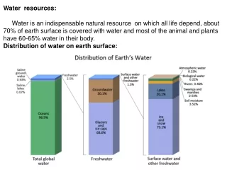
Water Resources Data for Missouri. Data Classification. Physical Data Water Level (GW, SW) Discharge Precipitation Biogeochemical Data (Water Quality) pH, Conductance, DS, DO, Turbidity Metallic elements and Toxicants contents Statistical Data Almanacs, Maps. Data Types. Numerical Data

Water Resources Data for Missouri
E N D
Presentation Transcript
Data Classification • Physical Data • Water Level (GW, SW) • Discharge • Precipitation • Biogeochemical Data (Water Quality) • pH, Conductance, DS, DO, Turbidity • Metallic elements and Toxicants contents • Statistical Data • Almanacs, Maps
Data Types • Numerical Data • Logging Data (Real-Time, Recent-Stored) • Geo spatial Data • Graphical Data • Vector Images • Raster Images • Documents • Data Reports • Investigation Reports • Maps
Major Data Providers • USGS • EPA • Missouri DNR • NOAA
Station Operators • USGS • EPA • NOAA • US Army • KCMO Water Services
USGS • NWISWeb (National Water Information System Website) Selected water-resources data for approximately 1.5 million sites across the United States from 1857 to present.
USGS • NWISWeb (National Water Information System Website) Real-Time and Recent-Stored Data Stage and Streamflow Data Ground Water Surface Water Quality Water Precipitation Data Daily Streamflow Conditions Map Missouri Current Water Resources Conditions National Streamflow Conditions Map Historical Streamflow Data Historical Water-Quality Data
USGS • NWISWeb (National Water Information System Website) Real-Time and Recent-Stored Data Surface Water – 190 stations Ground Water – 75 stations Quality Water – 10 stations Precipitation Data – 117 stations On Screen Displayed or Downloadable Text
USGS • NWISWeb (National Water Information System Website) Data Access -Via NWIS website -Input http address directly http://waterdata.usgs.gov/mo/nwis/dv?format=rdb&period=730&site_no=390945091494001 http://waterdata.usgs.gov/mo/nwis/uv?format=rdb&period=31&site_no=390945091494001 Monthly Real-Time: uv,31 Site ID Annual Recent-Daily: dv,730
USGS • NWISWeb (National Water Information System Website) Data Examples
USGS • National Hydrography Dataset (NHD) • Geospatial Data (On Demand) • On Screen Displayed Watershed and Flowlines in Jackson County
USGS • National Hydrography Dataset (NHD) • Geospatial Data (On Demand) • Downloadable (viewed with GIS software) files from FTP
EPA • On Demand Water Quality Data Access From “STORET”(STOrage and RETrieval) The map shows the locations of monitoring sites currently registered in the National STORET Data Warehouse
EPA • Data Example from STORET
ESRI ArcHydro Data Model • ArcHydro Surfacewater Model • ESRI Press, 2002 • Hydrography. • Time Series Connection • Hydrologic Modeling.
ESRI ArcHydro Data Model • Hydrography
ESRI ArcHydro Data Model • Time Series Connection
ESRI ArcHydro Data Model • Hydrologic Modeling
Data providing by states • In case of the states including High Plains aquifer Texas Kansas Wyoming Nebraska Colorado South Dakota New Mexico
Groundwater Data Search Engine • GROUNDWATER CENTRAL