Download
1 / 40
400 likes | 459 Vues
Reference for aircraft operations in IHOP 2002 deployment between May 13 and June 25, 2002. Includes schedules, basemap, mission information, flight track strategies, and contact details.

E N D
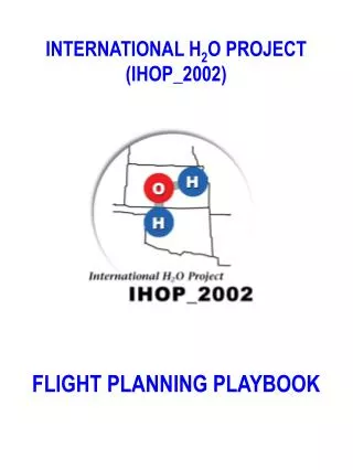
INTERNATIONAL H2O PROJECT (IHOP_2002) FLIGHT PLANNING PLAYBOOK
Introduction to International H20 Project (IHOP_2002) Flight Planning Playbook Introduction This document is a reference for aircraft operations associated with the IHOP_2002 field deployment. Operations will occur between May 13 and June 25, 2002. There will be as many as six aircraft participating in the project at any one time during this period. Figure 1 summarizes the schedules for IHOP_2002 aircraft participation. Figure 1: IHOP_2002 Aircraft Deployment Schedule Figure 2 is the standard basemap that will be used by the IHOP_2002 Project Office Aircraft Coordinator to notify ATC authorities of intended research flight operations. The map also indicates the latitude/longitude position of critical ground-based IHOP_2002 instrumentation that may be used as an anchor for aircraft operations.
Figure 2: IHOP_2002 Basemap All aircraft will be based at Will Rogers World Airport (OKC) located in Oklahoma City, Oklahoma for the duration of their involvement in IHOP_2002. Sections Explanation The tabbed sections in this notebook represent the major scientific classifications of research flight strategies. Table 1 lists each classification and the approximate number of flights anticipated within each category. Any other special characteristics are also listed.
Table 1: Research Mission Information The first page of each section presents the composite flight track strategy for each type of sampling experiment listed above. It shows how the aircraft will be directed to fly over the phenomena or geographic region of interest. Not all tracks in each composite will be flown during each mission. A vertical cross section showing nominal aircraft altitudes (Above Ground Level (AGL) under 10,000 ft and Flight Level (FL) at or above 10,000 feet) for each participating aircraft is also shown. It is important to note that having as many aircraft as possible working in the same horizontal region with necessary vertical separation is quite important to properly sample three-dimensional atmospheric conditions. It should be noted that aircraft may enter and leave the region on different schedules due to differences in aircraft performance capabilities. The pages that follow the composite in each section are the detailed tracks for each aircraft that might participate in the proposed mission. Also, the actual tracks will vary to some degree based on the winds in the region and evolving priorities. The following key assigns each IHOP_2002 aircraft a number that is always used within each category:
1 = University of Wyoming King Air (N2UW) 2 = Flight International Inc. Learjet (N12FN) 3 = Naval Research Laboratory P-3 (587) 4 = DLR Falcon (D-CMET) 5 = NASA DC-8 (N817NA) 6 = Proteus (N281PR) A small letter (a, b, c) may follow the number that notes a variation in the flight track for a single aircraft as shown in the playbook. Flight Plan Proposals The IHOP_2002 Operations Center will provide an IHOP_2002 Flight Plan Proposal to the ATC groups at least 12 hours in advance of proposed flight operations, typically on the afternoon prior to the proposed flight operations day. This form will include: • Proposed date of operations • A primary science mission objective: CI, ELLJ, etc. • A secondary or back-up mission objective: BLH, BLE, etc. • (This is done in case the weather conditions are different than those forecast or access to appropriate airspace for the primary mission is not possible for some reason). • A list of aircraft flight plans intended for the proposed primary and secondary missions: (e.g. CI: 1a, 2, 3 or ELLJ: 2,3) • A basemap with an outline of the intended operations area One exception to this will be the need to alert military ATC personnel on Fridays for planned operations the following Monday because ATC staff is not generally available on the weekends or federally designated holidays. Updates The choice of primary mission, secondary mission or cancellation will be sent to the ATC groups at least 2 hours prior to the take-off of the first aircraft. Updates, including changes during the mission, will be provided as soon as they are available. Contact Information IHOP_2002 Operations Center Telephone number IHOP_2002 Operations Center Fax number IHOP_2002 Aircraft Coordinator Pager number IHOP_2002 Operations Director Pager number
INTERNATIONAL H2O PROJECT (IHOP_2002) FLIGHT PLANNING BASEMAP
CONVECTION INITIATION (CI) Preferred Operation Time: 1200 – 2000 LT Necessary Weather: Pre-convective with slow-moving (< 5 m/s) boundary Number of Missions: 12-15
CI : 1a Convective Initiation Cross Pattern UW King Air (~29 min/circuit) (97 nm @ 200 kn) Flight tracks are not geographically fixed. They are based on Boundary/Weather.
CI : 1b Convective Initiation Cross-Box Pattern UW King Air ~42 min/circuit (140 nm @ 200 kn) Flight tracks are not geographically fixed. They are based on Boundary/Weather.
CI : 1c Convective Initiation ABL Pattern UW King Air ~26 min/circuit (86 nm @ 200 kn) Flight tracks are not geographically fixed. They are based on Boundary/Weather.
CI : 2 Convective Initiation FII Learjet ~23 min/circuit (94 nm @ 250 kn) Flight tracks are not geographically fixed. They are based on Boundary/Weather. Dropsondes may be dropped every ~11 nm
CI : 3 Convective Initiation NRL P-3 ~32 min/circuit (103 nm @ 300 kn) Flight tracks are not geographically fixed. They are based on Boundary/Weather.
CI : 4a Convective Initiation DLR Falcon ~21 min/circuit (95 nm @ 275 kn) Flight tracks are not geographically fixed. They are based on Boundary/Weather. Dropsondes may be dropped every ~11 nm
CI : 4b Convective Initiation DLR Falcon (~2 hrs 23 min/circuit) (551 nm @ 275 kn) Flight tracks are not geographically fixed. They are based on Boundary/Weather. Dropsondes may be dropped every ~11 nm
CI : 5 Convective Initiation NASA DC-8 ~1 hr 13 min/circuit (551 nm @ 450 kn) Flight tracks are not geographically fixed. They are based on Boundary/Weather.
CI : 6 Convective Initiation Proteus (~2 hrs 12 min/circuit) (551 nm @ 250 kn) Flight tracks are not geographically fixed. They are based on Boundary/Weather.
MORNING LOW-LEVEL JET (MLLJ) Preferred Operation Time: 0600 – 1200 LT Necessary Weather: Low-level jet and frontal zone or dryline Number of Missions: 2
MLLJ : 2 Morning Low-Level Jet FII Learjet ~1 hr 46 min/circuit (702 nm @ 400 kn) Flight tracks are geographically fixed. 25 Dropsondes spaced ~27 nm apart
MLLJ : 4 Morning Low-Level Jet DLR Falcon ~2 hrs 17 min/circuit (702 nm @ 275 kn) Flight tracks are geographically fixed. 25 Dropsondes spaced ~27 nm apart
MLLJ : 6 Morning Low-Level Jet NRL P-3 ~ 6hrs 2 min/circuit (1809 nm @ 300kn) Flight tracks are geographically fixed.
EVENING LOW-LEVEL JET (ELLJ) Preferred Operation Time: 1500 – 2100 LT Necessary Weather: Potential for low-level jet; no clouds to broken; potential for nocturnal convection (MCC). Number of Missions: 3
ELLJ : 3 Evening Low-Level Jet NRL P-3 ~ 5 hrs 27min/circuit (1636 nm @ 300 kn) Flight tracks are geographically fixed.
ELLJ : 4 Evening Low-Level Jet DLR Falcon ~ 4 hrs 18min/circuit (1183 nm @ 275 kn) Flight tracks are geographically fixed.
ELLJ : 5 Evening Low-Level Jet NASA DC-8 ~ 2 hrs 38min/circuit (1183 nm @ 450 kn) Flight tracks are geographically fixed.
BOUNDARY LAYER HETEROGENEITY (BLH) Preferred Operation Time: 0900 – 1400 LT Necessary Weather: Clear, sunny day Number of Missions: 12
BLH : 1a, 1b, 1c b c a Boundary Layer Heterogeneity UW King Air Stacked Pattern 1a, 1b, 1c ~8 min/circuit (38 nm @ 300 kn) Flight tracks are geographically fixed.
BLH : 3a, 3b, 3c a b c Boundary Layer Heterogeneity NRL P-3 Pattern 3a, 3b, 3c ~49 min/circuit (243 nm @300 kn) Flight tracks are geographically fixed.
BLH : 3d Boundary Layer Heterogeneity NRL P-3 Pattern 3d ~1 hr 53 min/circuit (567 nm @300 kn) Flight tracks are NOTgeographically fixed.
BLH: 4a, 4b, 4c a b c Boundary Layer Heterogeneity DLR Falcon Pattern 4a, 4b, 4c ~53 min/circuit (243 nm @ 275 kn) Flight tracks are geographically fixed. Dropsondes may be dropped 27-40 nm
BLH : 5 Boundary Layer Heterogeneity NASA DC-8 ~1 hr 16 min/circuit (243 nm @ 450 kn) Flight tracks are NOT geographically fixed.
BLH : 6 Boundary Layer Heterogeneity Proteus ~2 hrs 16 min/circuit (243 nm @ 250 kn) Flight tracks are NOT geographically fixed.
BOUNDARY LAYER EVOLUTION (BLE) Preferred Operation Time: 0600 – 0930 and 0930 – 1300 LT Necessary Weather: Clear, sunny day Number of Missions: 3
BLE : 1a, 1b, 1c a b c Boundary Layer Evolution Pattern 1a, 1b, 1c UW King Air ~3 min/circuit (16 nm @ 300 kn) Flight tracks are geographically fixed to S-Pol.
BLE : 3a Boundary Layer Evolution Early Pattern (0600 – 0930 LT) NRL P-3 ~8 min/circuit (38 nm @ 300 kn) Flight tracks are geographically fixed to S-Pol.
BLE : 3b Boundary Layer Evolution Late Pattern (0930 – 1300 LT) NRL P-3 ~24 min/circuit (121 nm @ 300 kn) Flight tracks are geographically fixed to S-Pol.
BLE : 4a,4b,4c a b c Boundary Layer Evolution Pattern 4a, 4b, 4c DLR Falcon ~4 min/circuit (16 nm @ 275 kn) Flight tracks are geographically fixed to S-Pol.
BLE : 5 Boundary Layer Evolution NASA DC-8 (~35 min/circuit) (259 nm @ 450 kn) Flight tracks are geographically fixed to S-Pol.
BLE : 6 Boundary Layer Evolution Proteus (~1 hr 2 min/circuit) (259 nm @ 250 kn) Flight tracks are geographically fixed to S-Pol.
NIGHTIME BORE EVENT (NBE) Preferred Operation Time: 2200 – 0300 LT Necessary Weather: Nighttime stable layer in advance of approaching fronts. Number of Missions: 2
NBE : 1 Bore UW King Air ~ 16 min/circuit (54 nm @ 200 kn) Flight tracks are geographically fixed.


![[SO 2 + H 2 O H 2 SO 3 ] SO 3 + H 2 O H 2 SO 4 CO 2 +H 2 O H 2 CO 3](https://cdn2.slideserve.com/4275035/slide1-dt.jpg)