Download
1 / 54
540 likes | 560 Vues
This presentation discusses Texas surface water rights under the prior appropriations doctrine, perpetual water rights, determining unappropriated water, flow duration curves, and water availability maps. Learn about the naturalized flow, regulated flow, unappropriated flow, key points, warnings, and cumulative inflow hydrographs to understand the complex hydrological conditions in Texas.

E N D
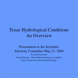
Texas Hydrological ConditionsAn Overview Presentation to the Scientific Advisory Committee May 21, 2004 By Todd Chenoweth Section Manager - Water Rights Permitting & Availability Texas Commission on Environmental Quality
. . . and a little law. • Texas surface water rights operate under the prior appropriations doctrine. • “First in time – first in right.” • Every water right is issued with a priority date. • In times of water shortage, those water rights issued first, the senior water rights, are entitled to take their water first. • Those water rights granted later, junior water rights, take their water after those water rights senior to them.
Perpetual Water Right In order to grant a water right, the commission must find that: “unappropriated water is available in the source of supply.” Texas Water Code Sec. 11.134(b)(2)
Determining Unappropriated Water To determine unappropriated water, merely add up the amount of water previously appropriated and subtract it from the amount of state water which the agency had previously determined the stream furnished. Motl v. Boyd, 286 S.W. 458 (Tex. 1926)
Flow Duration Curves • The graphs show the total annual volume of water at the location specified on the graph plotted against the frequency that the volume annually occurs over the period of record in the basin’s Water Availability Model. • Flow duration curves could be prepared based on the monthly volume of water and the monthly frequency of occurrence. It is also possible to construct a flow duration curve specific to a particular location for each month of the year. • The period of record is typically 40 years, but the duration of the record and historical years used vary by basin.
Legend • Naturalized Flow – modeled flow that removes known human diversions and contributions to the stream. Our best attempt to depict flow without the effects of human influence. • Regulated Flow - Current Conditions – modeled flow that assumes current reservoir area/capacities, return flows in the stream and highest historical use in the last 10 years (instead of fully authorized diversions) and diversion in accordance with the prior appropriations doctrine. • Unappropriated Flow - Full Authorization – modeled flow that assumes diversions at full authorized amounts taken in accordance with the prior appropriations doctrine.
Warnings • The scale on the X axis or “Percent of Time” is not necessarily the same length from graph to graph. • The scale of Y axis or “Annual Volume in Acre-Feet” definitely changes from graph to graph. • Do not compare slopes between graphs.
Key Points • Unappropriated flow below the red line is potentially available for permitting if the applicant can satisfy any special conditions to protect the environment, beneficially use the water without waste, and satisfy other statutory requirements. • Water for “environmental flows,” or to satisfy special conditions for the environment may show up on the graphs anywhere below the naturalized flow line.
Water Availability Maps • The state water availability maps give an overall impression of water available for direct diversion (no reservoirs) applications. • The maps do not indicate the amount of water that is available. Perhaps only 100 acre-feet per year is available in some areas. • Only simple reliabilites are shown, i.e. the percent of time that all of the water is available.
Water Availability MapsTerm Permits • The Water Availability Map for term permits includes permitted by unused water and return flows in the water available for appropriation.
The of effect of reservoirs on hydrology From Freshwater Inflows to Texas Bays and Estuaries 1994, William L. Longley, ed., pp. 30-34
Cumulative inflow hydrographs • Constructed by integrating the monthly inflows into the represented estuary • Represent the cumulative amount of water which has flowed into the estuary • Increases in slope of the hydrograph indicate increasing inflows • Decreases in slope of the hydrograph indicate decreasing inflow rates
Cumulative Inflow Hydrograph for Freshwater Inflows to Mission-Aransas (in millions of acre-feet) Joint Estuarine Research Study: TWDB & TPWD 1994.
Cumulative Inflow Hydrograph for Freshwater Inflows to Sabine Lake (in millions of acre-feet) Joint Estuarine Research Study: TWDB & TPWD 1994.
Cumulative Inflow Hydrograph for Freshwater Inflows to Galveston Bay (in millions of acre-feet) Joint Estuarine Research Study: TWDB & TPWD 1994.
Cumulative Inflow Hydrograph for Freshwater Inflows to Matagorda Bay (in millions of acre-feet) Joint Estuarine Research Study: TWDB & TPWD 1994.
Cumulative Inflow Hydrograph for Freshwater Inflows to San Antonio Bay (in millions of acre-feet) Joint Estuarine Research Study: TWDB & TPWD 1994.
Cumulative Inflow Hydrograph for Freshwater Inflows to Corpus Christi Bay (in millions of acre-feet) Joint Estuarine Research Study: TWDB & TPWD 1994.
Cumulative Inflow Hydrographs • “Decreases in slope appear during known drought periods in Texas, i.e. from roughly 1950 to 1958 and from 1962 to 1966.” • “Although several major reservoirs were built during the 1941 to 1987 period . , these hydrographs provide no clear evidence that the projects have significantly altered freshwater inflow rates to the estuaries.” Longley at page 30.
Cumulative inflow hydrographs • The report did note that the freshwater inflow rate to the Nueces Estuary has decreased, possibly due to disproportionate increases in water demand for Corpus Christi or irrigation without corresponding increases in runoff due to urbanization.
Freshwater Inflows to Estuaries – A Trend Analysis “The results of the trend analysis . . . confirm that freshwater inflows rates to Texas estuaries decreased . . . From the 1940’s to the 1950’s, a decrease attributable to the 1950’s drought. Similarly, from the late 1950’s to the mid-1960’s, inflow rates decreased in association with the dry period of the 1960’s. However, during the last 20 years of record, no significant trends are evident in any of the six estuaries studied.” Longley at page 32
TCEQ Contacts • Carolyn Brittin, 239-3268, cbrittin@tceq.state.tx.us • Todd Chenoweth, 239-4483, tchenowe@tceq.state.tx.us • Bruce Moulton, 239-4809, bmoulton@tceq.state.tx.us