Download
1 / 9
90 likes | 278 Vues
The GOES-R Proving Ground . Presented by Jim Gurka NOAA/NESDIS/GOES-R Program Office, Greenbelt, MD 20771 6 th GOES Users’ Conference Madison, WI November 4, 2009. Contributors . Steven Goodman and James Gurka NOAA/NESDIS/GOES-R Program Office, Greenbelt, MD 20771 Timothy Schmit

E N D
The GOES-R Proving Ground Presented by Jim Gurka NOAA/NESDIS/GOES-R Program Office, Greenbelt, MD 20771 6th GOES Users’ Conference Madison, WI November 4, 2009
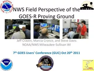
Contributors Steven Goodman and James Gurka NOAA/NESDIS/GOES-R Program Office, Greenbelt, MD 20771 Timothy Schmit NOAA/NESDIS/Center for Satellite Applications and Research, Madison, WI Mark DeMaria and Daniel Lindsey NOAA/NESDIS/Center for Satellite Applications and Research, Fort Collins, CO Wayne Feltz, Scott Bachmeier and Kris Bedka Cooperative Institute for Meteorological Satellite Studies, University of Wisconsin, Madison, WI Steven Miller Cooperative Institute for Research in the Atmosphere, Colorado State University, Fort Collins, CO Anthony Mostek National Weather Service/OCWWS, Training Division Gary Jedlovec and Richard Blakeslee NASA/MSFC Short-term Prediction Research and Transition (SPoRT) Center, Huntsville, AL Russell Schneider and Chris Siewert Cooperative Institute for Mesoscale Meteorological Studies, NOAA/NWS/Storm Prediction Center, Norman, OK Dick Reynolds Short and Associates, Annapolis MD
Proving Ground Mission Statement • The GOES-R Proving Ground engages NWS in pre-operational demonstrations of selected capabilities of next generation GOES • Objective is to bridge the gap between research and operations by: • Utilizing current systems (satellite, terrestrial, or model/synthetic) to emulate future GOES-R capabilities • Infusing GOES-R products and techniques into NWS operations with emphasis on AWIPS and transitioning to AWIPS-II. • Engaging in a dialogue to provide feedback to developers from users • The Proving Ground accomplishes its mission through: • Sustained interaction between developers and end users for training, product evaluation, and solicitation of user feedback. • Close coordination with GOES-R Algorithm Working Group (AWG) and Risk Reduction programs as sources of demonstration products, promoting a smooth transition to operations Intended outcomes are Day-1 readiness and maximum utilization for both the developers and users of GOES-R products, and an effective transition to operations
GOES-R Proving Ground • Place where technologies and ideas are tested and proven before being fielded in operations • Evaluates how infusion of technology or process in forecast environment impacts operations • Integrates technology or process with other available tools • User readiness risk mitigation • Recipient and originator of education and training • Key Benefit: users more accepting of fielded technology • They have had a say in the design • Design better fits an identified need
Key Components of Proving Ground • Ability to fully test individual components • Ability to fully test integrated components • Testing which simulates routine low-end events • Testing which simulates high-end non-routine events • Testing using archived events and simulation • Testing using live events • Test team independence • Test team membership made up of test experts, trainers, and operational users • Ability to make recommendations to the decision maker based on impacts noted in test findings
GOES-R Program Risks: User Readiness Mitigation M 6
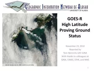
Lessons Learned at SPC • Convective Initiation (CI)/Cloud Top Cooling (CTC) • CTC is valuable product in itself • Diagnostic tool rather than prognostic over SE warm sector environments • Masked where thick cirrus present • Thin cirrus over land/water/water clouds and expanding edge false alarms • Avg. lead time ~15 minutes over radar (for successful nowcasts) • Full disk 30 min. scan limitations (false alarms/missed nowcasts) • Cloud detection limitations due to poor spatial/spectral resolution • Instantaneous fields more useful to forecasters than accumulated fields • Overlay on visible/IR essential to forecasters • Continue CTC after CI occurs (storm severity) interest from forecasters • Effective for terrain/dryline convection • CI misses some CTC signals • Works well in rapid scan operations
GOES-R Proving Ground Partners Green Bay, WI WFO Sullivan, WI WFO Cooperative Institute for Meteorological Satellite Studies Madison, Wisconsin Sterling, VA WFO Cheyenne, WY WFO Cooperative Remote Sensing Science and Technology Center New York, NY Cooperative Institute for Research in the Atmosphere Fort Collins, Colorado La Crosse, WI WFO Boulder, CO WFO NWS Headquarters;Cooperative Institute for Satellite Climate Studies; Center for Satellite Applications and Research; Office of Satellite Data Processing and Distribution;GOES-R Program Office; University of Maryland Baltimore County Maryland Eureka, CA WFO NWS Central Region Kansas City, MO Melbourne, FL WFO NASA Kennedy Space Center NWS Alaska Region Anchorage, Alaska NWS Pacific Region Honolulu, Hawaii NCEP Tropical Prediction Center Joint Hurricane Testbed Miami, Florida (Planned for FY2010) NCEP: National Centers for Environmental Prediction NWS: National Weather Service WFO: Weather Forecast Office NCEP Storm Prediction Center; Norman, OK WFO; National Severe Storms Laboratory; University of Oklahoma; Cooperative Institute for Mesoscale Meteorological Studies Norman, Oklahoma Hazardous Weather Testbed- Experimental Forecast and Warning Programs Huntsville, AL WFO University of Alabama Huntsville NASA Short-term Prediction Research and Transition Center Huntsville, AL
Summary • Program Plan under development • Phase I spin-up at CIMSS, CIRA (2008) • Phase II added SPoRT, AQ, Alaska, Pacific • HWT IOP with VORTEX-2 (2009) • Need real time and archived events (AWIPS2, WES) • PG is the ultimate tool for user interaction • Must maintain focus on clear path to operations • Ensuring pathway into operations by developing GOES-R proxy products for the AWIPS2 environment • Existing and Planned collaborations with NOAA Testbeds- HWT, JHT, DTC, HMT