Emerging Tools for Distributed Data Access and Collaborations
500 likes | 660 Vues
Emerging Tools for Distributed Data Access and Collaborations. Glenn K. Rutledge National Oceanic and Atmospheric Administration National Climatic Data Center 13 th Federation Assembly Meeting Earth Systems Information Partners

Emerging Tools for Distributed Data Access and Collaborations
E N D
Presentation Transcript
Emerging Tools for Distributed Data Access and Collaborations Glenn K. Rutledge National Oceanic and Atmospheric Administration National Climatic Data Center 13th Federation Assembly Meeting Earth Systems Information Partners Asheville, NC August 18, 2004 Image: Unidata idv
Briefing Overview • Earth System Interoperability • Science Exploration at the Data Level • Metadata, Catalogs, & Ontologies • Tools and Programs • Too many to count? • My World: NOMADS • Next Steps to Collaborations
Count the black dots.... XML SOAP OWL OPeNDAP ESML http/TCP Globus SWEET Data Interoperability... A moving target? Yes. Adapted fm L. Olsen
Science Exploration at the Data Level • What are the goals facing the GeoScience community? • Is it just access to high volume data (satellite, radar, and model)? • How will Agencies and Institutions address interoperability? • Should it be system, data or both? • Have the scientific requirements been adequately defined? • Do top down approaches adequately promote science? • How can Agencies and institutions develop partnerships while • allowing for attribution, with diverse goals and agendas? • Data interoperability is the key: Scientific Data Stewardship
Program Management at the Data Level Predictability Earth Systems Aerosols Solar Cycles Atmospheric Climate & Oceans Air Quality Space Wx DATA
Some Assumptions • Operational Forecasting- • Ensemble Predictions: flow-dependant prediction of weather and climate risk- nowcasting, medium range and seasonal. • Atmospheric and Oceanic Research- • Scalar and Vector processing and Workstation models • Model output statistics; data assimilation techniques • Global Climate Change and Advanced Analysis- • Clouds, initial conditions, true coupled simulations. • Long term climate monitoring: in-situ analysis, trends, data homogeneity, extremes, downscaling, reducing uncertainty... • On-demand Data Mining and Product Generation.
Science Opportunities • Data systems based on the integration of independently developed system elements offer many more opportunities than more traditional centrally developed ones. Peter Cornillon URI ...et al.
Collaborations: How do we get there? • Data transport is being actively pursued: OPeNDAP, SOAP, ... • Earth System Partners need to be able to find and use various data sets, wherever they may be, whatever format... • THREDDS can provide dynamic access and generate catalogs • GCMD is a major resource for metadata management for the entire GeoSciences community- this activity must evolve! • Ontology projects such as SWEET in conjunction with THREDDS and GCMD can provide individual data sources, data variables and metadata management for the community.
Ontology: SWEET • The Semantic Web for Earth and Environmental Terminology (SWEET) project provides a common semantic framework for various Earth science initiatives. • The semantic web is a transformation of the existing web that will enable software programs, applications, and agents to find meaning and understanding on web pages. • SWEET developed these capabilities in the context of finding and using Earth science data and information.
Tools for Users • Pare down large file sizes of high resolution data and products. • (re-) Group different data sets to create needed products – such as initialization files for model development, analysis, and intercomparison. • Subset the data sets in parameter space • Subset the data sets in physical space • Subset the data sets in temporal space
Tools for Users (cont.) • Data extraction for the generation of products “on-demand”. • Advanced data mining algorithms for pre-generation, or executed by (authorized) users also on-demand. • Access to mined physical processes or signatures thru data mining. • Search and location tools and metadata management.
Leveraging Partnerships Metadata and Catalog Programs • Just several programs addressing the data access, description, and search activities: • CLASS Comprehensive Large-Arary Stewardship System • DAAC Distributed Active Archive Centers • DIMES DIstributed MEtadata Server • DLESE Digital Library for Earth System Education • ECHO The EOS ClearingHouse (middleware) • ESIP Earth Science Information Partners • FGDC Federal Geographic Data Committee • FIND Federation Interactive Network for Discovery • GCMD Global Change Master Directory • GOSIC Global Observing System Information Center • NDG NERC Data Grid • NSDI National Spatial Data Infrastructure • NSDL National STEME Digital Library • NMMR NOAA Metadata Manager Repository • OAI Open Archives Initiative • SWEET Semantic Web for Earth and Environmental Terminology • THREDDS Thematic Realtime Environmental Data Distributed Services
Leveraging Partnerships THREDDS Data Providers • University of Alabama Huntsville (Sara Graves, Rahul Ramachandran, Steve Tanner, Ken Keiser) • ARM (Atmospheric Radiation Measurement, Chris Klaus) • CDC, the Climate Diagnostic Center (Roland Schweitzer) • COLA, Center for Oceans Land Atmosphere (Joe Wielgosz) • University of Florence (Stefano Nativi) • GMU, George Mason University (Menas Kafatos and Ruixin Yang) • IRI/LDEO, International Research Institute/Lamont Doherty Earth Observatory (Benno Blumenthal) • ESG, the Earth System GRID (Luca Cinquini, NCAR/SCD) • IRIS DMC, Incorporated Research Institutes for Seismology Data Management Center (Rob Casey) • NCAR, the National Center for Atmospheric Research (Don Middleton) • NCDC, the National Climatic Data Center (Ben Watkins) • NGDC, National Geophysical Data Center (Ted Habermann) • NOMADS,NOAA Operational Model Archive and Distribution System, (Glenn Rutledge, NCDC) • University of Oklahoma (Kelvin Droegemeier) • PMEL, the Pacific Marine Environment Laboratory (Steve Hankin) • FNMOC, Fleet Numerical Meteorological and Oceanographic Center (Phil Sharfstein) • SSEC, the Space Science and Engineering Center., U. of Wisconsin-Madison (Steve Ackerman, Tom Whittaker) • Unidata Community ADDE servers (Tom Yoksas, Unidata Program Center) • CIESIN (Consortium for International Earth Science Information Network, Bob Downs) • CUAHSI(Consortium of Universities for Advancement of Hydrologic Science, David Maidment) • ESIG/ NCAR (NCAR Environmental Societal Impacts Group, Bob Harriss) • Earthscope (UCAR UNAVCO, Chuck Meertens) • GEON(GEOphysical Network, Chaitan Baru, UCSD San Diego Supercomputer Center) • ESRI GIS Community (ESRI, Inc., Jack Dangermond, President)
Leveraging Partnerships THREDDS Collaborators • ADDE,Abstract Data Distribution Environment (University of Wisconsin – Madison, Tom Yoksas) • DIMES, DIstributed MEtadata System (George Mason University, Ruixin Yang) • DODS/OPeNDAP/Aggregation Server, Distributed Oceanographic Data System/Open source Project for a Network Data Access Protocol (University of Rhode Island, Unidata, Ethan Davis) • DLESE, Digital Library for Earth System Education (Rajul Pandya) • ESML, Earth System Markup Language (University of Alabama-Huntsville, Rahul Ramachandran) • ESRI, Environmental Science Research Institute (various) • GCMD, Global Change Master Directory (Gene Major) • OGC and ISO Standards (University of Florence, Stefano Nativi) • ADL (Gazetteer Services The University of California, Santa Barbara, Linda Hill and Michael Goodchild) • DLESE Evaluation Services(The University of Colorado CIRES, Susan Buhr) • DLESE Data Services (Tamara Ledley) • DLESE Program Center Digital Library for Earth System Education (Mary Marlino) • ESRI(Jack Dangermond, President) • OPeNDAP(The University of Rhode Island Open source Project for a Network Data Access Protocol -- formerly DODS, Peter Cornillon) • LAITS(Laboratory for Advanced Information Technology and Standards,Liping Di, George Mason University) • NSDL Evaluation Services (University of Colorado, Tamara Sumner) • OGC (Open GIS Consortium, David Schell, President) • SWEET (Semantic Web for Earth and Environmental Terminology, Rob Raskin)
Evolve GCMD? GCMD DODS/OPeNDAP Portal http://gcmd.gsfc.nasa.gov/Data/portals/dods/ http://gcmd.gsfc.nasa.gov/Data/portals/dods/freetext/ft_search.html
Metadata • Collaborations require long-term maintenance of both the data and descriptions of the data; i.e., metadata. The degree of system interoperability is determined by the associated metadata and the quality of that metadata. P.Cornillon/Rutledge.
Federation Interactive Network for Discovery FIND combines the capabilities of two search systems (the Global Change Master Directory and Mercury). It provides users with a rich set of options to locate ESIP Federation data, services, and information. FIND is accessible from the Federation Home Page. • Data search • Topical keyword search • Data tools and services search Data Set Metadata GCMD Service Metadata Harvested Web pages (Can be linked to data sets) Data Set Metadata • Federation-wide search • Web/data free text search • Advanced data search w/data order links Mercury EDG data set list http://www.esipfed.org/find Mercury Supplemental Metadata
NOAA-NESDIS Metadata • NESDIS Metadata • Working Group • - A good first start. • - Community wide • audience needed. • How? • GeoScience Technology • Forum (GTF) • NSF Cyber • Infrastructure • GEO ??
NOAA and other Programs • NOAA’s Scientific Data Stewardship (SDS) well conceived. • CLASS requires more community involvement and they are actively seeking feedback. The time is now to design interoperability into CLASS. Re-engineering difficult. • Many efforts now exist from which to leverage: • GCOS, IOOS, US Oceans, DMAC, NVODS, WCRP, IPCC, WMO, GCMD, THREDDS, (more on this)… • NOAA’s Office of Project Planning and Implementation now formed.
Group on Earth bservations Earth Observation Summit • Affirmed need for timely, quality, long-term, global information as a basis for sound decision making. • Recognized need to support: • Comprehensive, coordinated, and sustained Earth observation system or systems; • Coordinated effort to address capacity-building needs related to Earth observations; • Exchange of observations in a full and open manner with minimum time delay and minimum cost; and • Preparation of a 10-year Implementation Plan, building on existing systems and initiatives by European ministerial in late 2004 • Established ad hoc Group on Earth Observations (GEO) to develop Plan • Invited other governments to join.
Active Agency Participation with IWEGO • A system of systems can be designed with active • involvement with existing data managers system • managers and scientists: ESIP Role? • Leveraging intra-Agency activities with GEO • 10-year plan as the driver. • How is our community addressing the needs of GEO?
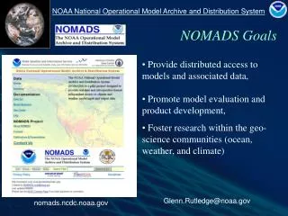
Overview • To overcome a deficiency in model data access, some of the Nations top scientists are actively engaged in a grass-roots framework to share data and research findings over the Internet. • NCDC, NCEP and GFDL initiated the NOAA Operational Model Archive and Distribution System. • NOMADS is a distributed data services pilot for format independent access to climate and weather models and data.
The NOAA Operational Model Archive and Distribution System NOMADS Goals • provide distributed access to models and associated data, • promote model evaluation and product development, • foster research within the geo-science • communities (ocean, weather, and climate) • to study multiple earth systems using • collections of distributed data, • develop institutional partnerships via distributed open technologies.
Scientific Data Networking? • The users experience is often frustrating— • - What data of interest exist? • - Are they going to be useful to me? • - How can I obtain them in a usable form? • Time and effort are wasted on data access and format • issues. • As a result atmosphere/ocean/climate data are under- • utilized. Model inter-comparison nearly impossible.
Advancing Collaborations Scientific Data Networking… NOMADS simplifies scientific data networking, allowing simple access to high volume remote data, unifying access to Climate and Weather models: • Data access (client) • Access to remote data in the users normal application • IDL / IDV / Matlab / Ferret • GrADS (GRIB/BUFR w/ GDS) • Netscape / Excel / http (wget) • CDAT (PCMDI) • Any netCDF application (i.e., AWIPS) • Don’t need to know the format in which the data are stored. • Data publishing (server) • Can serve data in various formats • netCDF / GRIB / BUFR / GRIB2 • HDF (3-5) / EOS • SQL / FreeForm • JGOFS / NcML • DSP • ascii, others... • Spatial and temporal sub-setting and host side computations on the fly.
Advancing Collaborations Collaborating Programs CAP Climate Action Partnership DOC DOE EPA State Dept CDP Community Data Portal NCAR CEOS Committee on EO Satellites NOAA Representative CEOP Coordinated Earth Obs Period NOAA Representative EPA Air Quality Models (in progress) GO-ESSP Earth Science Portal Founding Member NASA GCMD Science Advisory Board NERC DataGrid Advisory Committee NSF Cyberinfrastructure Member NSF LEAD & Geo-Science Tech Forum (GTF) Data / Planning Committee NVODS / US GODAE / GOOS Data Provider Unidata THREDDS, NSDL, DLESSE Data Provider WCRP World Climate Research Program JSC/CLIVAR Briefings
Advancing Collaborations The NOMADS Philosophy Multiple paths to format independent data access:
Framework • NOMADS uses the Open Source http based OPeNDAP. • OPeNDAP is a binary-level protocol designed for the transport • of scientific data subsets over the Internet. Provides server • side data manipulation on-the-fly (e.g., GrADS-DODS). • Data formats: GRIB, GRIB2, BUFR, HDF, NetCDF, ascii... • Conventions: COARDS, CF, FGDC, DIF....libraries built as • necessary. • APIs: JAVA-OPeNDAP, C++-OPeNDAP, NetCDF, GRIB, • BUFR, THREDDS, Python.
Advancing Collaborations GO-ESSP • A grass roots effort has formed by data managers called the Global Organization for Earth Systems Science Portals GO-ESSP http://esportal.gfdl.noaa.gov • Unidata • ESG (NCAR, LLNL) • OPeNDAP • COLA • NOMADS (GFDL, PMEL, NCDC, NCEP, others) • NASA/GCMD • BADC, BODC • WMO
Advancing Collaborations GO-ESSP • The Global Organization for Earth System Science Portal (GO-ESSP) is a collaboration designed to build the infrastructure needed to create web portals to provide access to observed and simulated data within the climate and weather communities. • The infrastructure created within GO-ESSP will provide a flexible framework that will allow interoperability between front-end and back-end software components. GO-ESSP is an international collaboration involving software developers from both Europe and the United States.
Advancing Collaborations Data Availability Overview • CDC: Reanalysis, climate weather models, in-situ GFDL: Coupled Models, Control and Perturbation Integrations and historical 20th century simulations using solar, volcano, GHG and aerosol forcings. FSL: MADIS mesoNets, Hi-Res RUC-II NCAR: Community Climate System Model / Land Surface CO2 predictive models (VEMAP), Reanalysis / Eta NCDC: Archive for NCEP model input/output / Select NCDC Observation datasets, Ocean/Ice WAVE, NARR, SST’s... NCEP: Real-time Input/Output, Reanalysis (I&II), Ensembles, Sea Ice Ocean, CDAS, Hourly Eta, Climate Forecast Models... LLNL: AMIP / Probabilistic information PMEL: Ocean and Climate datasets
NCDC and NCEP Data • NCDC NOMADS Archive • POR: 2002 to Real-Time • Eta (12km); GFS (1 degree); GDAS; NARR 12km 30yrs • RUC-II 20/40km; Ocean and Ice WAVE Models • NCDC Reference Data Sets (Reynolds SST’s, GHCN...) • NCDC Mirror site to NCEP NOMADS for Eta & GFS • NCEP Real-Time NOMADS • Global Forecast System GFS 1 degree • Hourly Eta at 12km • Regional Spectral Model (RSM) and Ensembles • Climate Data Assimilation System (CDAS) • AMIP Climate Monitoring, Climate Forecast Model • NCEP/NCAR Global Reanalysis 1&2
NOMADS Archive and Users • Data Philosophy and Retention • Data are free. • NWP forecast data are retained for five years. • Analysis, Reanalysis, observations, and GDAS model input are retained for long term stewardship. • Data Users • Resolution of IP addresses indicate a broad range, and • consistent use of NOMADS available data: • U.S. Agencies, Academic Institutions: K-12 to Research • International governments, (Italy, Japan, countries within • South America and Africa. Many others). • Private Sector and Non-Government Organizations NGO’s • World Bank, United Nations (FAO), others.
NOMADS Archive and Users (cont.) * 5-YR retention of fcsts. Long term for anal. Apr May Jun Jul 2004 Existing and Projected Volume
Promoting Model Collaborations NCDC Web Interface • Three primary • methods for data • access: • Web Interface • OPeNDAP • ftp w/ on the fly • Grib subsetting • On-line or • Off-line (archive) • Server-side data • computations...
* January Mean 500 Height (1981 to 1989) minus (1990 to 1998) * Mean & Standard Deviation for all 10 ensembles * Time required: 60 secs 'reinit' '!date' * baseURL = 'http://motherlode.ucar.edu:9090/dods/_expr_' * GKR 2/13/03 New NCAR URL baseURL = 'http://dataportal.ucar.edu:9191/dods/' expr = 'ave(z,t=387,t=483,12)-ave(z,t=495,t=591,12)' xdim = '0:360' ydim = '20:90' zdim = '500:500' tdim = '1nov1978:1nov1978' 'sdfopen 'baseURL'_expr_{C20C/C20C_A}{'expr'}{'xdim','ydim','zdim','tdim'}' 'sdfopen 'baseURL'_expr_{C20C/C20C_B}{'expr'}{'xdim','ydim','zdim','tdim'}' 'sdfopen 'baseURL'_expr_{C20C/C20C_C}{'expr'}{'xdim','ydim','zdim','tdim'}' 'sdfopen 'baseURL'_expr_{C20C/C20C_D}{'expr'}{'xdim','ydim','zdim','tdim'}' 'sdfopen 'baseURL'_expr_{C20C/C20C_E}{'expr'}{'xdim','ydim','zdim','tdim'}' 'sdfopen 'baseURL'_expr_{C20C/C20C_F}{'expr'}{'xdim','ydim','zdim','tdim'}' 'sdfopen 'baseURL'_expr_{C20C/C20C_G}{'expr'}{'xdim','ydim','zdim','tdim'}' 'sdfopen 'baseURL'_expr_{C20C/C20C_H}{'expr'}{'xdim','ydim','zdim','tdim'}' 'sdfopen 'baseURL'_expr_{C20C/C20C_I}{'expr'}{'xdim','ydim','zdim','tdim'}' 'sdfopen 'baseURL'_expr_{C20C/C20C_J}{'expr'}{'xdim','ydim','zdim','tdim'}' 'define resa = result.1' 'define resb = result.2' 'define resc = result.3' 'define resd = result.4' 'define rese = result.5' 'define resf = result.6' 'define resg = result.7' 'define resh = result.8' 'define resi = result.9' 'define resj = result.10' say 'got data' 'set lev 500' 'set lat 20 90' 'define mean = (resa + resb + resc + resd + rese + resf + resg + resh + resi + resj)/10' 'define d1 = (pow(resa-mean,2))' ; 'define d2 = (pow(resb-mean,2))' 'define d3 = (pow(resc-mean,2))' ; 'define d4 = (pow(resd-mean,2))' 'define d5 = (pow(rese-mean,2))' ; 'define d6 = (pow(resf-mean,2))' 'define d7 = (pow(resg-mean,2))' ; 'define d8 = (pow(resj-mean,2))' 'define d9 = (pow(resi-mean,2))' ; 'define d10 = (pow(resj-mean,2))' 'define stddev = pow((d1 + d2 + d3 + d4 + d5 + d6 + d7 + d8 + d9 + d10)/10,0.5)' 'set gxout shaded' 'set mproj nps' 'display mean' 'draw title January Mean 500 Height (1981 to 1989) minus (1990 to 1998)' 'set string 3 bc 1' 'draw string 5.5 .5 Mean & Standard Deviation for all 10 ensembles: ‘C20C Climate of the 20th Century Folland/Kinter' *'cbarn' 'set gxout contour' 'set ccolor 0' 'display stddev' '!date' At left is the complete script for generating mean and sdev at 500mb analyzing 18 years of “Climate of the 20th Century” over the Internet: Traditional vs. NOMADS methods: Data volume transported: 100Gb vs. 2Kb Time to access data: 2 days vs. 60 sec Code development: days vs. minutes Fortran based LOC: 1000 vs. 50 LOC
Promoting Model Collaborations NCDC Web Interface (cont.) The NCDC Web Interface originally developed at NCEP: NOMADS leverages efforts across the community.
Promoting Model Collaborations NOMADS “Web Plotter” • NCDC NOMADS • ingests 150K grids • day. POR 2002 • to present. • Any one of these • accessible in seconds • Via: OpENDAP • GDS • ftp • Web Plotter • LAS (soon)
Promoting Model to Obs. Intercomparisons NCDC Reference Datasets • NCDC reference • And others • datasets also available: • CARDS (IGRA) • GHCN • NARR • Ocean WAVE
Value Added Products National Digital Forecast Database • Value added retailers who make value added products can use NOMADS GDS to get the meteorological data they need without downloading entire files. • Users (forecasters) of NDFD can create their own products using GDS server accessing only data they need. • GDS reduces the bandwidth needed to create products in weather service operations. • For internet-2 bandwidth, servers at Regional Centers can distribute data to WFO’s for their operations.
Enabling private sector access: An example NOMADS Ensemble Access NOMADS Ensemble Probabilities on the fly • No need for image generation of ensembles... OPeNDAP constraint expression URL is: http://nomad3.ncep.noaa.gov:9090/dods/enshires/archive/ens20040809/ensc0_ 00z_1x1.ascii?pratesfc[3:3][125:125][277:277]
CLASS and NOMADS • Under NOAA’s Scientific Data Stewardship (SDS) programs • the NOAA Comprehensive Large Array-data Stewardship System (CLASS) will act as the main portal for NOAA/NESDIS environmental data, providing physical archive, access, and distribution capabilities for large array data sets. • The NOMADS team and its collaborators are working with CLASS as the system progresses through its phased implementation plans for access to weather and climate models via OPeNDAP and OPeNDAP Servers (GDS/LAS). Metadata management must be addressed at the Agency level.
Next Steps to Collaborations #1 • Leverage the resources as goals outlined by the Group on Earth Observations – GEO (& Earth Observation Summit) through appropriate Agency working groups and representatives: • Interagency Working Group on Earth Observations (IWGEO) Data and Information Systems (OWGDIS)
Next Steps to Collaborations 2 #2 • Ensure that NGO’s, University, or Institutional partners are involved in this process e.g., • COLA • EOGEO • many more...
Next Steps to Collaborations 3 #3 • Agencies partially fund (5%?) data management for each program. This should not be considered a separate activity.
Next Steps to Collaborations 4 #4 • Engage and leverage from existing efforts and organizations especially NASA, NOAA, NSF, etc. • - NSF CyberInfrastructure (Ad Hoc Committee June 2004) • - GO-ESSP • - LEAD GeoScience Technology Forum (GTF) • - THREDDS / GCMD / SWEET / FIND /... • - NERC Data Grid (Europe) • - WMO CBS
Next Steps to Collaborations 5 #5 • Advance Agency Program Management at the Data level.
Next Steps to Collaborations 6 #6 • Advance the building of Ontologies at Data Centers and Providers, (with SWEET), to interact with an enhanced “THREDDS & GCMD” effort for data search and access at the “variable” level*. * Using OPeNDAP enabled clients and Servers
For more information... • For NOMADS Program Information see: http://www.ncdc.noaa.gov/oa/climate/nomads/nomads.html • For NOMADS Model Data Access: NOAA NCDC Main Page Climate Model Resources http://nomads.ncdc.noaa.gov • Or contact: Glenn.Rutledge @ noaa.gov • Selected Publications on distributed data access and NOMADS: http://www.ncdc.noaa.gov/oa/model/publications/publications.html QUESTIONS ?