Download
1 / 56
600 likes | 938 Vues
World Geography GHSGT Review Jones County High School, GA Luella High School, GA. Geography. Geography is the study of the earth’s surface, land, bodies of water, climate, peoples, industries, & natural resources. Physical Geography.

E N D
World GeographyGHSGT ReviewJones County High School, GALuella High School, GA
Geography Geography is the study of the earth’s surface, land, bodies of water, climate, peoples, industries, & natural resources.
Physical Geography • Physical Geography is the study of how physical characteristics define a region or place. • land, climate, bodies of water, animal life • A place is an area of land that shares common features or is defined by common characteristics. • Gulf of Mexico - Gulf coast • Georgia - Kentucky • Physical features (a.k.a. topography) are the natural land formations that make up the surface area. • oceans - mountains – lakes - rivers
landform - plains, mountains, valleys • The Himalayas are the tallest mountains on earth • A body of water is a part of the earth’s surface covered with water. • river - lakes - oceans • climate – average weather conditions over time • temperature, humidity, precipitation, sunshine, cloudiness • natural vegetation- plants and trees that grow in an area • animal life – types of animals who naturally live in an area
Human Geography I pray, I pass the graduation test. My momma’s gonna kill me!!! • human characteristics – include language, religion, political systems, economic systems, population, and way of life. • population settlements – types of people who live in a place • culture – shared beliefs, values, customs, behaviors • customs and traditions – ways of doing things passed down from one generation of people, group, or society to the next. • rituals, weddings, holidays, showing respect • human activities –agriculture and industry • farming - banking - manufacturing
EARTH: It’s kind of a big deal
EARTH is • Home to 5 oceans (Placed in order by size) • The Pacific Ocean • The Atlantic Ocean • The Indian Ocean • The Southern Ocean • The Arctic Ocean
EARTH IS… • Home to 7 continents • (Placed in order by size) • Asia • Africa • North America • South America • Antarctica • Europe • Oceania (Australia)
2 TYPES OF GEOGRAPHY Physical geography- study of the Earth’s physical features; the Earth Science aspects Human geography- how humans interact with their physical environment AND the study of human behaviors (religion, economy, language, etc.)
Physical Geography Rocks and Minerals Landforms Soils Animals Plants Water Atmosphere Rivers and Other Water Bodies Environment Climate and Weather Oceans Human Geography Population Settlements Economic Activities Transportation Recreational Activities Religion Political Systems Social Traditions Human Migration Agricultural Systems Urban Systems
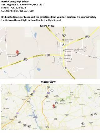
#1 LOCATION Types of location: Absolute location-the EXACT spot on the map; plotted on a point with lines of longitude and latitude. Relative location-the APPROXIMATE place; general region. EX: Where is Luella High? Absolute? Relative?
#2 PLACE Place includes the physical features and cultural characteristics of a location. Climate, landforms, vegetation, animals, etc. But also how the humans in those places live. What makes the American Southwest different from the American South?
#3 REGION Basic question: “How are places similar?” A region is an area on the Earth’s surface with similar characteristics. Tell me about the Middle East. Tell me about East Asia.
#4 HUMAN-ENVIRONMENT INTERACTION KEY QUESTIONS: How does environment shape humans? How do humans shape the environment? How humans interact and are shaped by their environment.
#5-MOVEMENT How do things move? How do people move? Movement is NOT just limited to physical things. Movement can also mean ideological. EX: Where did rap start?
People & Population Distribution • urbanization – the growth & development of cities • modernization – process of a society leaving primitive methods behind to adopt more modern techniques • population distribution - the arrangement or spread of people living in a given area; also, how the population of an area is arranged according to variables such as age, race, or sex
Understanding Maps • Compass Rose – A compass rose is a design on a map that shows directions. It shows north, south, east, west, northeast, northwest, southeast, and southwest. • There is a Compass Rose located on every map.
Complete the Compass Rose below. • On the compass rose above, only north is filled in. Fill in the rest of the directions on the compass rose, using the standard abbreviations:N=North, S=South, E=East, W=West, NE=Northeast, NW=Northwest, SE=Southeast, SW=Southwest.
Physical Map - water, lakes mountains, rivers, deserts Political Map – Shows national or state boundaries Two Types of Maps
Latitude & Longitude • Longitude and Latitude are sets of imaginary lines that slice the Earth into sections. • Using these imaginary lines, you can locate any point on the Earth and know its absolute location. • Lines of latitude are called parallels, and lines of longitude are called meridians.
Lines ofLatitude, parallels, circle the globe horizontally. Latitude describes your position, north or south of the equator. The equator = 0 degrees latitude. Lines of Longitude, meridians, run vertically from the North Pole to the South Pole. Meridians are used to measure distances in degrees east or west of the Prime Meridian. Latitude & Longitude
Legend • Since a map is a reduced representation of the real world, map symbols are used to represent real objects. Without symbols, we wouldn't have maps. • Both shapes and colors can be used for symbols on maps. • To ensure that a person can correctly read a map, a Map Legend is a key to all the symbols used on a map. It is like a dictionary so you can understand the meaning of what the map represents.
Scale • Since an accurate map represents the land, each map has a "scale" which indicates the relationship between a certain distance on the map and the distance on the ground. • The map scale is usually located in the legend box of a map. • A map scale can be printed in a variety of ways
27 MEMBER NATIONS OF THE EU • Austria • Belgium • Bulgaria • Cyprus • Czech Republic • Denmark • Estonia • Finland • France • Germany • Greece • Hungary • Ireland • Italy • Latvia • Lithuania • Luxembourg • Malta • Netherlands • Poland • Portugal • Romania • Slovakia • Slovenia • Spain • Sweden • United Kingdom
THE NEW ENGLAND COLONIES Massachusetts (1620) New Hampshire (1623) Rhode Island (1636) Connecticut (1636)
THE MIDDLE COLONIES New York (1664) (* a.k.a New Netherlands 1626) New Jersey (1664) Delaware (Swedish colony 1638) Pennsylvania (1682)
PENNSYLVANIA In 1681, King Charles II repaid a 16,000 pound debt to Sir William Penn by giving his son, William Penn, a huge tract of land south of New York. Penn believed in religious toleration and called Pennsylvania the 'holy experiment'.
William Penn Jr. turned Pennsylvania into a refuge for Quakers who were being persecuted in England and in New England. Penn’s father was very angry with William Jr. for being a Quaker. Pennsylvania attracted many German and Dutch settlers. Prosperous colony.
THE SOUTHERN COLONIES Virginia (1607) Maryland (1634) North Carolina (1653) South Carolina (1663) Georgia (1732)
Physical Features of the United States • Great Lakes - Rocky Mts. • Mississippi River - Great Plains • Gulf of Mexico - Appalachian Mts. • Atlantic Ocean - Pacific Ocean
Great Lakes Mississippi River – largest river system in North America More Bodies of Water
Religions Division in Africa and the Middle East 3 Main Religions • Christianity • Judaism • Islam
Impact of Religion • Monotheism – belief in one god • Judaism – Jewish faith; looks to ancient prophet Abraham as its founder; teaches that Jewish people are God’s chosen nation (Israel).
Jewish Culture • Palestine • Culture clash between native Palestinians and Jewish population • Argument over who has rights to the Holy Land in Israel • Example of faith as defining a region’s cultural environment